Overview for Walled Garden, ARBROATH, DD11 4QE
Introduction
Arbroath or Aberbrothock is a former royal burgh and the largest town in the council area of Angus, Scotland, with a population of 23,902. It lies on the North Sea coast, some 16 miles (26 km) east-northeast of Dundee and 45 miles (72 km) south-southwest of Aberdeen.
There is evidence of Iron Age settlement, but its history as a town began with the founding of Arbroath Abbey in 1178. It grew much during the Industrial Revolution through the flax and then the jute industry and the engineering sector. A new harbour was created in 1839; by the 20th century, Arbroath was one of Scotland's larger fishing ports.
The town is notable for the Declaration of Arbroath and the Arbroath smokie. Arbroath Football Club holds the world record for the number of goals scored in a professional football match: 36–0 against Bon Accord of Aberdeen in the Scottish Cup in 1885.
Summary for Walled Garden, ARBROATH, DD11 4QE
Roadworks near DD11 4QE
Road Safety near DD11 4QE
Details of personal injury accidents in and around Walled Garden, DD11 4QE that have been reported to over the past 20 years.
Traffic Levels near DD11 4QE
View traffic levels near Walled Garden, DD11 4QE from official Department for Transport counts.
Images taken near to Walled Garden, DD11 4QE and the surrounding area

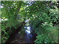
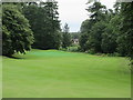

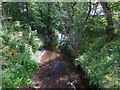
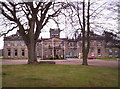


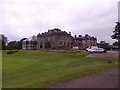
Please click the More button for more images, licensing and image copyright information.
Member of UK Parliament
This postcode is in the Angus parliamentary constituency.
Angus is a constituency in Scotland. The seat has been held by Dave Doogan (Scottish National Party) since December 2019.

Most Recent House Sales for Walled Garden, DD11 4QE
No recorded house sales or transfers for this postcode.
Local Petrol Station Prices
Coordinates for DD11 4QE
Sunrise and Sunset at DD11 4QE
Traffic Emission and Congestion Zones
Historical Weather Summary
| Clear | 9.32% |
| Cloudy | 45.32% |
| Rain | 10.67% |
| Windy | 34.24% |
| Other | 0.45% |
Average Energy Performance
Companies Registered at DD11 4QE
Postcode Details for DD11 4QE
Recent Updates
|
18 Apr 2024 Added Traffic Camera Views from Traffic Scotland to Roadworks within Scotland |
|
15 Apr 2024 Schools Data updated for April 2024 |
|
10 Apr 2024 Companies Data updated for March 2024 |
|
7 Apr 2024 New option to receive automatic updates to roadworks that affect you |
|
7 Apr 2024 Police and Crime data updated for February 2024 |
|
3 Apr 2024 Sold House Price data updated for February 2024 |
|
30 Mar 2024 Energy Performance Certificates (England and Wales) updated February 2024 |
|
28 Mar 2024 New feature to use Geolocating functions to detect your current location |
Random Postcodes
Want an idea of what is in our extensive website? Try somewhere completely random!
The Rural/Urban classification is based upon data collected during the 2011 Census and released in August 2013 and is categorised into 6 distinct classes.
[A] Urban Major conurbation: A built up area with a population of 10,000 (3,000 in Scotland) or more and is assigned to the major conurbation settlement category.
[B] Urban Minor conurbation: A built up area with a population of 10,000 (3,000 in Scotland) or more and is assigned to the minor conurbation settlement category.
[C] Urban City and town: A built up area with a population of 10,000 (3,000 in Scotland) or more and is assigned to the city and town settlement category.
[D] Rural Town and fringe
[E] Rural Village
[F] Rural Hamlet and isolated dwelling
The Index of Multiple Deprivation (IMD) is the official measure of relative deprivation.
The index is based on 39 separate indicators across seven distinct domains (Income; Employment; Health and Disability; Education, Skills and Training; Crime; Barriers to Housing and Services; Living Environment) to provide an overall measure of multiple deprivation and is calculated for every neighbourhood.
The index is relative rather than an absolute scale and so a neighbourhood with a score of 10 is more deprived than one rated 20, but this does not equate to being twice as deprived.
Please note: Different indices are used in England, Scotland, Wales and Northern Ireland and so comparison of scores from neighbourhoods in different countries should not be undertaken.
These figures report on incorporated UK companies only that are registered at this postcode and do not include sole-traders, partnerships or overseas organisations.
The population figure shown for your area are an estimate provided by the Office for National Statistics and is rounded to the nearest 1,000.
The estimates are derived from the Annual Population Survey (APS) which is the Labour Force Survey (LFS) plus various sample boosts.
There are 55 unitary authorities. They provide all local government services in their areas. These are mainly in the cities, urban areas and larger towns although there are now 6 shire county councils that are unitary (ie have no district councils beneath them).