Overview for Caledonia Street, MONTROSE, DD10 8HP
Introduction
Montrose is a town and former royal burgh in Angus, Scotland. Situated 28 miles (45 kilometres) north of Dundee and 37 miles (60 kilometres) south of Aberdeen, Montrose lies between the mouths of the North and South Esk rivers. It is the northernmost coastal town in Angus and developed as a natural harbour that traded in skins, hides, and cured salmon in medieval times.
With a population of approximately 12,000, the town functions as a port, but the major employer is GlaxoSmithKline, which was saved from closure in 2006. The skyline of Montrose is dominated by the 220-foot (67 m) steeple of Old and St Andrew's Church, designed by James Gillespie Graham and built between 1832 and 1834.
Montrose is a town with a wealth of architecture, and is a centre for international trade. It is an important commercial port for the oil and gas industry. It is known for its wide thoroughfare and high street, which
leads to picturesque closes containing secluded gardens. The town has a view of a tidal lagoon, Montrose Basin, which is considered a nature reserve of international importance. It is the largest inland salt water basin in the UK, and an important habitat for the mute swan. Just outside Montrose is the 18th-century House of Dun, designed by the Scottish architect William Adam and built in 1730 for David Erskine, Lord Dun, 13th Laird of Dun.
Summary for Caledonia Street, MONTROSE, DD10 8HP
Roadworks near DD10 8HP
Road Safety near DD10 8HP
Details of personal injury accidents in and around Caledonia Street, DD10 8HP that have been reported to over the past 20 years.
Traffic Levels near DD10 8HP
View traffic levels near Caledonia Street, DD10 8HP from official Department for Transport counts.
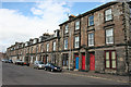
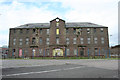
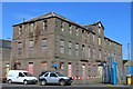
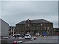
Images taken near to Caledonia Street, DD10 8HP and the surrounding area
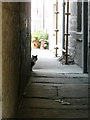

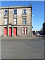
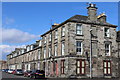
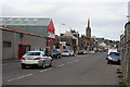
Please click the More button for more images, licensing and image copyright information.
Member of UK Parliament
This postcode is in the Angus parliamentary constituency.
Angus is a constituency in Scotland. The seat has been held by Dave Doogan (Scottish National Party) since December 2019.

Most Recent House Sales for Caledonia Street, DD10 8HP
No recorded house sales or transfers for this postcode.
Local Petrol Station Prices
Coordinates for DD10 8HP
Sunrise and Sunset at DD10 8HP
Traffic Emission and Congestion Zones
Historical Weather Summary
| Clear | 10.05% |
| Cloudy | 38.99% |
| Rain | 9.92% |
| Windy | 40.81% |
| Other | 0.23% |
Average Energy Performance
Companies Registered at DD10 8HP
Postcode Details for DD10 8HP
Recent Updates
|
18 Apr 2024 Added Traffic Camera Views from Traffic Scotland to Roadworks within Scotland |
|
15 Apr 2024 Schools Data updated for April 2024 |
|
10 Apr 2024 Companies Data updated for March 2024 |
|
7 Apr 2024 New option to receive automatic updates to roadworks that affect you |
|
7 Apr 2024 Police and Crime data updated for February 2024 |
|
3 Apr 2024 Sold House Price data updated for February 2024 |
|
30 Mar 2024 Energy Performance Certificates (England and Wales) updated February 2024 |
|
28 Mar 2024 New feature to use Geolocating functions to detect your current location |
Random Postcodes
Want an idea of what is in our extensive website? Try somewhere completely random!
The Rural/Urban classification is based upon data collected during the 2011 Census and released in August 2013 and is categorised into 6 distinct classes.
[A] Urban Major conurbation: A built up area with a population of 10,000 (3,000 in Scotland) or more and is assigned to the major conurbation settlement category.
[B] Urban Minor conurbation: A built up area with a population of 10,000 (3,000 in Scotland) or more and is assigned to the minor conurbation settlement category.
[C] Urban City and town: A built up area with a population of 10,000 (3,000 in Scotland) or more and is assigned to the city and town settlement category.
[D] Rural Town and fringe
[E] Rural Village
[F] Rural Hamlet and isolated dwelling
The Index of Multiple Deprivation (IMD) is the official measure of relative deprivation.
The index is based on 39 separate indicators across seven distinct domains (Income; Employment; Health and Disability; Education, Skills and Training; Crime; Barriers to Housing and Services; Living Environment) to provide an overall measure of multiple deprivation and is calculated for every neighbourhood.
The index is relative rather than an absolute scale and so a neighbourhood with a score of 10 is more deprived than one rated 20, but this does not equate to being twice as deprived.
Please note: Different indices are used in England, Scotland, Wales and Northern Ireland and so comparison of scores from neighbourhoods in different countries should not be undertaken.
These figures report on incorporated UK companies only that are registered at this postcode and do not include sole-traders, partnerships or overseas organisations.
The population figure shown for your area are an estimate provided by the Office for National Statistics and is rounded to the nearest 1,000.
The estimates are derived from the Annual Population Survey (APS) which is the Labour Force Survey (LFS) plus various sample boosts.
There are 55 unitary authorities. They provide all local government services in their areas. These are mainly in the cities, urban areas and larger towns although there are now 6 shire county councils that are unitary (ie have no district councils beneath them).