Overview for Shalmsford Street, CANTERBURY, CT4 7PY
Introduction
Canterbury is a city and UNESCO World Heritage Site, in the county of Kent, England; it was until 1974 a county borough. It lies on the River Stour. The city has a mild oceanic climate.
The city is a popular tourist destination. The city's economy is heavily reliant upon tourism, alongside higher education and retail. The city's population was over 55,000 in 2011. There is a substantial student population; the city has one of the highest proportions of students to permanent residents in the country.
The city has been occupied since Paleolithic times and served as the capital of the Celtic Cantiaci and Jute Kingdom of Kent. Many historical structures fill the area, including a city wall founded in Roman times and rebuilt in the 14th century, the Westgate Towers museum, the ruins of St Augustine's Abbey, the Norman Canterbury Castle, and the oldest extant school in the world, the King's School. Modern additions include the Marlowe Theatre and Kent County Cricket Club's St Lawrence Ground. Canterbury Cathedral is known for its architecture, its music, and for being the seat of the Archbishop of Canterbury; it receives a million visitors per year.
Summary for Shalmsford Street, CANTERBURY, CT4 7PY
Roadworks near CT4 7PY
Road Safety near CT4 7PY
Details of personal injury accidents in and around Shalmsford Street, CT4 7PY that have been reported to Kent Police over the past 20 years.
Traffic Levels near CT4 7PY
View traffic levels near Shalmsford Street, CT4 7PY from official Department for Transport counts.
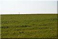
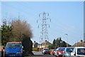
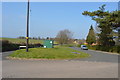
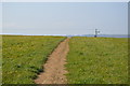
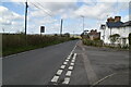
Images taken near to Shalmsford Street, CT4 7PY and the surrounding area
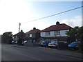
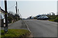
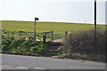
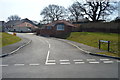

Please click the More button for more images, licensing and image copyright information.
Canterbury and nearby Videos From YouTube
Morrisons Supermarket in Canterbury | August 17th 2022 | DJI Mini 3 Drone Footage
This is aerial footage of the Morrisons supermarket in Canterbury. Situated in the Wincheap area of the Cathedral city.
Channel: Drones Deep (View Channel)
Published: 17 Aug 2022
Police
This area is policed by Kent Police.
Kent Police split their policing area into 293 separate neighbourhoods and this postcode is in the Chartham and Stone Street neighbourhood.

Chartham and Stone Street Neighbourhood Crime
Top 3 Categories
For full details of all categories together with more crime information, click on the Details button.
Member of UK Parliament
This postcode is in the Canterbury parliamentary constituency.
Canterbury is a constituency in the South East region of England. The seat has been held by Rosie Duffield (Labour) since June 2017.

Most Recent House Sales for Shalmsford Street, CT4 7PY
12 May 2023
21 Apr 2023
5 Apr 2022
29 Sep 2021
Local Petrol Station Prices
Coordinates for CT4 7PY
Residents at CT4 7PY
Sunrise and Sunset at CT4 7PY
Traffic Emission and Congestion Zones
Historical Weather Summary
| Clear | 10.65% |
| Cloudy | 69.44% |
| Rain | 8.67% |
| Windy | 11.24% |
| Other | 0.00% |
Population
Deprivation Index
the more deprived the postcode
Average Energy Performance
Companies Registered at CT4 7PY
Postcode Details for CT4 7PY
Recent Updates
|
18 Apr 2024 Added Traffic Camera Views from Traffic Scotland to Roadworks within Scotland |
|
15 Apr 2024 Schools Data updated for April 2024 |
|
10 Apr 2024 Companies Data updated for March 2024 |
|
7 Apr 2024 New option to receive automatic updates to roadworks that affect you |
|
7 Apr 2024 Police and Crime data updated for February 2024 |
|
3 Apr 2024 Sold House Price data updated for February 2024 |
|
30 Mar 2024 Energy Performance Certificates (England and Wales) updated February 2024 |
|
28 Mar 2024 New feature to use Geolocating functions to detect your current location |
Random Postcodes
Want an idea of what is in our extensive website? Try somewhere completely random!
The Rural/Urban classification is based upon data collected during the 2011 Census and released in August 2013 and is categorised into 6 distinct classes.
[A] Urban Major conurbation: A built up area with a population of 10,000 (3,000 in Scotland) or more and is assigned to the major conurbation settlement category.
[B] Urban Minor conurbation: A built up area with a population of 10,000 (3,000 in Scotland) or more and is assigned to the minor conurbation settlement category.
[C] Urban City and town: A built up area with a population of 10,000 (3,000 in Scotland) or more and is assigned to the city and town settlement category.
[D] Rural Town and fringe
[E] Rural Village
[F] Rural Hamlet and isolated dwelling
The Index of Multiple Deprivation (IMD) is the official measure of relative deprivation.
The index is based on 39 separate indicators across seven distinct domains (Income; Employment; Health and Disability; Education, Skills and Training; Crime; Barriers to Housing and Services; Living Environment) to provide an overall measure of multiple deprivation and is calculated for every neighbourhood.
The index is relative rather than an absolute scale and so a neighbourhood with a score of 10 is more deprived than one rated 20, but this does not equate to being twice as deprived.
Please note: Different indices are used in England, Scotland, Wales and Northern Ireland and so comparison of scores from neighbourhoods in different countries should not be undertaken.
These figures report on incorporated UK companies only that are registered at this postcode and do not include sole-traders, partnerships or overseas organisations.
The population figure shown for your area are an estimate provided by the Office for National Statistics and is rounded to the nearest 1,000.
The estimates are derived from the Annual Population Survey (APS) which is the Labour Force Survey (LFS) plus various sample boosts.
There are 26 county councils in 2-tier areas, providing services such as education, social services and waste disposal.
In 2-tier areas, each county council area is subdivided into districts, for which there is an independent district council. There are 192 district councils.
District councils are responsible for local services such as rubbish collection, housing and planning applications.