Overview for Watkin Road, FOLKESTONE, CT19 5ES
Introduction
Folkestone (FOHK-stən) is a port town on the English Channel, in Kent, south-east England. The town lies on the southern edge of the North Downs at a valley between two cliffs. It was an important harbour and shipping port for most of the 19th and 20th centuries.
There has been a settlement in this location since the Mesolithic era. A nunnery was founded by Eanswith, granddaughter of Æthelberht of Kent in the 7th century, who is still commemorated as part of the town's culture. During the 13th century it subsequently developed into a seaport and the harbour developed during the early 19th century to provide defence against a French invasion. Folkestone expanded further west after the arrival of the railway in 1843 as an elegant coastal resort, thanks to the investment of the Earl of Radnor under the urban plan of Decimus Burton.
In its heyday – during the Edwardian era – Folkestone was considered the most fashionable resort of the time, visited by royalties – amongst them Queen Victoria and Edward VII and other members of the English aristocracy. The architecture of the town, especially in the West End part of the town is a testimony of this period with many impressive buildings, townhouses, villas, private squares and large hotels built to accommodate the gentry. After two world wars and the boom of the overseas holiday package, the town quickly declined. The harbour's trade diminished following the opening of the nearby Channel Tunnel and the ending of ferry services from Folkestone, but it still remains in active use.
Summary for Watkin Road, FOLKESTONE, CT19 5ES
Roadworks near CT19 5ES
Road Safety near CT19 5ES
Details of personal injury accidents in and around Watkin Road, CT19 5ES that have been reported to Kent Police over the past 20 years.
Traffic Levels near CT19 5ES
View traffic levels near Watkin Road, CT19 5ES from official Department for Transport counts.
Images taken near to Watkin Road, CT19 5ES and the surrounding area
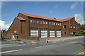
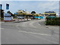

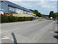
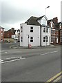


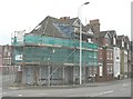
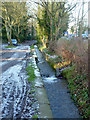
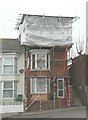
Please click the More button for more images, licensing and image copyright information.
Police
This area is policed by Kent Police.
Kent Police split their policing area into 293 separate neighbourhoods and this postcode is in the East Folkestone neighbourhood.

East Folkestone Neighbourhood Crime
Top 3 Categories
For full details of all categories together with more crime information, click on the Details button.
Member of UK Parliament
This postcode is in the Folkestone and Hythe parliamentary constituency.
Folkestone and Hythe is a constituency in the South East region of England. The seat has been held by Damian Collins (Conservative) since May 2010.

Most Recent House Sales for Watkin Road, CT19 5ES
19 Jan 2023
27 Jan 2016
2 Apr 2014
31 Jan 2013
Local Petrol Station Prices
Coordinates for CT19 5ES
Residents at CT19 5ES
Sunrise and Sunset at CT19 5ES
Traffic Emission and Congestion Zones
Historical Weather Summary
| Clear | 9.10% |
| Cloudy | 48.64% |
| Rain | 10.73% |
| Windy | 31.52% |
| Other | 0.01% |
Population
Deprivation Index
the more deprived the postcode
Average Energy Performance
Companies Registered at CT19 5ES
Postcode Details for CT19 5ES
Recent Updates
|
18 Apr 2024 Added Traffic Camera Views from Traffic Scotland to Roadworks within Scotland |
|
15 Apr 2024 Schools Data updated for April 2024 |
|
10 Apr 2024 Companies Data updated for March 2024 |
|
7 Apr 2024 New option to receive automatic updates to roadworks that affect you |
|
7 Apr 2024 Police and Crime data updated for February 2024 |
|
3 Apr 2024 Sold House Price data updated for February 2024 |
|
30 Mar 2024 Energy Performance Certificates (England and Wales) updated February 2024 |
|
28 Mar 2024 New feature to use Geolocating functions to detect your current location |
Random Postcodes
Want an idea of what is in our extensive website? Try somewhere completely random!
The Rural/Urban classification is based upon data collected during the 2011 Census and released in August 2013 and is categorised into 6 distinct classes.
[A] Urban Major conurbation: A built up area with a population of 10,000 (3,000 in Scotland) or more and is assigned to the major conurbation settlement category.
[B] Urban Minor conurbation: A built up area with a population of 10,000 (3,000 in Scotland) or more and is assigned to the minor conurbation settlement category.
[C] Urban City and town: A built up area with a population of 10,000 (3,000 in Scotland) or more and is assigned to the city and town settlement category.
[D] Rural Town and fringe
[E] Rural Village
[F] Rural Hamlet and isolated dwelling
The Index of Multiple Deprivation (IMD) is the official measure of relative deprivation.
The index is based on 39 separate indicators across seven distinct domains (Income; Employment; Health and Disability; Education, Skills and Training; Crime; Barriers to Housing and Services; Living Environment) to provide an overall measure of multiple deprivation and is calculated for every neighbourhood.
The index is relative rather than an absolute scale and so a neighbourhood with a score of 10 is more deprived than one rated 20, but this does not equate to being twice as deprived.
Please note: Different indices are used in England, Scotland, Wales and Northern Ireland and so comparison of scores from neighbourhoods in different countries should not be undertaken.
These figures report on incorporated UK companies only that are registered at this postcode and do not include sole-traders, partnerships or overseas organisations.
The population figure shown for your area are an estimate provided by the Office for National Statistics and is rounded to the nearest 1,000.
The estimates are derived from the Annual Population Survey (APS) which is the Labour Force Survey (LFS) plus various sample boosts.
There are 26 county councils in 2-tier areas, providing services such as education, social services and waste disposal.
In 2-tier areas, each county council area is subdivided into districts, for which there is an independent district council. There are 192 district councils.
District councils are responsible for local services such as rubbish collection, housing and planning applications.