Overview for St. Francis Close, DEAL, CT14 9LS
Introduction
Deal is a coastal town in Kent, England, which lies where the North Sea and the English Channel meet, 8 miles (13 km) north-east of Dover and 8 miles (13 km) south of Ramsgate. It is a former fishing, mining and garrison town whose history is closely linked to the anchorage in the Downs. Close to Deal is Walmer, a possible location for Julius Caesar's first arrival in Britain.
Deal became a 'limb port' of the Cinque Ports in 1278 and grew into the busiest port in England; today it is a seaside resort, its quaint streets and houses a reminder of its history along with many ancient buildings and monuments. In 1968, Middle Street was the first conservation area in Kent. The coast of France is approximately 25 miles (40 km) from the town and is visible on clear days. The Tudor-era Deal Castle, commissioned by then-King, Henry VIII, has a rose floor plan.
Summary for St. Francis Close, DEAL, CT14 9LS
Roadworks near CT14 9LS
Road Safety near CT14 9LS
Details of personal injury accidents in and around St. Francis Close, CT14 9LS that have been reported to Kent Police over the past 20 years.
Traffic Levels near CT14 9LS
View traffic levels near St. Francis Close, CT14 9LS from official Department for Transport counts.
Images taken near to St. Francis Close, CT14 9LS and the surrounding area
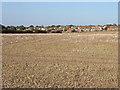
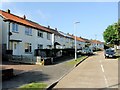
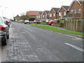
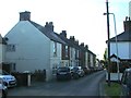
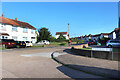
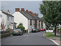
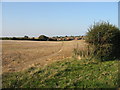
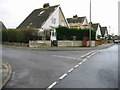
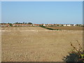
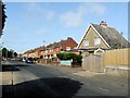
Please click the More button for more images, licensing and image copyright information.
Police
This area is policed by Kent Police.
Kent Police split their policing area into 293 separate neighbourhoods and this postcode is in the Guston, Kingsdown and St. Margaret's-at-Cliffe neighbourhood.

Guston, Kingsdown and St. Margaret's-at-Cliffe Neighbourhood Crime
Top 3 Categories
For full details of all categories together with more crime information, click on the Details button.
Member of UK Parliament
This postcode is in the Dover parliamentary constituency.
Dover is a constituency in the South East region of England. The seat has been held by Mrs Natalie Elphicke (Conservative) since December 2019.

Most Recent House Sales for St. Francis Close, CT14 9LS
19 Apr 2023
9 Dec 2022
28 Apr 2022
14 Jul 2021
Local Petrol Station Prices
Coordinates for CT14 9LS
Residents at CT14 9LS
Sunrise and Sunset at CT14 9LS
Traffic Emission and Congestion Zones
Historical Weather Summary
| Clear | 8.42% |
| Cloudy | 43.16% |
| Rain | 9.78% |
| Windy | 38.63% |
| Other | 0.01% |
Population
Deprivation Index
the more deprived the postcode
Average Energy Performance
Companies Registered at CT14 9LS
Postcode Details for CT14 9LS
Recent Updates
|
18 Apr 2024 Added Traffic Camera Views from Traffic Scotland to Roadworks within Scotland |
|
15 Apr 2024 Schools Data updated for April 2024 |
|
10 Apr 2024 Companies Data updated for March 2024 |
|
7 Apr 2024 New option to receive automatic updates to roadworks that affect you |
|
7 Apr 2024 Police and Crime data updated for February 2024 |
|
3 Apr 2024 Sold House Price data updated for February 2024 |
|
30 Mar 2024 Energy Performance Certificates (England and Wales) updated February 2024 |
|
28 Mar 2024 New feature to use Geolocating functions to detect your current location |
Random Postcodes
Want an idea of what is in our extensive website? Try somewhere completely random!
The Rural/Urban classification is based upon data collected during the 2011 Census and released in August 2013 and is categorised into 6 distinct classes.
[A] Urban Major conurbation: A built up area with a population of 10,000 (3,000 in Scotland) or more and is assigned to the major conurbation settlement category.
[B] Urban Minor conurbation: A built up area with a population of 10,000 (3,000 in Scotland) or more and is assigned to the minor conurbation settlement category.
[C] Urban City and town: A built up area with a population of 10,000 (3,000 in Scotland) or more and is assigned to the city and town settlement category.
[D] Rural Town and fringe
[E] Rural Village
[F] Rural Hamlet and isolated dwelling
The Index of Multiple Deprivation (IMD) is the official measure of relative deprivation.
The index is based on 39 separate indicators across seven distinct domains (Income; Employment; Health and Disability; Education, Skills and Training; Crime; Barriers to Housing and Services; Living Environment) to provide an overall measure of multiple deprivation and is calculated for every neighbourhood.
The index is relative rather than an absolute scale and so a neighbourhood with a score of 10 is more deprived than one rated 20, but this does not equate to being twice as deprived.
Please note: Different indices are used in England, Scotland, Wales and Northern Ireland and so comparison of scores from neighbourhoods in different countries should not be undertaken.
These figures report on incorporated UK companies only that are registered at this postcode and do not include sole-traders, partnerships or overseas organisations.
The population figure shown for your area are an estimate provided by the Office for National Statistics and is rounded to the nearest 1,000.
The estimates are derived from the Annual Population Survey (APS) which is the Labour Force Survey (LFS) plus various sample boosts.
There are 26 county councils in 2-tier areas, providing services such as education, social services and waste disposal.
In 2-tier areas, each county council area is subdivided into districts, for which there is an independent district council. There are 192 district councils.
District councils are responsible for local services such as rubbish collection, housing and planning applications.