Overview for Long Lane, CROYDON, CR0 7AP
Introduction
Croydon is a large town in South London, England, 9.4 miles (15.1 km) south of Charing Cross. Part of the London Borough of Croydon, a local government district of Greater London, it is one of the largest commercial districts in Greater London, with an extensive shopping district and night-time economy. The entire town had a population of 192,064 as of 2011, whilst the wider borough had a population of 384,837.
Historically an ancient parish in the Wallington hundred of Surrey, at the time of the Norman conquest of England Croydon had a church, a mill, and around 365 inhabitants, as recorded in the Domesday Book of 1086. Croydon expanded in the Middle Ages as a market town and a centre for charcoal production, leather tanning and brewing. The Surrey Iron Railway from Croydon to Wandsworth opened in 1803 and was an early public railway. Later 19th century railway building facilitated Croydon's growth as a commuter town for London. By the early 20th century, Croydon was an important industrial area, known for car manufacture, metal working and Croydon Airport. In the mid 20th century these sectors were replaced by retailing and the service economy, brought about by massive redevelopment which saw the rise of office blocks and the Whitgift Centre, the largest shopping centre in Greater London until 2008. Historically, the town formed part of the County of Surrey, and between 1889 and 1965 a county borough, but was amalgamated into Greater London in 1965.
Croydon lies on a transport corridor between central London and the south coast of England, to the north of two high gaps in the North Downs, one taken by the A23 Brighton Road and the main railway line through Purley and Merstham and the other by the A22 from Purley to the M25 Godstone interchange. Road traffic is diverted away from a largely pedestrianised town centre, mostly consisting of North End. East Croydon railway station is a hub of the national railway system, with frequent fast services to central London, Brighton and the south coast. The town is also at the centre of the only tramway system in southern England.
Summary for Long Lane, CROYDON, CR0 7AP
Roadworks near CR0 7AP
Road Safety near CR0 7AP
Details of personal injury accidents in and around Long Lane, CR0 7AP that have been reported to Metropolitan Police Service over the past 20 years.
Traffic Levels near CR0 7AP
View traffic levels near Long Lane, CR0 7AP from official Department for Transport counts.
Images taken near to Long Lane, CR0 7AP and the surrounding area
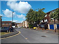
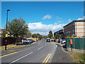
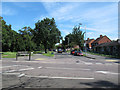
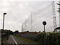
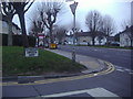
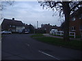
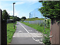
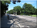
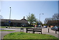
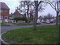
Please click the More button for more images, licensing and image copyright information.
Member of UK Parliament
This postcode is in the Croydon Central parliamentary constituency.
Croydon Central is a constituency in London, England. The seat has been held by Sarah Jones (Labour) since June 2017.

Most Recent House Sales for Long Lane, CR0 7AP
19 Mar 2021
15 Jul 2020
19 Oct 2018
10 Oct 2018
Local Petrol Station Prices
Coordinates for CR0 7AP
Residents at CR0 7AP
Sunrise and Sunset at CR0 7AP
Traffic Emission Zones
Historical Weather Summary
| Clear | 19.35% |
| Cloudy | 48.86% |
| Rain | 5.75% |
| Windy | 25.94% |
| Other | 0.10% |
Population
Deprivation Index
the more deprived the postcode
Average Energy Performance
Companies Registered at CR0 7AP
Postcode Details for CR0 7AP
Recent Updates
|
18 Apr 2024 Added Traffic Camera Views from Traffic Scotland to Roadworks within Scotland |
|
15 Apr 2024 Schools Data updated for April 2024 |
|
10 Apr 2024 Companies Data updated for March 2024 |
|
7 Apr 2024 New option to receive automatic updates to roadworks that affect you |
|
7 Apr 2024 Police and Crime data updated for February 2024 |
|
3 Apr 2024 Sold House Price data updated for February 2024 |
|
30 Mar 2024 Energy Performance Certificates (England and Wales) updated February 2024 |
|
28 Mar 2024 New feature to use Geolocating functions to detect your current location |
Random Postcodes
Want an idea of what is in our extensive website? Try somewhere completely random!
The Rural/Urban classification is based upon data collected during the 2011 Census and released in August 2013 and is categorised into 6 distinct classes.
[A] Urban Major conurbation: A built up area with a population of 10,000 (3,000 in Scotland) or more and is assigned to the major conurbation settlement category.
[B] Urban Minor conurbation: A built up area with a population of 10,000 (3,000 in Scotland) or more and is assigned to the minor conurbation settlement category.
[C] Urban City and town: A built up area with a population of 10,000 (3,000 in Scotland) or more and is assigned to the city and town settlement category.
[D] Rural Town and fringe
[E] Rural Village
[F] Rural Hamlet and isolated dwelling
The Index of Multiple Deprivation (IMD) is the official measure of relative deprivation.
The index is based on 39 separate indicators across seven distinct domains (Income; Employment; Health and Disability; Education, Skills and Training; Crime; Barriers to Housing and Services; Living Environment) to provide an overall measure of multiple deprivation and is calculated for every neighbourhood.
The index is relative rather than an absolute scale and so a neighbourhood with a score of 10 is more deprived than one rated 20, but this does not equate to being twice as deprived.
Please note: Different indices are used in England, Scotland, Wales and Northern Ireland and so comparison of scores from neighbourhoods in different countries should not be undertaken.
These figures report on incorporated UK companies only that are registered at this postcode and do not include sole-traders, partnerships or overseas organisations.
The population figure shown for your area are an estimate provided by the Office for National Statistics and is rounded to the nearest 1,000.
The estimates are derived from the Annual Population Survey (APS) which is the Labour Force Survey (LFS) plus various sample boosts.
There are 32 London boroughs. They provide nearly all the services in their area. However, the Greater London Authority (GLA) provides London-wide government, including special responsibility for police, fire, strategic planning and transport.