Overview for Garrison Lane, SUDBURY, CO10 0RP
Introduction
Sudbury is a market town in the south west of Suffolk, England, on the River Stour near the Essex border, 60 miles (97 km) north-east of London. At the 2011 census, it had a population of 13,063. It is the largest town in the Babergh local government district and part of the South Suffolk constituency.
Sudbury was an Anglo-Saxon settlement from the end of the 8th century, and its market was established in the early 11th century. Its textile industries prospered in the Late Middle Ages, the wealth of which funded many of its buildings and churches. The town became notable for its art in the 18th century, being the birthplace of Thomas Gainsborough, whose landscapes offered inspiration to John Constable, another Suffolk painter of the surrounding Stour Valley area. The 19th century saw the arrival of the railway with the opening of a station on the historic Stour Valley Railway, and Sudbury railway station forms the current terminus of the Gainsborough Line. In World War II, US Army Air Forces bombers operated from RAF Sudbury.
Today, Sudbury retains its status as a market town with a twice-weekly market in the town centre in front of St Peter's Church, which is now a cultural venue for events such as concerts and exhibitions. In sport, the town has a semi-professional football club, A.
F.
C. Sudbury, which competes at the seventh level of the football pyramid.
It is home to the Gainsborough's House museum, celebrating the work of the artist.
Summary for Garrison Lane, SUDBURY, CO10 0RP
Roadworks near CO10 0RP
Road Safety near CO10 0RP
Details of personal injury accidents in and around Garrison Lane, CO10 0RP that have been reported to Suffolk Constabulary over the past 20 years.
Traffic Levels near CO10 0RP
View traffic levels near Garrison Lane, CO10 0RP from official Department for Transport counts.
Images taken near to Garrison Lane, CO10 0RP and the surrounding area
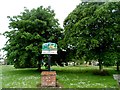
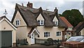
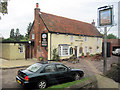
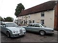
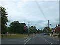
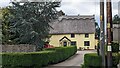
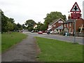
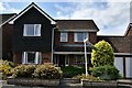
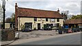
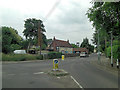
Please click the More button for more images, licensing and image copyright information.
Police
This area is policed by Suffolk Constabulary.
Suffolk Constabulary split their policing area into 50 separate neighbourhoods and this postcode is in the Sudbury neighbourhood.

Sudbury Neighbourhood Crime
Top 3 Categories
For full details of all categories together with more crime information, click on the Details button.
Member of UK Parliament
This postcode is in the South Suffolk parliamentary constituency.
South Suffolk is a constituency in the East of England region of England. The seat has been held by James Cartlidge (Conservative) since May 2015.

Most Recent House Sales for Garrison Lane, CO10 0RP
15 Dec 2017
26 Oct 2015
27 Oct 2011
4 Apr 2008
Local Petrol Station Prices
Coordinates for CO10 0RP
Residents at CO10 0RP
Sunrise and Sunset at CO10 0RP
Traffic Emission and Congestion Zones
Historical Weather Summary
| Clear | 10.05% |
| Cloudy | 65.90% |
| Rain | 6.88% |
| Windy | 17.07% |
| Other | 0.10% |
Population
Deprivation Index
the more deprived the postcode
Average Energy Performance
Companies Registered at CO10 0RP
Postcode Details for CO10 0RP
Recent Updates
|
18 Apr 2024 Added Traffic Camera Views from Traffic Scotland to Roadworks within Scotland |
|
15 Apr 2024 Schools Data updated for April 2024 |
|
10 Apr 2024 Companies Data updated for March 2024 |
|
7 Apr 2024 New option to receive automatic updates to roadworks that affect you |
|
7 Apr 2024 Police and Crime data updated for February 2024 |
|
3 Apr 2024 Sold House Price data updated for February 2024 |
|
30 Mar 2024 Energy Performance Certificates (England and Wales) updated February 2024 |
|
28 Mar 2024 New feature to use Geolocating functions to detect your current location |
Random Postcodes
Want an idea of what is in our extensive website? Try somewhere completely random!
The Rural/Urban classification is based upon data collected during the 2011 Census and released in August 2013 and is categorised into 6 distinct classes.
[A] Urban Major conurbation: A built up area with a population of 10,000 (3,000 in Scotland) or more and is assigned to the major conurbation settlement category.
[B] Urban Minor conurbation: A built up area with a population of 10,000 (3,000 in Scotland) or more and is assigned to the minor conurbation settlement category.
[C] Urban City and town: A built up area with a population of 10,000 (3,000 in Scotland) or more and is assigned to the city and town settlement category.
[D] Rural Town and fringe
[E] Rural Village
[F] Rural Hamlet and isolated dwelling
The Index of Multiple Deprivation (IMD) is the official measure of relative deprivation.
The index is based on 39 separate indicators across seven distinct domains (Income; Employment; Health and Disability; Education, Skills and Training; Crime; Barriers to Housing and Services; Living Environment) to provide an overall measure of multiple deprivation and is calculated for every neighbourhood.
The index is relative rather than an absolute scale and so a neighbourhood with a score of 10 is more deprived than one rated 20, but this does not equate to being twice as deprived.
Please note: Different indices are used in England, Scotland, Wales and Northern Ireland and so comparison of scores from neighbourhoods in different countries should not be undertaken.
These figures report on incorporated UK companies only that are registered at this postcode and do not include sole-traders, partnerships or overseas organisations.
The population figure shown for your area are an estimate provided by the Office for National Statistics and is rounded to the nearest 1,000.
The estimates are derived from the Annual Population Survey (APS) which is the Labour Force Survey (LFS) plus various sample boosts.
There are 26 county councils in 2-tier areas, providing services such as education, social services and waste disposal.
In 2-tier areas, each county council area is subdivided into districts, for which there is an independent district council. There are 192 district councils.
District councils are responsible for local services such as rubbish collection, housing and planning applications.