Overview for Southern Way, HARLOW, CM20 9SF
Introduction
Harlow is a town and local government district located in the west of Essex, England. Founded as a new town, it is situated on the border with Hertfordshire and London, Harlow occupies a large area of land on the south bank of the upper Stort Valley, which has been made navigable through other towns and features a canal section near its watermill.
Old Harlow is a historic village founded by the early medieval age and most of its high street buildings are early Victorian and residential, mostly protected by one of the Conservation Areas in the district. In Old Harlow is a field named Harlowbury, a de-settled monastic area which has the remains of a chapel, a scheduled ancient monument. The M11 motorway passes through to the east of the town. Harlow has its own commercial and leisure economy. It is also an outer part of the London commuter belt and employment centre of the M11 corridor which includes Cambridge and London Stansted Airport to the north.
At the time of the 2011 Census, Harlow's population was recorded at 81,944 and its district had the third-highest proportion of social housing in England, 26.9%, a legacy of the 1947 commitment to re-house blitzed London families after World War II and provide a percentage of homes for other needy families who cannot afford market rents.
Summary for Southern Way, HARLOW, CM20 9SF
Roadworks near CM20 9SF
Road Safety near CM20 9SF
Details of personal injury accidents in and around Southern Way, CM20 9SF that have been reported to Essex Police over the past 20 years.
Traffic Levels near CM20 9SF
View traffic levels near Southern Way, CM20 9SF from official Department for Transport counts.
Images taken near to Southern Way, CM20 9SF and the surrounding area
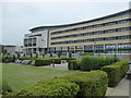
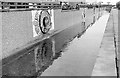
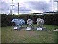
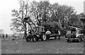

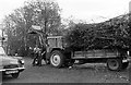

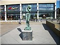
Please click the More button for more images, licensing and image copyright information.
Police
This area is policed by Essex Police.
Essex Police split their policing area into 56 separate neighbourhoods and this postcode is in the Harlow Town Centre neighbourhood.

Harlow Town Centre Neighbourhood Crime
Top 3 Categories
For full details of all categories together with more crime information, click on the Details button.
Member of UK Parliament
This postcode is in the Harlow parliamentary constituency.
Harlow is a constituency in the East of England region of England. The seat has been held by Robert Halfon (Conservative) since May 2010.

Most Recent House Sales for Southern Way, CM20 9SF
No recorded house sales or transfers for this postcode.
Local Petrol Station Prices
Coordinates for CM20 9SF
Residents at CM20 9SF
Sunrise and Sunset at CM20 9SF
Traffic Emission and Congestion Zones
Historical Weather Summary
| Clear | 9.24% |
| Cloudy | 80.64% |
| Rain | 7.51% |
| Windy | 2.56% |
| Other | 0.05% |
Population
Deprivation Index
the more deprived the postcode
Companies Registered at CM20 9SF
Postcode Details for CM20 9SF
Recent Updates
|
18 Apr 2024 Added Traffic Camera Views from Traffic Scotland to Roadworks within Scotland |
|
15 Apr 2024 Schools Data updated for April 2024 |
|
10 Apr 2024 Companies Data updated for March 2024 |
|
7 Apr 2024 New option to receive automatic updates to roadworks that affect you |
|
7 Apr 2024 Police and Crime data updated for February 2024 |
|
3 Apr 2024 Sold House Price data updated for February 2024 |
|
30 Mar 2024 Energy Performance Certificates (England and Wales) updated February 2024 |
|
28 Mar 2024 New feature to use Geolocating functions to detect your current location |
Random Postcodes
Want an idea of what is in our extensive website? Try somewhere completely random!
The Rural/Urban classification is based upon data collected during the 2011 Census and released in August 2013 and is categorised into 6 distinct classes.
[A] Urban Major conurbation: A built up area with a population of 10,000 (3,000 in Scotland) or more and is assigned to the major conurbation settlement category.
[B] Urban Minor conurbation: A built up area with a population of 10,000 (3,000 in Scotland) or more and is assigned to the minor conurbation settlement category.
[C] Urban City and town: A built up area with a population of 10,000 (3,000 in Scotland) or more and is assigned to the city and town settlement category.
[D] Rural Town and fringe
[E] Rural Village
[F] Rural Hamlet and isolated dwelling
The Index of Multiple Deprivation (IMD) is the official measure of relative deprivation.
The index is based on 39 separate indicators across seven distinct domains (Income; Employment; Health and Disability; Education, Skills and Training; Crime; Barriers to Housing and Services; Living Environment) to provide an overall measure of multiple deprivation and is calculated for every neighbourhood.
The index is relative rather than an absolute scale and so a neighbourhood with a score of 10 is more deprived than one rated 20, but this does not equate to being twice as deprived.
Please note: Different indices are used in England, Scotland, Wales and Northern Ireland and so comparison of scores from neighbourhoods in different countries should not be undertaken.
These figures report on incorporated UK companies only that are registered at this postcode and do not include sole-traders, partnerships or overseas organisations.
The population figure shown for your area are an estimate provided by the Office for National Statistics and is rounded to the nearest 1,000.
The estimates are derived from the Annual Population Survey (APS) which is the Labour Force Survey (LFS) plus various sample boosts.
There are 26 county councils in 2-tier areas, providing services such as education, social services and waste disposal.
In 2-tier areas, each county council area is subdivided into districts, for which there is an independent district council. There are 192 district councils.
District councils are responsible for local services such as rubbish collection, housing and planning applications.