Overview for Bridgeman Road, CHESTER, CH1 5LY
Introduction
Chester is a cathedral city and the county town of Cheshire, England, on the River Dee, close to the England-Wales border. With a population of 79,645 in 2011, it is the most populous settlement of Cheshire West and Chester (a unitary authority which had a population of 329,608 in 2011) and serves as its administrative headquarters. It is also the historic county town of Cheshire and the second-largest settlement in Cheshire after Warrington.
Chester was founded in 79 AD as a "castrum" or Roman fort with the name Deva Victrix during the reign of Emperor Vespasian. One of the main army camps in Roman Britain, Deva later became a major civilian settlement. In 689, King Æthelred of Mercia founded the Minster Church of West Mercia, which later became Chester's first cathedral, and the Angles extended and strengthened the walls to protect the city against the Danes. Chester was one of the last cities in England to fall to the Normans, and William the Conqueror ordered the construction of a castle to dominate the town and the nearby Welsh border. Chester was granted city status in 1541.
The city walls of Chester are some of the best-preserved in the country and have Grade I listed status. It has a number of medieval buildings, but many of the black-and-white buildings within the city centre are Victorian restorations, originating from the Black-and-white Revival movement. Apart from a 100-metre (330 ft) section, the walls are almost complete. The Industrial Revolution brought railways, canals, and new roads to the city, which saw substantial expansion and development; Chester Town Hall and the Grosvenor Museum are examples of Victorian architecture from this period. Tourism, the retail industry, public administration, and financial services are important to the modern economy. Chester signs itself as Chester International Heritage City on road signs on the main roads entering the city.
Summary for Bridgeman Road, CHESTER, CH1 5LY
Roadworks near CH1 5LY
Road Safety near CH1 5LY
Details of personal injury accidents in and around Bridgeman Road, CH1 5LY that have been reported to Cheshire Constabulary over the past 20 years.
Traffic Levels near CH1 5LY
View traffic levels near Bridgeman Road, CH1 5LY from official Department for Transport counts.
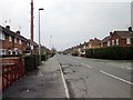
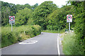
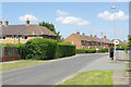
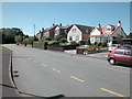
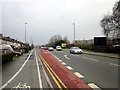
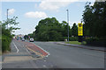
Images taken near to Bridgeman Road, CH1 5LY and the surrounding area
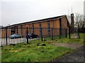
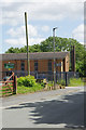
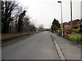
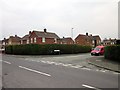
Please click the More button for more images, licensing and image copyright information.
Chester and nearby Videos From YouTube
Old Dee Bridge to Queens Park Bridge - Chester By Drone
A dramatic trip up the River Dee in the beautiful and ancient Roman walled city of Chester, England. The arched bridge on view ...
Channel: Orion Aerial Images (View Channel)
Published: 21 Apr 2022
Police
This area is policed by Cheshire Constabulary.
Cheshire Constabulary split their policing area into 122 separate neighbourhoods and this postcode is in the Blacon neighbourhood.

Blacon Neighbourhood Crime
Top 3 Categories
For full details of all categories together with more crime information, click on the Details button.
Member of UK Parliament
Unfortunately, Parliamentary details are not available for this postcode.
Most Recent House Sales for Bridgeman Road, CH1 5LY
12 Aug 2022
27 Sep 2021
21 Feb 2019
29 Aug 2014
Local Petrol Station Prices
Coordinates for CH1 5LY
Residents at CH1 5LY
Sunrise and Sunset at CH1 5LY
Traffic Emission and Congestion Zones
Historical Weather Summary
| Clear | 19.52% |
| Cloudy | 62.58% |
| Rain | 6.88% |
| Windy | 10.97% |
| Other | 0.05% |
Population
Deprivation Index
the more deprived the postcode
Average Energy Performance
Companies Registered at CH1 5LY
Postcode Details for CH1 5LY
Recent Updates
|
18 Apr 2024 Added Traffic Camera Views from Traffic Scotland to Roadworks within Scotland |
|
15 Apr 2024 Schools Data updated for April 2024 |
|
10 Apr 2024 Companies Data updated for March 2024 |
|
7 Apr 2024 New option to receive automatic updates to roadworks that affect you |
|
7 Apr 2024 Police and Crime data updated for February 2024 |
|
3 Apr 2024 Sold House Price data updated for February 2024 |
|
30 Mar 2024 Energy Performance Certificates (England and Wales) updated February 2024 |
|
28 Mar 2024 New feature to use Geolocating functions to detect your current location |
Random Postcodes
Want an idea of what is in our extensive website? Try somewhere completely random!
The Rural/Urban classification is based upon data collected during the 2011 Census and released in August 2013 and is categorised into 6 distinct classes.
[A] Urban Major conurbation: A built up area with a population of 10,000 (3,000 in Scotland) or more and is assigned to the major conurbation settlement category.
[B] Urban Minor conurbation: A built up area with a population of 10,000 (3,000 in Scotland) or more and is assigned to the minor conurbation settlement category.
[C] Urban City and town: A built up area with a population of 10,000 (3,000 in Scotland) or more and is assigned to the city and town settlement category.
[D] Rural Town and fringe
[E] Rural Village
[F] Rural Hamlet and isolated dwelling
The Index of Multiple Deprivation (IMD) is the official measure of relative deprivation.
The index is based on 39 separate indicators across seven distinct domains (Income; Employment; Health and Disability; Education, Skills and Training; Crime; Barriers to Housing and Services; Living Environment) to provide an overall measure of multiple deprivation and is calculated for every neighbourhood.
The index is relative rather than an absolute scale and so a neighbourhood with a score of 10 is more deprived than one rated 20, but this does not equate to being twice as deprived.
Please note: Different indices are used in England, Scotland, Wales and Northern Ireland and so comparison of scores from neighbourhoods in different countries should not be undertaken.
These figures report on incorporated UK companies only that are registered at this postcode and do not include sole-traders, partnerships or overseas organisations.
The population figure shown for your area are an estimate provided by the Office for National Statistics and is rounded to the nearest 1,000.
The estimates are derived from the Annual Population Survey (APS) which is the Labour Force Survey (LFS) plus various sample boosts.
There are 55 unitary authorities. They provide all local government services in their areas. These are mainly in the cities, urban areas and larger towns although there are now 6 shire county councils that are unitary (ie have no district councils beneath them).