Overview for Colhugh Street, LLANTWIT MAJOR, CF61 1RE
Introduction
Llantwit Major is a town and community in Wales on the Bristol Channel coast. It is one of four towns in the Vale of Glamorgan, with the third largest population (13,366 in 2001) after Barry and Penarth, and ahead of Cowbridge. It is 4+1⁄2 miles (7.2 km) from Cowbridge, 9 miles (14 km) from Bridgend, 10 miles (16 km) from Barry, and 15 miles (24 km) from Cardiff. It had a population of 9,530 in 2021.
Llanilltud Fawr, named for the Llan of Saint Illtud, was home to the Monastery of Illtud and the college known as Bangor Illtyd. It became one of the most esteemed centres of Christian culture in the Celtic world. At its peak it had over 2,000 students, including princes, eminent clergymen, and revered saints. The institutions were destroyed by the raiding Vikings in 987, but Normans rebuilt the monastery in 1111 and it continued to be a centre of learning until it was disbanded in 1539 during the Dissolution of the Monasteries. The 13th-century St Illtyd's Church, near the ancient monastery, is a Grade I listed building and one of Wales' oldest parish churches.
In the 20th century, the modern town developed rapidly to accommodate Royal Air Force personnel from the St Athan base. Remnants of the medieval cobbled streets can be seen adjacent to 12th century Old Swan Inn; and numerous buildings of the 15th and 16th centuries remain.
Colhugh Beach is a popular surfing venue and has the remnants of an Iron Age fort and some of Wales' finest examples of Jurassic Period fossils. The pebble beach and its clifftops are protected by the Glamorgan Heritage Coast, which stretches for 14 miles (23 km) from Gileston to the east to Southerndown and Newton Point to the west.
Summary for Colhugh Street, LLANTWIT MAJOR, CF61 1RE
Roadworks near CF61 1RE
A local roadworks feed is not available for Wales at this time.
However, Traffic Wales/Traffig Cymru provide works details for motorways and major trunk roads in Wales on their website at traffic.wales/roadworks
Road Safety near CF61 1RE
Details of personal injury accidents in and around Colhugh Street, CF61 1RE that have been reported to South Wales Police over the past 20 years.
Traffic Levels near CF61 1RE
View traffic levels near Colhugh Street, CF61 1RE from official Department for Transport counts.
Images taken near to Colhugh Street, CF61 1RE and the surrounding area
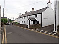
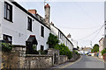
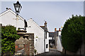
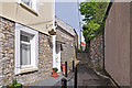
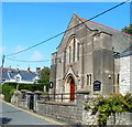
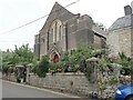
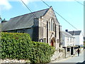
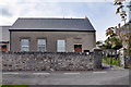
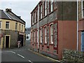
Please click the More button for more images, licensing and image copyright information.
Police
This area is policed by South Wales Police.
South Wales Police split their policing area into 230 separate neighbourhoods and this postcode is in the Llantwit Major neighbourhood.

Llantwit Major Neighbourhood Crime
Top 3 Categories
For full details of all categories together with more crime information, click on the Details button.
Member of UK Parliament
This postcode is in the Vale of Glamorgan parliamentary constituency.
Vale of Glamorgan is a constituency in Wales. The seat has been held by Alun Cairns (Conservative) since May 2010.

Most Recent House Sales for Colhugh Street, CF61 1RE
28 Jan 2022
17 Aug 2021
4 Sep 2020
16 Jan 2020
Local Petrol Station Prices
Coordinates for CF61 1RE
Residents at CF61 1RE
Sunrise and Sunset at CF61 1RE
Traffic Emission and Congestion Zones
Historical Weather Summary
| Clear | 19.72% |
| Cloudy | 62.99% |
| Rain | 8.91% |
| Windy | 8.18% |
| Other | 0.20% |
Population
Deprivation Index
the more deprived the postcode
Average Energy Performance
Companies Registered at CF61 1RE
Postcode Details for CF61 1RE
Recent Updates
|
18 Apr 2024 Added Traffic Camera Views from Traffic Scotland to Roadworks within Scotland |
|
15 Apr 2024 Schools Data updated for April 2024 |
|
10 Apr 2024 Companies Data updated for March 2024 |
|
7 Apr 2024 New option to receive automatic updates to roadworks that affect you |
|
7 Apr 2024 Police and Crime data updated for February 2024 |
|
3 Apr 2024 Sold House Price data updated for February 2024 |
|
30 Mar 2024 Energy Performance Certificates (England and Wales) updated February 2024 |
|
28 Mar 2024 New feature to use Geolocating functions to detect your current location |
Random Postcodes
Want an idea of what is in our extensive website? Try somewhere completely random!
The Rural/Urban classification is based upon data collected during the 2011 Census and released in August 2013 and is categorised into 6 distinct classes.
[A] Urban Major conurbation: A built up area with a population of 10,000 (3,000 in Scotland) or more and is assigned to the major conurbation settlement category.
[B] Urban Minor conurbation: A built up area with a population of 10,000 (3,000 in Scotland) or more and is assigned to the minor conurbation settlement category.
[C] Urban City and town: A built up area with a population of 10,000 (3,000 in Scotland) or more and is assigned to the city and town settlement category.
[D] Rural Town and fringe
[E] Rural Village
[F] Rural Hamlet and isolated dwelling
The Index of Multiple Deprivation (IMD) is the official measure of relative deprivation.
The index is based on 39 separate indicators across seven distinct domains (Income; Employment; Health and Disability; Education, Skills and Training; Crime; Barriers to Housing and Services; Living Environment) to provide an overall measure of multiple deprivation and is calculated for every neighbourhood.
The index is relative rather than an absolute scale and so a neighbourhood with a score of 10 is more deprived than one rated 20, but this does not equate to being twice as deprived.
Please note: Different indices are used in England, Scotland, Wales and Northern Ireland and so comparison of scores from neighbourhoods in different countries should not be undertaken.
These figures report on incorporated UK companies only that are registered at this postcode and do not include sole-traders, partnerships or overseas organisations.
The population figure shown for your area are an estimate provided by the Office for National Statistics and is rounded to the nearest 1,000.
The estimates are derived from the Annual Population Survey (APS) which is the Labour Force Survey (LFS) plus various sample boosts.
There are 55 unitary authorities. They provide all local government services in their areas. These are mainly in the cities, urban areas and larger towns although there are now 6 shire county councils that are unitary (ie have no district councils beneath them).