Overview for The Hawthorns, MERTHYR TYDFIL, CF48 2EJ
Introduction
Merthyr Tydfil is the main town in Merthyr Tydfil County Borough, Wales, administered by Merthyr Tydfil County Borough Council. It is about 23 miles (37 km) north of Cardiff. Often called just Merthyr, it is said to be named after Tydfil, daughter of King Brychan of Brycheiniog, who according to legend was slain at Merthyr by pagans about 480 CE. Merthyr generally means "martyr" in modern Welsh, but here closer to the Latin martyrium: a place of worship built over a martyr's relics. Similar place names in south Wales are Merthyr Cynog, Merthyr Dyfan and Merthyr Mawr.
Noted for its industrial past, Merthyr was known as the 'Iron Capital of the World' in the early 19th century, due to the scale of its iron production. The worlds first ever railway journey happened in Merthyr in 1804, travelling 9 miles from the ironworks at Penydarren to the Glamorganshire Canal on the Merthyr Tramroad. The 1851 census found Wales to be the world's first industrialised nation, as more people were employed in industry than agriculture, with Merthyr the biggest town in Wales at that time. The Ukrainian City of Donetsk, originally 'Hughesovka', was founded by John Hughes of Merthyr in 1870, when he took iron working to the area. Iron production declined in Merthyr from 1860 on, though Merthyr's population continued to rise due to the emergence of coal mining in the area, peaking with around 81,000 people in 1911.
The area is currently known for its industrial heritage and adventure tourism. Merthyr and the surrounding areas boast the Grade-I listed Cyfarthfa Castle, the world’s fastest seated zip line, the UK's largest mountain bike park, the largest indoor climbing wall in Wales, national cycle routes and plans for the UK's longest indoor ski slope.
Summary for The Hawthorns, MERTHYR TYDFIL, CF48 2EJ
Roadworks near CF48 2EJ
A local roadworks feed is not available for Wales at this time.
However, Traffic Wales/Traffig Cymru provide works details for motorways and major trunk roads in Wales on their website at traffic.wales/roadworks
Road Safety near CF48 2EJ
Details of personal injury accidents in and around The Hawthorns, CF48 2EJ that have been reported to South Wales Police over the past 20 years.
Traffic Levels near CF48 2EJ
View traffic levels near The Hawthorns, CF48 2EJ from official Department for Transport counts.
Images taken near to The Hawthorns, CF48 2EJ and the surrounding area

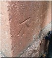
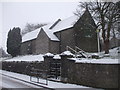
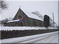
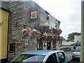
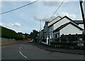
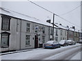
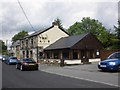
Please click the More button for more images, licensing and image copyright information.
Police
This area is policed by South Wales Police.
South Wales Police split their policing area into 230 separate neighbourhoods and this postcode is in the Dowlais neighbourhood.

Dowlais Neighbourhood Crime
Top 3 Categories
For full details of all categories together with more crime information, click on the Details button.
Member of UK Parliament
This postcode is in the Merthyr Tydfil and Rhymney parliamentary constituency.
Merthyr Tydfil and Rhymney is a constituency in Wales. The seat has been held by Gerald Jones (Labour) since May 2015.

Most Recent House Sales for The Hawthorns, CF48 2EJ
22 Jul 2022
9 Dec 2021
27 Aug 2021
17 Mar 2021
Local Petrol Station Prices
Coordinates for CF48 2EJ
Residents at CF48 2EJ
Sunrise and Sunset at CF48 2EJ
Traffic Emission and Congestion Zones
Historical Weather Summary
| Clear | 18.13% |
| Cloudy | 65.62% |
| Rain | 8.97% |
| Windy | 5.82% |
| Other | 1.46% |
Population
Deprivation Index
the more deprived the postcode
Average Energy Performance
Companies Registered at CF48 2EJ
Postcode Details for CF48 2EJ
Recent Updates
|
18 Apr 2024 Added Traffic Camera Views from Traffic Scotland to Roadworks within Scotland |
|
15 Apr 2024 Schools Data updated for April 2024 |
|
10 Apr 2024 Companies Data updated for March 2024 |
|
7 Apr 2024 New option to receive automatic updates to roadworks that affect you |
|
7 Apr 2024 Police and Crime data updated for February 2024 |
|
3 Apr 2024 Sold House Price data updated for February 2024 |
|
30 Mar 2024 Energy Performance Certificates (England and Wales) updated February 2024 |
|
28 Mar 2024 New feature to use Geolocating functions to detect your current location |
Random Postcodes
Want an idea of what is in our extensive website? Try somewhere completely random!
The Rural/Urban classification is based upon data collected during the 2011 Census and released in August 2013 and is categorised into 6 distinct classes.
[A] Urban Major conurbation: A built up area with a population of 10,000 (3,000 in Scotland) or more and is assigned to the major conurbation settlement category.
[B] Urban Minor conurbation: A built up area with a population of 10,000 (3,000 in Scotland) or more and is assigned to the minor conurbation settlement category.
[C] Urban City and town: A built up area with a population of 10,000 (3,000 in Scotland) or more and is assigned to the city and town settlement category.
[D] Rural Town and fringe
[E] Rural Village
[F] Rural Hamlet and isolated dwelling
The Index of Multiple Deprivation (IMD) is the official measure of relative deprivation.
The index is based on 39 separate indicators across seven distinct domains (Income; Employment; Health and Disability; Education, Skills and Training; Crime; Barriers to Housing and Services; Living Environment) to provide an overall measure of multiple deprivation and is calculated for every neighbourhood.
The index is relative rather than an absolute scale and so a neighbourhood with a score of 10 is more deprived than one rated 20, but this does not equate to being twice as deprived.
Please note: Different indices are used in England, Scotland, Wales and Northern Ireland and so comparison of scores from neighbourhoods in different countries should not be undertaken.
These figures report on incorporated UK companies only that are registered at this postcode and do not include sole-traders, partnerships or overseas organisations.
The population figure shown for your area are an estimate provided by the Office for National Statistics and is rounded to the nearest 1,000.
The estimates are derived from the Annual Population Survey (APS) which is the Labour Force Survey (LFS) plus various sample boosts.
There are 55 unitary authorities. They provide all local government services in their areas. These are mainly in the cities, urban areas and larger towns although there are now 6 shire county councils that are unitary (ie have no district councils beneath them).