Overview for Pant Glas, CARDIFF, CF23 7EU
Introduction
Cardiff is the capital and largest city of Wales. Cardiff had a population of 362,310 in 2021, and forms a principal area officially known as the City and County of Cardiff . The city is the eleventh-largest in the United Kingdom. Located in the south-east of Wales and in the Cardiff Capital Region, Cardiff is the county town of the historic county of Glamorgan and in 1974–1996 of South Glamorgan. It belongs to the Eurocities network of the largest European cities. A small town until the early 19th century, its prominence as a port for coal when mining began in the region helped its expansion. In 1905, it was ranked as a city and in 1955 proclaimed capital of Wales. Cardiff Built-up Area covers a larger area outside the county boundary, including the towns of Dinas Powys and Penarth.
Cardiff is the main commercial centre of Wales as well as the base for the Senedd, the Welsh Parliament. At the 2021 census, the unitary authority area population was put at 362,400. The population of the wider urban area in 2011 was 479,000. In 2011, it ranked sixth in the world in a National Geographic magazine list of alternative tourist destinations. It is the most popular destination in Wales with 21.3 million visitors in 2017.
Cardiff is a major centre for television and film production (such as the 2005 revival of Doctor Who, Torchwood and Sherlock) and is the Welsh base for the main national broadcasters.
Cardiff Bay contains the Senedd building and the Wales Millennium Centre arts complex. Work continues at Cardiff Bay and in the centre, on projects such as Cardiff International Sports Village, BBC drama village, and a new business district.
Summary for Pant Glas, CARDIFF, CF23 7EU
Roadworks near CF23 7EU
A local roadworks feed is not available for Wales at this time.
However, Traffic Wales/Traffig Cymru provide works details for motorways and major trunk roads in Wales on their website at traffic.wales/roadworks
Road Safety near CF23 7EU
Details of personal injury accidents in and around Pant Glas, CF23 7EU that have been reported to South Wales Police over the past 20 years.
Traffic Levels near CF23 7EU
View traffic levels near Pant Glas, CF23 7EU from official Department for Transport counts.
Images taken near to Pant Glas, CF23 7EU and the surrounding area
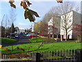
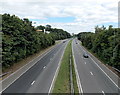
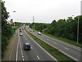
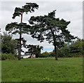
Please click the More button for more images, licensing and image copyright information.
Cardiff and nearby Videos From YouTube
Cardiff South Wales United kingdom , Travel Guide, 4k Drone
Channel: Sussex Explorer (View Channel)
Published: 3 Jun 2019
Police
This area is policed by South Wales Police.
South Wales Police split their policing area into 230 separate neighbourhoods and this postcode is in the Pentwyn neighbourhood.

Pentwyn Neighbourhood Crime
Top 3 Categories
For full details of all categories together with more crime information, click on the Details button.
Member of UK Parliament
This postcode is in the Cardiff Central parliamentary constituency.
Cardiff Central is a constituency in Wales. The seat has been held by Jo Stevens (Labour) since May 2015.

Most Recent House Sales for Pant Glas, CF23 7EU
28 Oct 2022
1 Jul 2022
8 Mar 2021
12 Feb 2021
Local Petrol Station Prices
Coordinates for CF23 7EU
Residents at CF23 7EU
Sunrise and Sunset at CF23 7EU
Traffic Emission and Congestion Zones
Historical Weather Summary
| Clear | 19.99% |
| Cloudy | 67.83% |
| Rain | 8.71% |
| Windy | 3.22% |
| Other | 0.25% |
Population
Deprivation Index
the more deprived the postcode
Average Energy Performance
Companies Registered at CF23 7EU
Postcode Details for CF23 7EU
Recent Updates
|
18 Apr 2024 Added Traffic Camera Views from Traffic Scotland to Roadworks within Scotland |
|
15 Apr 2024 Schools Data updated for April 2024 |
|
10 Apr 2024 Companies Data updated for March 2024 |
|
7 Apr 2024 New option to receive automatic updates to roadworks that affect you |
|
7 Apr 2024 Police and Crime data updated for February 2024 |
|
3 Apr 2024 Sold House Price data updated for February 2024 |
|
30 Mar 2024 Energy Performance Certificates (England and Wales) updated February 2024 |
|
28 Mar 2024 New feature to use Geolocating functions to detect your current location |
Random Postcodes
Want an idea of what is in our extensive website? Try somewhere completely random!
The Rural/Urban classification is based upon data collected during the 2011 Census and released in August 2013 and is categorised into 6 distinct classes.
[A] Urban Major conurbation: A built up area with a population of 10,000 (3,000 in Scotland) or more and is assigned to the major conurbation settlement category.
[B] Urban Minor conurbation: A built up area with a population of 10,000 (3,000 in Scotland) or more and is assigned to the minor conurbation settlement category.
[C] Urban City and town: A built up area with a population of 10,000 (3,000 in Scotland) or more and is assigned to the city and town settlement category.
[D] Rural Town and fringe
[E] Rural Village
[F] Rural Hamlet and isolated dwelling
The Index of Multiple Deprivation (IMD) is the official measure of relative deprivation.
The index is based on 39 separate indicators across seven distinct domains (Income; Employment; Health and Disability; Education, Skills and Training; Crime; Barriers to Housing and Services; Living Environment) to provide an overall measure of multiple deprivation and is calculated for every neighbourhood.
The index is relative rather than an absolute scale and so a neighbourhood with a score of 10 is more deprived than one rated 20, but this does not equate to being twice as deprived.
Please note: Different indices are used in England, Scotland, Wales and Northern Ireland and so comparison of scores from neighbourhoods in different countries should not be undertaken.
These figures report on incorporated UK companies only that are registered at this postcode and do not include sole-traders, partnerships or overseas organisations.
The population figure shown for your area are an estimate provided by the Office for National Statistics and is rounded to the nearest 1,000.
The estimates are derived from the Annual Population Survey (APS) which is the Labour Force Survey (LFS) plus various sample boosts.
There are 55 unitary authorities. They provide all local government services in their areas. These are mainly in the cities, urban areas and larger towns although there are now 6 shire county councils that are unitary (ie have no district councils beneath them).