Overview for Carlisle Road, CARLISLE, CA5 7NG
Introduction
Carlisle is a cathedral city in the ceremonial county of Cumbria in England. It is the administrative centre of Cumberland Council which covers an area similar to the historic county of Cumberland.
Carlisle's early history is marked by the establishment of a Roman settlement to serve forts along Hadrian's Wall in Roman Britain. Due to its proximity to Scotland (being located 8 mi (13 km) south of the current Anglo-Scottish border), Carlisle Castle and the city became an important military stronghold in the Middle Ages. The castle served as a prison for Mary, Queen of Scots in 1568 and currently hosts the Duke of Lancaster's Regiment and the Border Regiment Museum. In the early 12th century, a priory was built and gained cathedral status with a diocese in 1133 (city status at the time meant the settlement became a city) while the county of Carliol was created and later renamed Cumberland.
In the 19th century, the introduction of textile manufacture during the Industrial Revolution began a process of socioeconomic transformation in Carlisle, which developed into a densely populated mill town. This, combined with its strategic position, allowed for the development of Carlisle as an important railway town, with seven railway companies sharing Carlisle railway station. Nicknamed the 'Great Border City', Carlisle today is a main cultural, commercial and industrial centre in the British borders. It is home to the main campuses of the University of Cumbria and a variety of museums and heritage centres.
Summary for Carlisle Road, CARLISLE, CA5 7NG
Roadworks near CA5 7NG
Road Safety near CA5 7NG
Details of personal injury accidents in and around Carlisle Road, CA5 7NG that have been reported to Cumbria Constabulary over the past 20 years.
Traffic Levels near CA5 7NG
View traffic levels near Carlisle Road, CA5 7NG from official Department for Transport counts.
Images taken near to Carlisle Road, CA5 7NG and the surrounding area
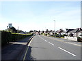
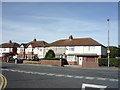
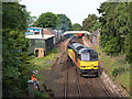
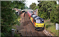
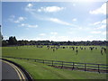
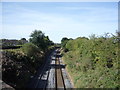
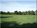
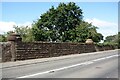
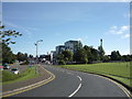
Please click the More button for more images, licensing and image copyright information.
Carlisle and nearby Videos From YouTube
Rickerby Park in Carlisle | Parks in Cumbria | @kajdowy | drone view | 4K
Kajdowy Rickerby Park in Carlisle (Cumbria) is a traditional Victorian parkland located on the banks of the River Eden…
Channel: Kajdowy (View Channel)
Published: 4 Apr 2023
Police
This area is policed by Cumbria Constabulary.
Cumbria Constabulary split their policing area into 33 separate neighbourhoods and this postcode is in the Carlisle West Rural neighbourhood.

Carlisle West Rural Neighbourhood Crime
Top 3 Categories
For full details of all categories together with more crime information, click on the Details button.
Member of UK Parliament
This postcode is in the Carlisle parliamentary constituency.
Carlisle is a constituency in the North West region of England. The seat has been held by John Stevenson (Conservative) since May 2010.

Most Recent House Sales for Carlisle Road, CA5 7NG
6 Mar 2023
16 Jul 2021
24 Jun 2021
29 Jan 2021
Local Petrol Station Prices
Coordinates for CA5 7NG
Residents at CA5 7NG
Sunrise and Sunset at CA5 7NG
Traffic Emission and Congestion Zones
Historical Weather Summary
| Clear | 7.85% |
| Cloudy | 53.27% |
| Rain | 11.43% |
| Windy | 27.17% |
| Other | 0.28% |
Deprivation Index
the more deprived the postcode
Average Energy Performance
Companies Registered at CA5 7NG
Postcode Details for CA5 7NG
Recent Updates
|
18 Apr 2024 Added Traffic Camera Views from Traffic Scotland to Roadworks within Scotland |
|
15 Apr 2024 Schools Data updated for April 2024 |
|
10 Apr 2024 Companies Data updated for March 2024 |
|
7 Apr 2024 New option to receive automatic updates to roadworks that affect you |
|
7 Apr 2024 Police and Crime data updated for February 2024 |
|
3 Apr 2024 Sold House Price data updated for February 2024 |
|
30 Mar 2024 Energy Performance Certificates (England and Wales) updated February 2024 |
|
28 Mar 2024 New feature to use Geolocating functions to detect your current location |
Random Postcodes
Want an idea of what is in our extensive website? Try somewhere completely random!
The Rural/Urban classification is based upon data collected during the 2011 Census and released in August 2013 and is categorised into 6 distinct classes.
[A] Urban Major conurbation: A built up area with a population of 10,000 (3,000 in Scotland) or more and is assigned to the major conurbation settlement category.
[B] Urban Minor conurbation: A built up area with a population of 10,000 (3,000 in Scotland) or more and is assigned to the minor conurbation settlement category.
[C] Urban City and town: A built up area with a population of 10,000 (3,000 in Scotland) or more and is assigned to the city and town settlement category.
[D] Rural Town and fringe
[E] Rural Village
[F] Rural Hamlet and isolated dwelling
The Index of Multiple Deprivation (IMD) is the official measure of relative deprivation.
The index is based on 39 separate indicators across seven distinct domains (Income; Employment; Health and Disability; Education, Skills and Training; Crime; Barriers to Housing and Services; Living Environment) to provide an overall measure of multiple deprivation and is calculated for every neighbourhood.
The index is relative rather than an absolute scale and so a neighbourhood with a score of 10 is more deprived than one rated 20, but this does not equate to being twice as deprived.
Please note: Different indices are used in England, Scotland, Wales and Northern Ireland and so comparison of scores from neighbourhoods in different countries should not be undertaken.
These figures report on incorporated UK companies only that are registered at this postcode and do not include sole-traders, partnerships or overseas organisations.
The population figure shown for your area are an estimate provided by the Office for National Statistics and is rounded to the nearest 1,000.
The estimates are derived from the Annual Population Survey (APS) which is the Labour Force Survey (LFS) plus various sample boosts.
There are 55 unitary authorities. They provide all local government services in their areas. These are mainly in the cities, urban areas and larger towns although there are now 6 shire county councils that are unitary (ie have no district councils beneath them).