Overview for Loop Road South, WHITEHAVEN, CA28 7TW
Introduction
Whitehaven is a town and port on the English north west coast and near to the Lake District National Park in Cumberland, Cumbria, England. It lies by road 38 miles (61 km) south-west of Carlisle and 45 miles (72 km) to the north of Barrow-in-Furness. It was the administrative seat of the former Borough of Copeland, and has a town council for the parish of Whitehaven. The population of the town was 23,986 at the 2011 census.
The town's growth was largely due to the exploitation of the extensive coal measures by the Lowther family, driving a growing export of coal through the harbour from the 17th century onwards. It was also a major port for trading with the American colonies, and was, after London, the second busiest port of England by tonnage from 1750 to 1772. This prosperity led to the creation of a Georgian planned town in the 18th century which has left an architectural legacy of over 170 listed buildings. Whitehaven has been designated a "gem town" by the Council for British Archaeology due to the historic quality of the town environment.
Whitehaven was the site of a major chemical industry after World War II, but both that and the coal industry have disappeared, and today the major industry is the nearby Sellafield nuclear complex, which is the largest local employer of labour and has a significant administrative base in the town. Whitehaven includes a number of former villages, estates and suburbs, such as Mirehouse, Woodhouse, Kells and Hensingham, and is served by the Cumbrian coast railway line and the A595 road.
Summary for Loop Road South, WHITEHAVEN, CA28 7TW
Roadworks near CA28 7TW
Road Safety near CA28 7TW
Details of personal injury accidents in and around Loop Road South, CA28 7TW that have been reported to Cumbria Constabulary over the past 20 years.
Traffic Levels near CA28 7TW
View traffic levels near Loop Road South, CA28 7TW from official Department for Transport counts.
Images taken near to Loop Road South, CA28 7TW and the surrounding area
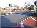
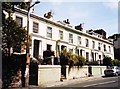
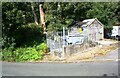
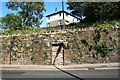
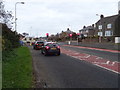
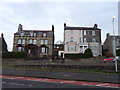
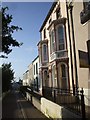
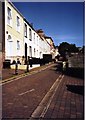
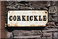
Please click the More button for more images, licensing and image copyright information.
Police
This area is policed by Cumbria Constabulary.
Cumbria Constabulary split their policing area into 33 separate neighbourhoods and this postcode is in the North and East Whitehaven neighbourhood.

North and East Whitehaven Neighbourhood Crime
Top 3 Categories
For full details of all categories together with more crime information, click on the Details button.
Member of UK Parliament
This postcode is in the Copeland parliamentary constituency.
Copeland is a constituency in the North West region of England. The seat has been held by Trudy Harrison (Conservative) since February 2017.

Most Recent House Sales for Loop Road South, CA28 7TW
11 May 2021
9 Oct 2020
24 Apr 2020
31 May 2019
Local Petrol Station Prices
Coordinates for CA28 7TW
Residents at CA28 7TW
Sunrise and Sunset at CA28 7TW
Traffic Emission and Congestion Zones
Historical Weather Summary
| Clear | 8.62% |
| Cloudy | 46.95% |
| Rain | 15.89% |
| Windy | 28.26% |
| Other | 0.28% |
Deprivation Index
the more deprived the postcode
Average Energy Performance
Companies Registered at CA28 7TW
Postcode Details for CA28 7TW
Recent Updates
|
15 Apr 2024 Schools Data updated for April 2024 |
|
10 Apr 2024 Companies Data updated for March 2024 |
|
7 Apr 2024 New option to receive automatic updates to roadworks that affect you |
|
7 Apr 2024 Police and Crime data updated for February 2024 |
|
3 Apr 2024 Sold House Price data updated for February 2024 |
|
30 Mar 2024 Energy Performance Certificates (England and Wales) updated February 2024 |
|
28 Mar 2024 New feature to use Geolocating functions to detect your current location |
|
17 Mar 2024 Schools Data updated for March 2024 |
Random Postcodes
Want an idea of what is in our extensive website? Try somewhere completely random!
The Rural/Urban classification is based upon data collected during the 2011 Census and released in August 2013 and is categorised into 6 distinct classes.
[A] Urban Major conurbation: A built up area with a population of 10,000 (3,000 in Scotland) or more and is assigned to the major conurbation settlement category.
[B] Urban Minor conurbation: A built up area with a population of 10,000 (3,000 in Scotland) or more and is assigned to the minor conurbation settlement category.
[C] Urban City and town: A built up area with a population of 10,000 (3,000 in Scotland) or more and is assigned to the city and town settlement category.
[D] Rural Town and fringe
[E] Rural Village
[F] Rural Hamlet and isolated dwelling
The Index of Multiple Deprivation (IMD) is the official measure of relative deprivation.
The index is based on 39 separate indicators across seven distinct domains (Income; Employment; Health and Disability; Education, Skills and Training; Crime; Barriers to Housing and Services; Living Environment) to provide an overall measure of multiple deprivation and is calculated for every neighbourhood.
The index is relative rather than an absolute scale and so a neighbourhood with a score of 10 is more deprived than one rated 20, but this does not equate to being twice as deprived.
Please note: Different indices are used in England, Scotland, Wales and Northern Ireland and so comparison of scores from neighbourhoods in different countries should not be undertaken.
These figures report on incorporated UK companies only that are registered at this postcode and do not include sole-traders, partnerships or overseas organisations.
The population figure shown for your area are an estimate provided by the Office for National Statistics and is rounded to the nearest 1,000.
The estimates are derived from the Annual Population Survey (APS) which is the Labour Force Survey (LFS) plus various sample boosts.
There are 55 unitary authorities. They provide all local government services in their areas. These are mainly in the cities, urban areas and larger towns although there are now 6 shire county councils that are unitary (ie have no district councils beneath them).