Overview for Crow Park Way, MOOR ROW, CA24 3HZ
Introduction
Moor Row is a village in Cumbria, North West England. It is in Egremont civil parish and lies on a minor road off the A595, south-east of Whitehaven. In 2018 it had an estimated population of 759.
Moor Row is a residential community on Cumbria's coastal plain. Government records, notably in census reports, record its name as Low Keekle, Ingwell View, Moor Row Junction, Moorroe, and Scalegill. The history of Moor Row goes back to before 1762 when the area between Summerhill Mansion and Woodend with Cleator was populated with residents of the Low Moor Row and High Moor Row homesteads. The Wildridge family lived at the Low Moor Row home stead on what became known as Church St. The Wildridge daughter Elizabeth married the local gardener called Dalzell who took over his new wife's estates when the Wildridges died. The village of Moor Row was built originally to house railway workers on the newly built Whitehaven Cleator and Egremont Railway, at the junction from Whitehaven south to Egremont and East to Cleator and the Frizington iron mines. The railway opened in 1855, and the first workers cottages had been built on the east side of what became Dalzell Street by 1860. The 19th century discovery of iron ore in the vicinity brought many off comers to serve the nascent iron and steel industry in West Cumbria, from Ireland, Scotland, the Isle of Man, Italy, and England. The 'row of houses on a moor' expanded as the employers needed moreworkers to keep their businesses going. Cornish tin miners were amongst those that moved here to work the mines, whose presence is noted by the name Penzance Street. Another street, Dalzell, is named after the Dalzell family who owned parcels of land along the road from Moor Row to Woodend past Gutterby and around Frizington and Aspatria. By 1885 the Dalzells estates were being run by the trustees of the family.
Summary for Crow Park Way, MOOR ROW, CA24 3HZ
Roadworks near CA24 3HZ
Road Safety near CA24 3HZ
Details of personal injury accidents in and around Crow Park Way, CA24 3HZ that have been reported to Cumbria Constabulary over the past 20 years.
Traffic Levels near CA24 3HZ
View traffic levels near Crow Park Way, CA24 3HZ from official Department for Transport counts.
Images taken near to Crow Park Way, CA24 3HZ and the surrounding area
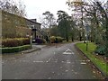
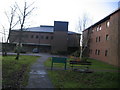

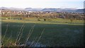
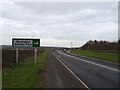
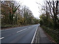
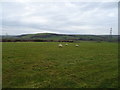
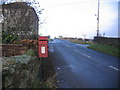
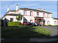

Please click the More button for more images, licensing and image copyright information.
Police
This area is policed by Cumbria Constabulary.
Cumbria Constabulary split their policing area into 33 separate neighbourhoods and this postcode is in the South Whitehaven and St Bees neighbourhood.

South Whitehaven and St Bees Neighbourhood Crime
Top 3 Categories
For full details of all categories together with more crime information, click on the Details button.
Member of UK Parliament
This postcode is in the Copeland parliamentary constituency.
Copeland is a constituency in the North West region of England. The seat has been held by Trudy Harrison (Conservative) since February 2017.

Most Recent House Sales for Crow Park Way, CA24 3HZ
No recorded house sales or transfers for this postcode.
Local Petrol Station Prices
Coordinates for CA24 3HZ
Residents at CA24 3HZ
Sunrise and Sunset at CA24 3HZ
Traffic Emission and Congestion Zones
Historical Weather Summary
| Clear | 16.36% |
| Cloudy | 49.90% |
| Rain | 8.75% |
| Windy | 24.57% |
| Other | 0.42% |
Deprivation Index
the more deprived the postcode
Companies Registered at CA24 3HZ
Postcode Details for CA24 3HZ
Recent Updates
|
18 Apr 2024 Added Traffic Camera Views from Traffic Scotland to Roadworks within Scotland |
|
15 Apr 2024 Schools Data updated for April 2024 |
|
10 Apr 2024 Companies Data updated for March 2024 |
|
7 Apr 2024 New option to receive automatic updates to roadworks that affect you |
|
7 Apr 2024 Police and Crime data updated for February 2024 |
|
3 Apr 2024 Sold House Price data updated for February 2024 |
|
30 Mar 2024 Energy Performance Certificates (England and Wales) updated February 2024 |
|
28 Mar 2024 New feature to use Geolocating functions to detect your current location |
Random Postcodes
Want an idea of what is in our extensive website? Try somewhere completely random!
The Rural/Urban classification is based upon data collected during the 2011 Census and released in August 2013 and is categorised into 6 distinct classes.
[A] Urban Major conurbation: A built up area with a population of 10,000 (3,000 in Scotland) or more and is assigned to the major conurbation settlement category.
[B] Urban Minor conurbation: A built up area with a population of 10,000 (3,000 in Scotland) or more and is assigned to the minor conurbation settlement category.
[C] Urban City and town: A built up area with a population of 10,000 (3,000 in Scotland) or more and is assigned to the city and town settlement category.
[D] Rural Town and fringe
[E] Rural Village
[F] Rural Hamlet and isolated dwelling
The Index of Multiple Deprivation (IMD) is the official measure of relative deprivation.
The index is based on 39 separate indicators across seven distinct domains (Income; Employment; Health and Disability; Education, Skills and Training; Crime; Barriers to Housing and Services; Living Environment) to provide an overall measure of multiple deprivation and is calculated for every neighbourhood.
The index is relative rather than an absolute scale and so a neighbourhood with a score of 10 is more deprived than one rated 20, but this does not equate to being twice as deprived.
Please note: Different indices are used in England, Scotland, Wales and Northern Ireland and so comparison of scores from neighbourhoods in different countries should not be undertaken.
These figures report on incorporated UK companies only that are registered at this postcode and do not include sole-traders, partnerships or overseas organisations.
The population figure shown for your area are an estimate provided by the Office for National Statistics and is rounded to the nearest 1,000.
The estimates are derived from the Annual Population Survey (APS) which is the Labour Force Survey (LFS) plus various sample boosts.
There are 55 unitary authorities. They provide all local government services in their areas. These are mainly in the cities, urban areas and larger towns although there are now 6 shire county councils that are unitary (ie have no district councils beneath them).