Overview for Brittons Parade, BELFAST, BT12 7PJ
Introduction
Belfast is the capital and largest city of Northern Ireland, standing on the banks of the River Lagan on the east coast. It is the 10th-largest primary urban area in the United Kingdom and the second-largest city in Ireland. Belfast City had a population of 293,298 in 2021. The population of its metropolitan area was 671,559 in 2011, and the Belfast Local Government District had a population 345,418 in 2021.
By the early 19th century, Belfast was a major port. It played an important role in the Industrial Revolution in Ireland, briefly becoming the biggest linen-producer in the world, earning it the nickname "Linenopolis". By the time it was granted city status in 1888, it was a major centre of Irish linen production, tobacco-processing and rope-making. Shipbuilding was also a key industry; the Harland & Wolff shipyard, which built the RMS Titanic and SS Canberra, was the world's largest shipyard. Industrialisation, and the resulting inward migration, made Belfast one of Ireland's biggest cities. Following the partition of Ireland in 1921, Belfast became the seat of government for Northern Ireland. There was major communal violence in the city during partition. Belfast saw further severe violence and numerous bombings during the thirty years of the Troubles, c. 1969–1998, and parts of the city remain segregated between Catholics and Protestants.
Belfast is still a port with commercial and industrial docks, including the Harland & Wolff shipyard, dominating the Belfast Lough shoreline. It also has a major aerospace industry. It is served by two airports: George Best Belfast City Airport, 3 miles (5 kilometres) from the city centre, and Belfast International Airport 15 miles (24 kilometres) west of the city.
Summary for Brittons Parade, BELFAST, BT12 7PJ
Roadworks near BT12 7PJ
Local roadworks in Northern Ireland are provided by Traffic Watch NI on their website at trafficwatchni.com/twni/traffic-news.
Unfortunately, whilst the information is provided, the orgasation do not provide location coordinates and so we are unable to map the planned works to local postcodes at this time.
Road Safety near BT12 7PJ
Details of personal injury accidents in and around Brittons Parade, BT12 7PJ that have been reported to Police Service of Northern Ireland over the past 20 years.
Traffic Levels near BT12 7PJ
View traffic levels near Brittons Parade, BT12 7PJ from official Department for Transport counts.
Images taken near to Brittons Parade, BT12 7PJ and the surrounding area
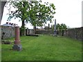
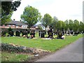
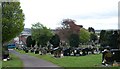
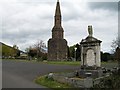
Please click the More button for more images, licensing and image copyright information.
Belfast and nearby Videos From YouTube
Belfast, Northern Ireland | DJI Mavic Pro | DJI Osmo Mobile 2
Amazing footage of Belfast, Northern Ireland from a new perspective. A mixture of overhead drone footage and handheld gimbal ...
Channel: Zac McMenemy (View Channel)
Published: 8 May 2018
Police
This area is policed by Police Service of Northern Ireland.
Police Service of Northern Ireland split their policing area into 26 separate neighbourhoods and this postcode is in the Woodbourne neighbourhood.

Woodbourne Neighbourhood Crime
Top 3 Categories
For full details of all categories together with more crime information, click on the Details button.
Member of UK Parliament
Unfortunately, Parliamentary details are not available for this postcode.
Most Recent House Sales for Brittons Parade, BT12 7PJ
No recorded house sales or transfers for this postcode.
Local Petrol Station Prices
Coordinates for BT12 7PJ
Sunrise and Sunset at BT12 7PJ
Traffic Emission and Congestion Zones
Historical Weather Summary
| Clear | 13.54% |
| Cloudy | 64.12% |
| Rain | 11.59% |
| Windy | 9.01% |
| Other | 1.74% |
Companies Registered at BT12 7PJ
Postcode Details for BT12 7PJ
Recent Updates
|
18 Apr 2024 Added Traffic Camera Views from Traffic Scotland to Roadworks within Scotland |
|
15 Apr 2024 Schools Data updated for April 2024 |
|
10 Apr 2024 Companies Data updated for March 2024 |
|
7 Apr 2024 New option to receive automatic updates to roadworks that affect you |
|
7 Apr 2024 Police and Crime data updated for February 2024 |
|
3 Apr 2024 Sold House Price data updated for February 2024 |
|
30 Mar 2024 Energy Performance Certificates (England and Wales) updated February 2024 |
|
28 Mar 2024 New feature to use Geolocating functions to detect your current location |
Random Postcodes
Want an idea of what is in our extensive website? Try somewhere completely random!
The Rural/Urban classification is based upon data collected during the 2011 Census and released in August 2013 and is categorised into 6 distinct classes.
[A] Urban Major conurbation: A built up area with a population of 10,000 (3,000 in Scotland) or more and is assigned to the major conurbation settlement category.
[B] Urban Minor conurbation: A built up area with a population of 10,000 (3,000 in Scotland) or more and is assigned to the minor conurbation settlement category.
[C] Urban City and town: A built up area with a population of 10,000 (3,000 in Scotland) or more and is assigned to the city and town settlement category.
[D] Rural Town and fringe
[E] Rural Village
[F] Rural Hamlet and isolated dwelling
The Index of Multiple Deprivation (IMD) is the official measure of relative deprivation.
The index is based on 39 separate indicators across seven distinct domains (Income; Employment; Health and Disability; Education, Skills and Training; Crime; Barriers to Housing and Services; Living Environment) to provide an overall measure of multiple deprivation and is calculated for every neighbourhood.
The index is relative rather than an absolute scale and so a neighbourhood with a score of 10 is more deprived than one rated 20, but this does not equate to being twice as deprived.
Please note: Different indices are used in England, Scotland, Wales and Northern Ireland and so comparison of scores from neighbourhoods in different countries should not be undertaken.
These figures report on incorporated UK companies only that are registered at this postcode and do not include sole-traders, partnerships or overseas organisations.
The population figure shown for your area are an estimate provided by the Office for National Statistics and is rounded to the nearest 1,000.
The estimates are derived from the Annual Population Survey (APS) which is the Labour Force Survey (LFS) plus various sample boosts.
There are 26 county councils in 2-tier areas, providing services such as education, social services and waste disposal.
In 2-tier areas, each county council area is subdivided into districts, for which there is an independent district council. There are 192 district councils.
District councils are responsible for local services such as rubbish collection, housing and planning applications.