Overview for St. Pauls Road, WESTON-SUPER-MARE, BS23 4AE
Introduction
Weston-super-Mare, also known simply as Weston, is a seaside town in the North Somerset unitary area in the county of Somerset, England. It lies by the Bristol Channel 20 miles (32 km) south-west of Bristol between Worlebury Hill and Bleadon Hill. Its population at the 2021 census was 82,418.
The area around the town has been occupied since the Iron Age. It was still a small village until the 19th century when it developed as a seaside resort. A railway station and two piers were built. In the second half of the 20th century it was connected to the M5 motorway but the number of people holidaying in the town declined and some local industries closed, although the number of day visitors has risen.
Attractions include the Grand Pier, Weston Museum and The Helicopter Museum. Cultural venues include The Playhouse, the Winter Gardens and the Blakehay Theatre.
The Bristol Channel has a large tidal range; the low tide mark in Weston Bay is about 1 mile (1.6 km) from the seafront. The beach is sandy but low tide reveals areas of thick mud which are dangerous to walk on. The mouth of the River Axe is at the south end of the beach. To the north of the town is Sand Point which marks the upper limit of the Bristol Channel and the lower limit of the Severn Estuary. In the centre of the town is Ellenborough Park, which is a biological Site of Special Scientific Interest (SSSI) due to the range of plant species found there.
Summary for St. Pauls Road, WESTON-SUPER-MARE, BS23 4AE
Roadworks near BS23 4AE
Road Safety near BS23 4AE
Details of personal injury accidents in and around St. Pauls Road, BS23 4AE that have been reported to Avon and Somerset Constabulary over the past 20 years.
Traffic Levels near BS23 4AE
View traffic levels near St. Pauls Road, BS23 4AE from official Department for Transport counts.
Images taken near to St. Pauls Road, BS23 4AE and the surrounding area
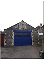

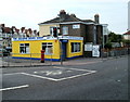
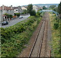
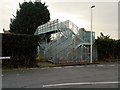

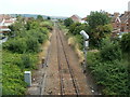
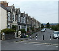
Please click the More button for more images, licensing and image copyright information.
Police
This area is policed by Avon and Somerset Constabulary.
Avon and Somerset Constabulary split their policing area into 123 separate neighbourhoods and this postcode is in the Weston Town Centre neighbourhood.

Weston Town Centre Neighbourhood Crime
Top 3 Categories
For full details of all categories together with more crime information, click on the Details button.
Member of UK Parliament
This postcode is in the Weston-super-Mare parliamentary constituency.
Weston-super-Mare is a constituency in the South West region of England. The seat has been held by John Penrose (Conservative) since May 2010.

Most Recent House Sales for St. Pauls Road, BS23 4AE
29 Apr 2022
8 Feb 2019
19 Aug 2014
24 Feb 2012
Local Petrol Station Prices
Coordinates for BS23 4AE
Residents at BS23 4AE
Sunrise and Sunset at BS23 4AE
Traffic Emission and Congestion Zones
Historical Weather Summary
| Clear | 20.47% |
| Cloudy | 66.37% |
| Rain | 8.19% |
| Windy | 4.68% |
| Other | 0.29% |
Population
Deprivation Index
the more deprived the postcode
Average Energy Performance
Companies Registered at BS23 4AE
Postcode Details for BS23 4AE
Recent Updates
|
18 Apr 2024 Added Traffic Camera Views from Traffic Scotland to Roadworks within Scotland |
|
15 Apr 2024 Schools Data updated for April 2024 |
|
10 Apr 2024 Companies Data updated for March 2024 |
|
7 Apr 2024 New option to receive automatic updates to roadworks that affect you |
|
7 Apr 2024 Police and Crime data updated for February 2024 |
|
3 Apr 2024 Sold House Price data updated for February 2024 |
|
30 Mar 2024 Energy Performance Certificates (England and Wales) updated February 2024 |
|
28 Mar 2024 New feature to use Geolocating functions to detect your current location |
Random Postcodes
Want an idea of what is in our extensive website? Try somewhere completely random!
The Rural/Urban classification is based upon data collected during the 2011 Census and released in August 2013 and is categorised into 6 distinct classes.
[A] Urban Major conurbation: A built up area with a population of 10,000 (3,000 in Scotland) or more and is assigned to the major conurbation settlement category.
[B] Urban Minor conurbation: A built up area with a population of 10,000 (3,000 in Scotland) or more and is assigned to the minor conurbation settlement category.
[C] Urban City and town: A built up area with a population of 10,000 (3,000 in Scotland) or more and is assigned to the city and town settlement category.
[D] Rural Town and fringe
[E] Rural Village
[F] Rural Hamlet and isolated dwelling
The Index of Multiple Deprivation (IMD) is the official measure of relative deprivation.
The index is based on 39 separate indicators across seven distinct domains (Income; Employment; Health and Disability; Education, Skills and Training; Crime; Barriers to Housing and Services; Living Environment) to provide an overall measure of multiple deprivation and is calculated for every neighbourhood.
The index is relative rather than an absolute scale and so a neighbourhood with a score of 10 is more deprived than one rated 20, but this does not equate to being twice as deprived.
Please note: Different indices are used in England, Scotland, Wales and Northern Ireland and so comparison of scores from neighbourhoods in different countries should not be undertaken.
These figures report on incorporated UK companies only that are registered at this postcode and do not include sole-traders, partnerships or overseas organisations.
The population figure shown for your area are an estimate provided by the Office for National Statistics and is rounded to the nearest 1,000.
The estimates are derived from the Annual Population Survey (APS) which is the Labour Force Survey (LFS) plus various sample boosts.
There are 55 unitary authorities. They provide all local government services in their areas. These are mainly in the cities, urban areas and larger towns although there are now 6 shire county councils that are unitary (ie have no district councils beneath them).