Overview for Beckenham Road, BECKENHAM, BR3 4PS
Introduction
Beckenham is a town in Greater London, England, within the London Borough of Bromley. Until 1965 it was part of the historic county of Kent. It is located 8.4 miles (13.5 km) south-east of Charing Cross, situated north of Elmers End and Eden Park, east of Penge, south of Lower Sydenham and Bellingham, and west of Bromley and Shortlands. Its population at the 2011 census counted 46,844 inhabitants.
Beckenham was, until the coming of the railway in 1857, a small village, with most of its land being rural and private parkland. John Barwell Cator and his family began the leasing and selling of land for the building of villas which led to a rapid increase in population, between 1850 and 1900, from 2,000 to 26,000. Housing and population growth has continued at a lesser pace since 1900.
The town, directly west of Bromley, has areas of commerce and industry, principally around the curved network of streets featuring its high street and is served in transport by three main railway stations — nine within the post town — plus towards its western periphery two Tramlink stations. In common with the rest of Bromley, the largest borough of London by area, Beckenham has several pockets of recreational land which are a mixture of sports grounds, fishing ponds and parks.
Summary for Beckenham Road, BECKENHAM, BR3 4PS
Roadworks near BR3 4PS
Road Safety near BR3 4PS
Details of personal injury accidents in and around Beckenham Road, BR3 4PS that have been reported to Metropolitan Police Service over the past 20 years.
Traffic Levels near BR3 4PS
View traffic levels near Beckenham Road, BR3 4PS from official Department for Transport counts.
Images taken near to Beckenham Road, BR3 4PS and the surrounding area
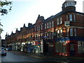
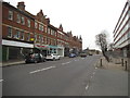
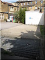
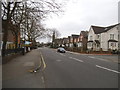

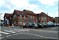
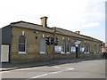
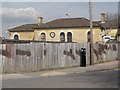
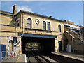
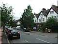
Please click the More button for more images, licensing and image copyright information.
Member of UK Parliament
This postcode is in the Lewisham West and Penge parliamentary constituency.
Lewisham West and Penge is a constituency in London, England. The seat has been held by Ellie Reeves (Labour) since June 2017.

Most Recent House Sales for Beckenham Road, BR3 4PS
3 Oct 2022
29 Jul 2020
29 Jan 2016
6 Jun 2013
Local Petrol Station Prices
Coordinates for BR3 4PS
Residents at BR3 4PS
Sunrise and Sunset at BR3 4PS
Traffic Emission Zones
Historical Weather Summary
| Clear | 19.35% |
| Cloudy | 48.86% |
| Rain | 5.75% |
| Windy | 25.94% |
| Other | 0.10% |
Population
Deprivation Index
the more deprived the postcode
Average Energy Performance
Companies Registered at BR3 4PS
Postcode Details for BR3 4PS
Recent Updates
|
18 Apr 2024 Added Traffic Camera Views from Traffic Scotland to Roadworks within Scotland |
|
15 Apr 2024 Schools Data updated for April 2024 |
|
10 Apr 2024 Companies Data updated for March 2024 |
|
7 Apr 2024 New option to receive automatic updates to roadworks that affect you |
|
7 Apr 2024 Police and Crime data updated for February 2024 |
|
3 Apr 2024 Sold House Price data updated for February 2024 |
|
30 Mar 2024 Energy Performance Certificates (England and Wales) updated February 2024 |
|
28 Mar 2024 New feature to use Geolocating functions to detect your current location |
Random Postcodes
Want an idea of what is in our extensive website? Try somewhere completely random!
The Rural/Urban classification is based upon data collected during the 2011 Census and released in August 2013 and is categorised into 6 distinct classes.
[A] Urban Major conurbation: A built up area with a population of 10,000 (3,000 in Scotland) or more and is assigned to the major conurbation settlement category.
[B] Urban Minor conurbation: A built up area with a population of 10,000 (3,000 in Scotland) or more and is assigned to the minor conurbation settlement category.
[C] Urban City and town: A built up area with a population of 10,000 (3,000 in Scotland) or more and is assigned to the city and town settlement category.
[D] Rural Town and fringe
[E] Rural Village
[F] Rural Hamlet and isolated dwelling
The Index of Multiple Deprivation (IMD) is the official measure of relative deprivation.
The index is based on 39 separate indicators across seven distinct domains (Income; Employment; Health and Disability; Education, Skills and Training; Crime; Barriers to Housing and Services; Living Environment) to provide an overall measure of multiple deprivation and is calculated for every neighbourhood.
The index is relative rather than an absolute scale and so a neighbourhood with a score of 10 is more deprived than one rated 20, but this does not equate to being twice as deprived.
Please note: Different indices are used in England, Scotland, Wales and Northern Ireland and so comparison of scores from neighbourhoods in different countries should not be undertaken.
These figures report on incorporated UK companies only that are registered at this postcode and do not include sole-traders, partnerships or overseas organisations.
The population figure shown for your area are an estimate provided by the Office for National Statistics and is rounded to the nearest 1,000.
The estimates are derived from the Annual Population Survey (APS) which is the Labour Force Survey (LFS) plus various sample boosts.
There are 32 London boroughs. They provide nearly all the services in their area. However, the Greater London Authority (GLA) provides London-wide government, including special responsibility for police, fire, strategic planning and transport.