Overview for High Close, BRIGHTON, BN41 2PD
Introduction
Brighton (BRY-tən) is a seaside resort and one of the two main areas of the city of Brighton and Hove in the county of East Sussex, England. It is located 47 mi (76 km) south of London.
Archaeological evidence of settlement in the area dates back to the Bronze Age, Roman and Anglo-Saxon periods. The ancient settlement of "Brighthelmstone" was documented in the Domesday Book (1086). The town's importance grew in the Middle Ages as the Old Town developed, but it languished in the early modern period, affected by foreign attacks, storms, a suffering economy and a declining population. Brighton began to attract more visitors following improved road transport to London and becoming a boarding point for boats travelling to France. The town also developed in popularity as a health resort for sea bathing as a purported cure for illnesses.
In the Georgian era, Brighton developed as a highly fashionable seaside resort, encouraged by the patronage of the Prince Regent, later King George IV, who spent much time in the town and constructed the Royal Pavilion in the Regency era. Brighton continued to grow as a major centre of tourism following the arrival of the railways in 1841, becoming a popular destination for day-trippers from London. Many of the major attractions were built in the Victorian era, including the Grand Hotel, the Hilton Brighton Metropole, the Palace Pier and the West Pier. The town continued to grow into the 20th century, expanding to incorporate more areas into the town's boundaries before joining Hove to form the unitary authority of Brighton and Hove in 1997, which was granted city status in 2000. Today, Brighton and Hove district has a resident population of about 277,103 and the wider Brighton and Hove conurbation has a population of 474,485 (2011 census).
Brighton's location has made it a popular destination for tourists, renowned for its diverse communities, shopping areas, large and vibrant cultural, music and arts scene, and its large LGBT population, leading to its recognition as the "unofficial gay capital of the UK" and as of the 2021 census, 10.7% of the population of Brighton and Hove over the age of 18 identify as gay, lesbian or bisexual, the highest percentage in the entire UK. Brighton has been called the UK's "hippest city" and "the happiest place to live in the UK".
Summary for High Close, BRIGHTON, BN41 2PD
Roadworks near BN41 2PD
Road Safety near BN41 2PD
Details of personal injury accidents in and around High Close, BN41 2PD that have been reported to Sussex Police over the past 20 years.
Traffic Levels near BN41 2PD
View traffic levels near High Close, BN41 2PD from official Department for Transport counts.
Images taken near to High Close, BN41 2PD and the surrounding area
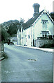
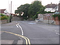
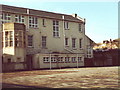
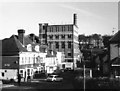
Please click the More button for more images, licensing and image copyright information.
Brighton and nearby Videos From YouTube
Brighton By Drone - East Sussex, UK (2021) (HD)
Brighton from the skies. Best viewed in 1080p.
Channel: FritzMedia (View Channel)
Published: 17 Apr 2021
Police
This area is policed by Sussex Police.
Sussex Police split their policing area into 273 separate neighbourhoods and this postcode is in the South Portslade neighbourhood.

South Portslade Neighbourhood Crime
Top 3 Categories
For full details of all categories together with more crime information, click on the Details button.
Member of UK Parliament
This postcode is in the Hove parliamentary constituency.
Hove is a constituency in the South East region of England. The seat has been held by Peter Kyle (Labour) since May 2015.

Most Recent House Sales for High Close, BN41 2PD
29 Sep 2021
15 Feb 2021
26 Jan 2021
2 Jun 2016
Local Petrol Station Prices
Coordinates for BN41 2PD
Residents at BN41 2PD
Sunrise and Sunset at BN41 2PD
Traffic Emission and Congestion Zones
Historical Weather Summary
| Clear | 10.71% |
| Cloudy | 65.89% |
| Rain | 11.08% |
| Windy | 12.27% |
| Other | 0.05% |
Population
Deprivation Index
the more deprived the postcode
Average Energy Performance
Companies Registered at BN41 2PD
Postcode Details for BN41 2PD
Recent Updates
|
15 Apr 2024 Schools Data updated for April 2024 |
|
10 Apr 2024 Companies Data updated for March 2024 |
|
7 Apr 2024 New option to receive automatic updates to roadworks that affect you |
|
7 Apr 2024 Police and Crime data updated for February 2024 |
|
3 Apr 2024 Sold House Price data updated for February 2024 |
|
30 Mar 2024 Energy Performance Certificates (England and Wales) updated February 2024 |
|
28 Mar 2024 New feature to use Geolocating functions to detect your current location |
|
17 Mar 2024 Schools Data updated for March 2024 |
Random Postcodes
Want an idea of what is in our extensive website? Try somewhere completely random!
The Rural/Urban classification is based upon data collected during the 2011 Census and released in August 2013 and is categorised into 6 distinct classes.
[A] Urban Major conurbation: A built up area with a population of 10,000 (3,000 in Scotland) or more and is assigned to the major conurbation settlement category.
[B] Urban Minor conurbation: A built up area with a population of 10,000 (3,000 in Scotland) or more and is assigned to the minor conurbation settlement category.
[C] Urban City and town: A built up area with a population of 10,000 (3,000 in Scotland) or more and is assigned to the city and town settlement category.
[D] Rural Town and fringe
[E] Rural Village
[F] Rural Hamlet and isolated dwelling
The Index of Multiple Deprivation (IMD) is the official measure of relative deprivation.
The index is based on 39 separate indicators across seven distinct domains (Income; Employment; Health and Disability; Education, Skills and Training; Crime; Barriers to Housing and Services; Living Environment) to provide an overall measure of multiple deprivation and is calculated for every neighbourhood.
The index is relative rather than an absolute scale and so a neighbourhood with a score of 10 is more deprived than one rated 20, but this does not equate to being twice as deprived.
Please note: Different indices are used in England, Scotland, Wales and Northern Ireland and so comparison of scores from neighbourhoods in different countries should not be undertaken.
These figures report on incorporated UK companies only that are registered at this postcode and do not include sole-traders, partnerships or overseas organisations.
The population figure shown for your area are an estimate provided by the Office for National Statistics and is rounded to the nearest 1,000.
The estimates are derived from the Annual Population Survey (APS) which is the Labour Force Survey (LFS) plus various sample boosts.
There are 55 unitary authorities. They provide all local government services in their areas. These are mainly in the cities, urban areas and larger towns although there are now 6 shire county councils that are unitary (ie have no district councils beneath them).