Overview for Park Road, SEAFORD, BN25 2PG
Introduction
Seaford is a town in East Sussex, England, east of Newhaven and west of Eastbourne.
In the Middle Ages, Seaford was one of the main ports serving Southern England, but the town's fortunes declined due to coastal sedimentation silting up its harbour and persistent raids by French pirates. The coastal confederation of Cinque Ports in the mediaeval period consisted of forty-two towns and villages; Seaford was included under the "Limb" of Hastings.
Between 1350 and 1550, the French burned down the town several times. In the 16th century, the people of Seaford were known as the "cormorants" or "shags" because of their enthusiasm for looting ships wrecked in the bay. Local legend has it that Seaford residents would, on occasion, cause ships to run aground by placing fake harbour lights on the cliffs.
Seaford's fortunes revived in the 19th century with the arrival of the railway connecting the town to Lewes and London. It became a small seaside resort town, and more recently a dormitory town for the nearby larger settlements of Eastbourne and Brighton, as well as for London.
The traditional Sussex pronunciation of the name has a full vowel in each syllable: "sea-ford". However, outside Sussex, and increasingly within, it is commonly pronounced with a reduced vowel on the second syllable: SEE-fərd.
Summary for Park Road, SEAFORD, BN25 2PG
Roadworks near BN25 2PG
Road Safety near BN25 2PG
Details of personal injury accidents in and around Park Road, BN25 2PG that have been reported to Sussex Police over the past 20 years.
Traffic Levels near BN25 2PG
View traffic levels near Park Road, BN25 2PG from official Department for Transport counts.
Images taken near to Park Road, BN25 2PG and the surrounding area
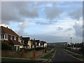
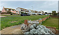
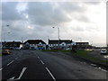
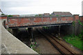
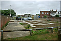
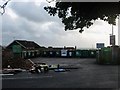
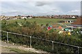
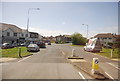
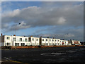
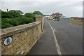
Please click the More button for more images, licensing and image copyright information.
Police
This area is policed by Sussex Police.
Sussex Police split their policing area into 273 separate neighbourhoods and this postcode is in the Seaford West neighbourhood.

Seaford West Neighbourhood Crime
Top 3 Categories
For full details of all categories together with more crime information, click on the Details button.
Member of UK Parliament
This postcode is in the Lewes parliamentary constituency.
Lewes is a constituency in the South East region of England. The seat has been held by Maria Caulfield (Conservative) since May 2015.

Most Recent House Sales for Park Road, BN25 2PG
29 May 2019
20 Feb 2017
11 Jul 2014
3 Sep 2012
Local Petrol Station Prices
Coordinates for BN25 2PG
Residents at BN25 2PG
Sunrise and Sunset at BN25 2PG
Traffic Emission and Congestion Zones
Historical Weather Summary
| Clear | 7.01% |
| Cloudy | 36.68% |
| Rain | 9.16% |
| Windy | 47.02% |
| Other | 0.13% |
Population
Deprivation Index
the more deprived the postcode
Average Energy Performance
Companies Registered at BN25 2PG
Postcode Details for BN25 2PG
Recent Updates
|
15 Apr 2024 Schools Data updated for April 2024 |
|
10 Apr 2024 Companies Data updated for March 2024 |
|
7 Apr 2024 New option to receive automatic updates to roadworks that affect you |
|
7 Apr 2024 Police and Crime data updated for February 2024 |
|
3 Apr 2024 Sold House Price data updated for February 2024 |
|
30 Mar 2024 Energy Performance Certificates (England and Wales) updated February 2024 |
|
28 Mar 2024 New feature to use Geolocating functions to detect your current location |
|
17 Mar 2024 Schools Data updated for March 2024 |
Random Postcodes
Want an idea of what is in our extensive website? Try somewhere completely random!
The Rural/Urban classification is based upon data collected during the 2011 Census and released in August 2013 and is categorised into 6 distinct classes.
[A] Urban Major conurbation: A built up area with a population of 10,000 (3,000 in Scotland) or more and is assigned to the major conurbation settlement category.
[B] Urban Minor conurbation: A built up area with a population of 10,000 (3,000 in Scotland) or more and is assigned to the minor conurbation settlement category.
[C] Urban City and town: A built up area with a population of 10,000 (3,000 in Scotland) or more and is assigned to the city and town settlement category.
[D] Rural Town and fringe
[E] Rural Village
[F] Rural Hamlet and isolated dwelling
The Index of Multiple Deprivation (IMD) is the official measure of relative deprivation.
The index is based on 39 separate indicators across seven distinct domains (Income; Employment; Health and Disability; Education, Skills and Training; Crime; Barriers to Housing and Services; Living Environment) to provide an overall measure of multiple deprivation and is calculated for every neighbourhood.
The index is relative rather than an absolute scale and so a neighbourhood with a score of 10 is more deprived than one rated 20, but this does not equate to being twice as deprived.
Please note: Different indices are used in England, Scotland, Wales and Northern Ireland and so comparison of scores from neighbourhoods in different countries should not be undertaken.
These figures report on incorporated UK companies only that are registered at this postcode and do not include sole-traders, partnerships or overseas organisations.
The population figure shown for your area are an estimate provided by the Office for National Statistics and is rounded to the nearest 1,000.
The estimates are derived from the Annual Population Survey (APS) which is the Labour Force Survey (LFS) plus various sample boosts.
There are 26 county councils in 2-tier areas, providing services such as education, social services and waste disposal.
In 2-tier areas, each county council area is subdivided into districts, for which there is an independent district council. There are 192 district councils.
District councils are responsible for local services such as rubbish collection, housing and planning applications.