Overview for Middle Onslow Close, WORTHING, BN12 5RT
Introduction
Worthing is a seaside resort town in West Sussex, England, at the foot of the South Downs, 11.4 miles (18 km) west of Brighton, and 18 miles (29 km) east of Chichester. With a population of 113,094 and an area of 12.5 square miles (32.4 km2), the borough is the second largest component of the Brighton and Hove built-up area, the 15th most populous urban area in the United Kingdom. Since 2010, northern parts of the borough, including the Worthing Downland Estate, have formed part of the South Downs National Park. In 2019, the Art Deco Worthing Pier was dubbed the best in Britain.
Lying within the borough, the Iron Age hill fort of Cissbury Ring is one of Britain's largest. The recorded history of Worthing began with the Domesday Book. It is historically part of Sussex in the rape of Bramber; Goring, which forms part of the rape of Arundel, was incorporated in 1929. Worthing was a small mackerel fishing hamlet for many centuries until, in the late 18th century, it developed into an elegant Georgian seaside resort and attracted the well-known and wealthy of the day. In the 19th and 20th centuries, the area was one of Britain's chief market gardening centres.
Modern Worthing has a large service industry, particularly in financial services. It has three theatres and one of Britain's oldest cinemas, the Dome. Writers Oscar Wilde and Harold Pinter lived and worked in the town.
Summary for Middle Onslow Close, WORTHING, BN12 5RT
Roadworks near BN12 5RT
Road Safety near BN12 5RT
Details of personal injury accidents in and around Middle Onslow Close, BN12 5RT that have been reported to Sussex Police over the past 20 years.
Traffic Levels near BN12 5RT
View traffic levels near Middle Onslow Close, BN12 5RT from official Department for Transport counts.
Images taken near to Middle Onslow Close, BN12 5RT and the surrounding area
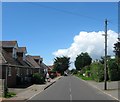

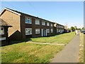
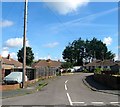
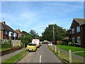
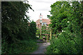
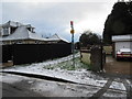
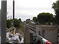
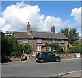
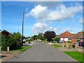
Please click the More button for more images, licensing and image copyright information.
Worthing and nearby Videos From YouTube
M A P [ by drone ] Worthing Pier, South Coast England
Drone aerial video of Worthing Pier, south coast of England, UK. Shot on DJI Mavic Pro.
Channel: M A P [ by drone ] (View Channel)
Published: 11 Jan 2020
Police
This area is policed by Sussex Police.
Sussex Police split their policing area into 273 separate neighbourhoods and this postcode is in the Ferring neighbourhood.

Ferring Neighbourhood Crime
Top 3 Categories
For full details of all categories together with more crime information, click on the Details button.
Member of UK Parliament
This postcode is in the Worthing West parliamentary constituency.
Worthing West is a constituency in the South East region of England. The seat has been held by Sir Peter Bottomley (Conservative) since May 2010.

Most Recent House Sales for Middle Onslow Close, BN12 5RT
23 Oct 2023
15 Dec 2020
28 Oct 2019
12 Apr 2017
Local Petrol Station Prices
Coordinates for BN12 5RT
Residents at BN12 5RT
Sunrise and Sunset at BN12 5RT
Traffic Emission and Congestion Zones
Historical Weather Summary
| Clear | 10.13% |
| Cloudy | 49.87% |
| Rain | 10.71% |
| Windy | 29.30% |
| Other | -0.01% |
Population
Deprivation Index
the more deprived the postcode
Average Energy Performance
Companies Registered at BN12 5RT
Postcode Details for BN12 5RT
Recent Updates
|
18 Apr 2024 Added Traffic Camera Views from Traffic Scotland to Roadworks within Scotland |
|
15 Apr 2024 Schools Data updated for April 2024 |
|
10 Apr 2024 Companies Data updated for March 2024 |
|
7 Apr 2024 New option to receive automatic updates to roadworks that affect you |
|
7 Apr 2024 Police and Crime data updated for February 2024 |
|
3 Apr 2024 Sold House Price data updated for February 2024 |
|
30 Mar 2024 Energy Performance Certificates (England and Wales) updated February 2024 |
|
28 Mar 2024 New feature to use Geolocating functions to detect your current location |
Random Postcodes
Want an idea of what is in our extensive website? Try somewhere completely random!
The Rural/Urban classification is based upon data collected during the 2011 Census and released in August 2013 and is categorised into 6 distinct classes.
[A] Urban Major conurbation: A built up area with a population of 10,000 (3,000 in Scotland) or more and is assigned to the major conurbation settlement category.
[B] Urban Minor conurbation: A built up area with a population of 10,000 (3,000 in Scotland) or more and is assigned to the minor conurbation settlement category.
[C] Urban City and town: A built up area with a population of 10,000 (3,000 in Scotland) or more and is assigned to the city and town settlement category.
[D] Rural Town and fringe
[E] Rural Village
[F] Rural Hamlet and isolated dwelling
The Index of Multiple Deprivation (IMD) is the official measure of relative deprivation.
The index is based on 39 separate indicators across seven distinct domains (Income; Employment; Health and Disability; Education, Skills and Training; Crime; Barriers to Housing and Services; Living Environment) to provide an overall measure of multiple deprivation and is calculated for every neighbourhood.
The index is relative rather than an absolute scale and so a neighbourhood with a score of 10 is more deprived than one rated 20, but this does not equate to being twice as deprived.
Please note: Different indices are used in England, Scotland, Wales and Northern Ireland and so comparison of scores from neighbourhoods in different countries should not be undertaken.
These figures report on incorporated UK companies only that are registered at this postcode and do not include sole-traders, partnerships or overseas organisations.
The population figure shown for your area are an estimate provided by the Office for National Statistics and is rounded to the nearest 1,000.
The estimates are derived from the Annual Population Survey (APS) which is the Labour Force Survey (LFS) plus various sample boosts.
There are 26 county councils in 2-tier areas, providing services such as education, social services and waste disposal.
In 2-tier areas, each county council area is subdivided into districts, for which there is an independent district council. There are 192 district councils.
District councils are responsible for local services such as rubbish collection, housing and planning applications.