Overview for Crosby Road, BOLTON, BL1 4EJ
Introduction
Bolton is a town in Greater Manchester in England. In the foothills of the West Pennine Moors, Bolton is between Manchester (10 miles (16 km) south-east), Blackburn, Wigan, Bury and Salford. It is surrounded by several towns and villages that form the wider borough, of which Bolton is the administrative centre. The town is also within the historic county boundaries of Lancashire.
A former mill town, Bolton has been a centre for textile production since the 14th century when Flemish weavers settled in the area, introducing a wool and cotton-weaving tradition. It was a 19th-century boomtown, development largely coincided with the introduction of textile manufacture during the Industrial Revolution. At its peak in 1929, its 216 cotton mills and 26 bleaching and dyeing works made it one of the largest and most productive centres of cotton spinning in the world. The British cotton industry declined sharply after the First World War and, by the 1980s, cotton manufacture had virtually ceased in the town.
The town has a population of 139,403, whilst the wider metropolitan borough has a population of 262,400. Bolton originated as a small settlement in the moorland known as Bolton le Moors. In the English Civil War, the town was a Parliamentarian outpost in a staunchly Royalist region and, as a result, was stormed by 3,000 Royalist troops led by Prince Rupert of the Rhine in 1644. In what became known as the Bolton Massacre, 1,600 residents were killed and 700 were taken prisoner.
Bolton Wanderers football club now play home games at the University of Bolton Stadium in Horwich and the WBA World light-welterweight champion Amir Khan was born in the town. Cultural interests include the Octagon Theatre and the Bolton Museum and Art Gallery, as well as one of the earliest public libraries established after the Public Libraries Act 1850.
Summary for Crosby Road, BOLTON, BL1 4EJ
Roadworks near BL1 4EJ
Road Safety near BL1 4EJ
Details of personal injury accidents in and around Crosby Road, BL1 4EJ that have been reported to Greater Manchester Police over the past 20 years.
Traffic Levels near BL1 4EJ
View traffic levels near Crosby Road, BL1 4EJ from official Department for Transport counts.
Images taken near to Crosby Road, BL1 4EJ and the surrounding area
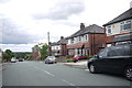
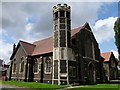
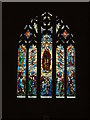
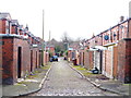
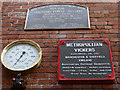
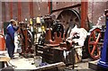
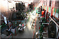
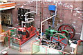

Please click the More button for more images, licensing and image copyright information.
Bolton and nearby Videos From YouTube
Bury from above
My most recent drone video of Bury and surrounding areas. I'm raising money for the #NHS if you enjoy the video please consider ...
Channel: Richard Hilley (View Channel)
Published: 25 Apr 2020
Member of UK Parliament
This postcode is in the Bolton West parliamentary constituency.
Bolton West is a constituency in the North West region of England. The seat has been held by Chris Green (Conservative) since May 2015.

Most Recent House Sales for Crosby Road, BL1 4EJ
5 Nov 2021
29 Sep 2015
6 Aug 2015
28 Aug 2013
Local Petrol Station Prices
Coordinates for BL1 4EJ
Residents at BL1 4EJ
Sunrise and Sunset at BL1 4EJ
Traffic Emission and Congestion Zones
Historical Weather Summary
| Clear | 7.23% |
| Cloudy | 74.01% |
| Rain | 13.11% |
| Windy | 5.48% |
| Other | 0.17% |
Population
Deprivation Index
the more deprived the postcode
Average Energy Performance
Companies Registered at BL1 4EJ
Postcode Details for BL1 4EJ
Recent Updates
|
18 Apr 2024 Added Traffic Camera Views from Traffic Scotland to Roadworks within Scotland |
|
15 Apr 2024 Schools Data updated for April 2024 |
|
10 Apr 2024 Companies Data updated for March 2024 |
|
7 Apr 2024 New option to receive automatic updates to roadworks that affect you |
|
7 Apr 2024 Police and Crime data updated for February 2024 |
|
3 Apr 2024 Sold House Price data updated for February 2024 |
|
30 Mar 2024 Energy Performance Certificates (England and Wales) updated February 2024 |
|
28 Mar 2024 New feature to use Geolocating functions to detect your current location |
Random Postcodes
Want an idea of what is in our extensive website? Try somewhere completely random!
The Rural/Urban classification is based upon data collected during the 2011 Census and released in August 2013 and is categorised into 6 distinct classes.
[A] Urban Major conurbation: A built up area with a population of 10,000 (3,000 in Scotland) or more and is assigned to the major conurbation settlement category.
[B] Urban Minor conurbation: A built up area with a population of 10,000 (3,000 in Scotland) or more and is assigned to the minor conurbation settlement category.
[C] Urban City and town: A built up area with a population of 10,000 (3,000 in Scotland) or more and is assigned to the city and town settlement category.
[D] Rural Town and fringe
[E] Rural Village
[F] Rural Hamlet and isolated dwelling
The Index of Multiple Deprivation (IMD) is the official measure of relative deprivation.
The index is based on 39 separate indicators across seven distinct domains (Income; Employment; Health and Disability; Education, Skills and Training; Crime; Barriers to Housing and Services; Living Environment) to provide an overall measure of multiple deprivation and is calculated for every neighbourhood.
The index is relative rather than an absolute scale and so a neighbourhood with a score of 10 is more deprived than one rated 20, but this does not equate to being twice as deprived.
Please note: Different indices are used in England, Scotland, Wales and Northern Ireland and so comparison of scores from neighbourhoods in different countries should not be undertaken.
These figures report on incorporated UK companies only that are registered at this postcode and do not include sole-traders, partnerships or overseas organisations.
The population figure shown for your area are an estimate provided by the Office for National Statistics and is rounded to the nearest 1,000.
The estimates are derived from the Annual Population Survey (APS) which is the Labour Force Survey (LFS) plus various sample boosts.
There are 36 metropolitan district councils which together cover 6 large urban areas: the counties of Greater Manchester, Merseyside, South Yorkshire, Tyne and Wear, West Midlands, and West Yorkshire.
Metropolitan districts are responsible for all services in their area, although certain conurbation wide services such as fire and civil defence, police, waste disposal and passenger transport are provided through joint authorities (the districts acting jointly).