Overview for Henley Gardens, BOURNEMOUTH, BH7 7EH
Introduction
Bournemouth is a coastal resort town on the south coast in the Bournemouth, Christchurch and Poole borough of Dorset, England. The town's urban subdivision had a population of 187,503 at the 2011 census making it the largest town in the county; the town is part of the South East Dorset conurbation, which has a population of 465,000.
Founded in 1810 by Lewis Tregonwell, in an area of deserted heathland occasionally visited by fishermen and smugglers, as a health resort, Bournemouth became a town in 1870, with growth from the arrival of the railway. Bournemouth lies in the historic county of Hampshire. Following the local government reorganisation in 1974 the town was transferred to the county of Dorset, governed by Dorset County Council. Although the borough gained unitary authority in 1997, it retained Dorset's ceremonial county functions and emergency services. In April 2019, the borough was replaced by the current borough, also with unitary authority status, governing the town, Poole, Christchurch and surrounding areas.
Victorian architecture is notable in town centre. The 202-foot (62 m) spire of St Peter's Church, one of three Grade I listed churches in the borough, is a local landmark. The town's location has made it a popular destination for tourists, attracting over five million visitors annually with its beaches and popular nightlife. It is also a regional centre of business, home of the Bournemouth International Centre (BIC) and a financial sector that is worth more than £1 billion in gross value added.
Summary for Henley Gardens, BOURNEMOUTH, BH7 7EH
Roadworks near BH7 7EH
Road Safety near BH7 7EH
Details of personal injury accidents in and around Henley Gardens, BH7 7EH that have been reported to Dorset Police over the past 20 years.
Traffic Levels near BH7 7EH
View traffic levels near Henley Gardens, BH7 7EH from official Department for Transport counts.
Images taken near to Henley Gardens, BH7 7EH and the surrounding area
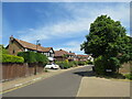
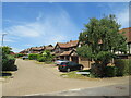
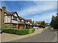
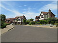
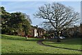
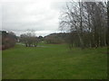
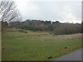
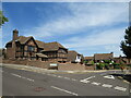
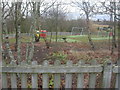
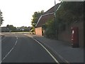
Please click the More button for more images, licensing and image copyright information.
Bournemouth and nearby Videos From YouTube
My first ever drone flight - Bournemouth, Dorset
And here it is, my first ever drone flight and my first ever drone video shot in Bournemouth, Dorset. I think it was not that bad, ...
Channel: SteveHardyImages (View Channel)
Published: 18 May 2022
Police
This area is policed by Dorset Police.
Dorset Police split their policing area into 21 separate neighbourhoods and this postcode is in the Bournemouth East - East neighbourhood.

Bournemouth East - East Neighbourhood Crime
Top 3 Categories
For full details of all categories together with more crime information, click on the Details button.
Member of UK Parliament
This postcode is in the Bournemouth East parliamentary constituency.
Bournemouth East is a constituency in the South West region of England. The seat has been held by Mr Tobias Ellwood (Conservative) since May 2010.

Most Recent House Sales for Henley Gardens, BH7 7EH
21 Jul 2022
21 Jan 2022
18 Feb 2021
1 Jul 2019
Local Petrol Station Prices
Coordinates for BH7 7EH
Residents at BH7 7EH
Sunrise and Sunset at BH7 7EH
Traffic Emission and Congestion Zones
Historical Weather Summary
| Clear | 11.82% |
| Cloudy | 63.95% |
| Rain | 10.82% |
| Windy | 13.41% |
| Other | 0.00% |
Deprivation Index
the more deprived the postcode
Average Energy Performance
Companies Registered at BH7 7EH
Postcode Details for BH7 7EH
Recent Updates
|
18 Apr 2024 Added Traffic Camera Views from Traffic Scotland to Roadworks within Scotland |
|
15 Apr 2024 Schools Data updated for April 2024 |
|
10 Apr 2024 Companies Data updated for March 2024 |
|
7 Apr 2024 New option to receive automatic updates to roadworks that affect you |
|
7 Apr 2024 Police and Crime data updated for February 2024 |
|
3 Apr 2024 Sold House Price data updated for February 2024 |
|
30 Mar 2024 Energy Performance Certificates (England and Wales) updated February 2024 |
|
28 Mar 2024 New feature to use Geolocating functions to detect your current location |
Random Postcodes
Want an idea of what is in our extensive website? Try somewhere completely random!
The Rural/Urban classification is based upon data collected during the 2011 Census and released in August 2013 and is categorised into 6 distinct classes.
[A] Urban Major conurbation: A built up area with a population of 10,000 (3,000 in Scotland) or more and is assigned to the major conurbation settlement category.
[B] Urban Minor conurbation: A built up area with a population of 10,000 (3,000 in Scotland) or more and is assigned to the minor conurbation settlement category.
[C] Urban City and town: A built up area with a population of 10,000 (3,000 in Scotland) or more and is assigned to the city and town settlement category.
[D] Rural Town and fringe
[E] Rural Village
[F] Rural Hamlet and isolated dwelling
The Index of Multiple Deprivation (IMD) is the official measure of relative deprivation.
The index is based on 39 separate indicators across seven distinct domains (Income; Employment; Health and Disability; Education, Skills and Training; Crime; Barriers to Housing and Services; Living Environment) to provide an overall measure of multiple deprivation and is calculated for every neighbourhood.
The index is relative rather than an absolute scale and so a neighbourhood with a score of 10 is more deprived than one rated 20, but this does not equate to being twice as deprived.
Please note: Different indices are used in England, Scotland, Wales and Northern Ireland and so comparison of scores from neighbourhoods in different countries should not be undertaken.
These figures report on incorporated UK companies only that are registered at this postcode and do not include sole-traders, partnerships or overseas organisations.
The population figure shown for your area are an estimate provided by the Office for National Statistics and is rounded to the nearest 1,000.
The estimates are derived from the Annual Population Survey (APS) which is the Labour Force Survey (LFS) plus various sample boosts.
There are 55 unitary authorities. They provide all local government services in their areas. These are mainly in the cities, urban areas and larger towns although there are now 6 shire county councils that are unitary (ie have no district councils beneath them).