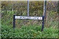
Overview for Braggers Lane, CHRISTCHURCH, BH23 8EF
Introduction
Christchurch is a town and civil parish on the south coast of Dorset, England. The parish had a population of 31,372 in 2021. It adjoins Bournemouth to the west, with the New Forest to the east. Part of the historic county of Hampshire, Christchurch was a borough within the administrative county of Dorset from 1974 until 2019, when it became part of the new Bournemouth, Christchurch and Poole unitary authority.
Founded in the 7th century at the confluence of the rivers Avon and Stour which flow into Christchurch Harbour, the town was originally named Twynham but became known as Christchurch following the construction of the priory in 1094. The town developed into an important trading port, and was fortified in the 9th century. Further defences were added in the 12th century with the construction of a castle, which was destroyed during the English Civil War by the Parliamentarian Army. During the 18th and 19th centuries, smuggling flourished and became one of the town's most lucrative industries. The town was heavily fortified during the Second World War as a precaution against an expected invasion, and in 1940 an Airspeed factory was established on the town's airfield to make aircraft for the Royal Air Force.
The town's harbour, beaches, nature reserves and historically important buildings have made Christchurch a popular tourist destination. Bournemouth Airport, an international airport which handled around 800,000 passengers in 2019, is within the former borough boundary at Hurn. The airport's industrial park contains a number of aerospace and engineering businesses and is one of the largest employment sites in Dorset.
Summary for Braggers Lane, CHRISTCHURCH, BH23 8EF
Roadworks near BH23 8EF
Road Safety near BH23 8EF
Details of personal injury accidents in and around Braggers Lane, BH23 8EF that have been reported to Hampshire Constabulary over the past 20 years.
Traffic Levels near BH23 8EF
View traffic levels near Braggers Lane, BH23 8EF from official Department for Transport counts.
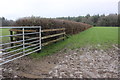
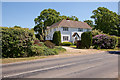
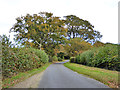
Images taken near to Braggers Lane, BH23 8EF and the surrounding area
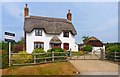
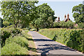
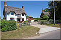
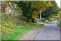
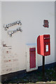
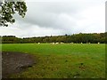
Please click the More button for more images, licensing and image copyright information.
Police
This area is policed by Hampshire Constabulary.
Hampshire Constabulary split their policing area into 95 separate neighbourhoods and this postcode is in the Ringwood and Fordingbridge neighbourhood.

Ringwood and Fordingbridge Neighbourhood Crime
Top 3 Categories
For full details of all categories together with more crime information, click on the Details button.
Member of UK Parliament
This postcode is in the New Forest West parliamentary constituency.
New Forest West is a constituency in the South East region of England. The seat has been held by Sir Desmond Swayne (Conservative) since May 2010.

Most Recent House Sales for Braggers Lane, BH23 8EF
16 Mar 2016
15 Aug 2014
10 Sep 2010
25 Jun 2004
Local Petrol Station Prices
Coordinates for BH23 8EF
Residents at BH23 8EF
Sunrise and Sunset at BH23 8EF
Traffic Emission and Congestion Zones
Historical Weather Summary
| Clear | 24.78% |
| Cloudy | 63.69% |
| Rain | 8.01% |
| Windy | 3.26% |
| Other | 0.26% |
Population
Deprivation Index
the more deprived the postcode
Average Energy Performance
Companies Registered at BH23 8EF
National Park for BH23 8EF
Postcode Details for BH23 8EF
Recent Updates
|
18 Apr 2024 Added Traffic Camera Views from Traffic Scotland to Roadworks within Scotland |
|
15 Apr 2024 Schools Data updated for April 2024 |
|
10 Apr 2024 Companies Data updated for March 2024 |
|
7 Apr 2024 New option to receive automatic updates to roadworks that affect you |
|
7 Apr 2024 Police and Crime data updated for February 2024 |
|
3 Apr 2024 Sold House Price data updated for February 2024 |
|
30 Mar 2024 Energy Performance Certificates (England and Wales) updated February 2024 |
|
28 Mar 2024 New feature to use Geolocating functions to detect your current location |
Random Postcodes
Want an idea of what is in our extensive website? Try somewhere completely random!
The Rural/Urban classification is based upon data collected during the 2011 Census and released in August 2013 and is categorised into 6 distinct classes.
[A] Urban Major conurbation: A built up area with a population of 10,000 (3,000 in Scotland) or more and is assigned to the major conurbation settlement category.
[B] Urban Minor conurbation: A built up area with a population of 10,000 (3,000 in Scotland) or more and is assigned to the minor conurbation settlement category.
[C] Urban City and town: A built up area with a population of 10,000 (3,000 in Scotland) or more and is assigned to the city and town settlement category.
[D] Rural Town and fringe
[E] Rural Village
[F] Rural Hamlet and isolated dwelling
The Index of Multiple Deprivation (IMD) is the official measure of relative deprivation.
The index is based on 39 separate indicators across seven distinct domains (Income; Employment; Health and Disability; Education, Skills and Training; Crime; Barriers to Housing and Services; Living Environment) to provide an overall measure of multiple deprivation and is calculated for every neighbourhood.
The index is relative rather than an absolute scale and so a neighbourhood with a score of 10 is more deprived than one rated 20, but this does not equate to being twice as deprived.
Please note: Different indices are used in England, Scotland, Wales and Northern Ireland and so comparison of scores from neighbourhoods in different countries should not be undertaken.
These figures report on incorporated UK companies only that are registered at this postcode and do not include sole-traders, partnerships or overseas organisations.
The population figure shown for your area are an estimate provided by the Office for National Statistics and is rounded to the nearest 1,000.
The estimates are derived from the Annual Population Survey (APS) which is the Labour Force Survey (LFS) plus various sample boosts.
There are 26 county councils in 2-tier areas, providing services such as education, social services and waste disposal.
In 2-tier areas, each county council area is subdivided into districts, for which there is an independent district council. There are 192 district councils.
District councils are responsible for local services such as rubbish collection, housing and planning applications.