Overview for Redcliffe Road, SWANAGE, BH19 1NA
Introduction
Swanage is a coastal town and civil parish in the south east of Dorset, England. It is at the eastern end of the Isle of Purbeck and one of its two towns, approximately 6+1⁄4 miles (10 km) south of Poole and 25 miles (40 km) east of Dorchester. In the 2011 census the civil parish had a population of 9,601. Nearby are Ballard Down and Old Harry Rocks, with Studland Bay and Poole Harbour to the north. Within the parish are Durlston Bay and Durlston Country Park to the south of the town. The parish also includes the areas of Herston, just to the west of the town, and Durlston, just to the south.
The town, originally a small port and fishing village, flourished in the Victorian era, when it first became a significant quarrying port and later a seaside resort for the rich of the day. Today the town remains a popular tourist resort, this being the town's primary industry, with many thousands of visitors coming to the town during the peak summer season, drawn by the bay's sandy beaches and other attractions.
During its history the bay was listed variously as Swanawic, Swanwich and Sandwich, and only in more recent history as Swanage.
The town is located at the eastern end of the Jurassic Coast, a World Heritage Site. The town contains many listed buildings and two conservation areas – Swanage Conservation Area and Herston Conservation Area.
Summary for Redcliffe Road, SWANAGE, BH19 1NA
Roadworks near BH19 1NA
Road Safety near BH19 1NA
Details of personal injury accidents in and around Redcliffe Road, BH19 1NA that have been reported to Dorset Police over the past 20 years.
Traffic Levels near BH19 1NA
View traffic levels near Redcliffe Road, BH19 1NA from official Department for Transport counts.
Images taken near to Redcliffe Road, BH19 1NA and the surrounding area
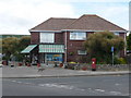
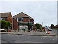
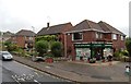
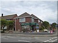
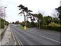
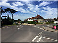
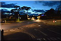
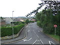
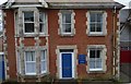
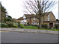
Please click the More button for more images, licensing and image copyright information.
Police
This area is policed by Dorset Police.
Dorset Police split their policing area into 21 separate neighbourhoods and this postcode is in the Purbeck South neighbourhood.

Purbeck South Neighbourhood Crime
Top 3 Categories
For full details of all categories together with more crime information, click on the Details button.
Member of UK Parliament
This postcode is in the South Dorset parliamentary constituency.
South Dorset is a constituency in the South West region of England. The seat has been held by Richard Drax (Conservative) since May 2010.

Most Recent House Sales for Redcliffe Road, BH19 1NA
30 Mar 2016
9 Oct 2014
29 Oct 2007
24 Aug 2007
Local Petrol Station Prices
Coordinates for BH19 1NA
Residents at BH19 1NA
Sunrise and Sunset at BH19 1NA
Traffic Emission and Congestion Zones
Historical Weather Summary
| Clear | 12.54% |
| Cloudy | 49.20% |
| Rain | 10.82% |
| Windy | 27.44% |
| Other | 0.00% |
Deprivation Index
the more deprived the postcode
Average Energy Performance
Companies Registered at BH19 1NA
Postcode Details for BH19 1NA
Recent Updates
|
18 Apr 2024 Added Traffic Camera Views from Traffic Scotland to Roadworks within Scotland |
|
15 Apr 2024 Schools Data updated for April 2024 |
|
10 Apr 2024 Companies Data updated for March 2024 |
|
7 Apr 2024 New option to receive automatic updates to roadworks that affect you |
|
7 Apr 2024 Police and Crime data updated for February 2024 |
|
3 Apr 2024 Sold House Price data updated for February 2024 |
|
30 Mar 2024 Energy Performance Certificates (England and Wales) updated February 2024 |
|
28 Mar 2024 New feature to use Geolocating functions to detect your current location |
Random Postcodes
Want an idea of what is in our extensive website? Try somewhere completely random!
The Rural/Urban classification is based upon data collected during the 2011 Census and released in August 2013 and is categorised into 6 distinct classes.
[A] Urban Major conurbation: A built up area with a population of 10,000 (3,000 in Scotland) or more and is assigned to the major conurbation settlement category.
[B] Urban Minor conurbation: A built up area with a population of 10,000 (3,000 in Scotland) or more and is assigned to the minor conurbation settlement category.
[C] Urban City and town: A built up area with a population of 10,000 (3,000 in Scotland) or more and is assigned to the city and town settlement category.
[D] Rural Town and fringe
[E] Rural Village
[F] Rural Hamlet and isolated dwelling
The Index of Multiple Deprivation (IMD) is the official measure of relative deprivation.
The index is based on 39 separate indicators across seven distinct domains (Income; Employment; Health and Disability; Education, Skills and Training; Crime; Barriers to Housing and Services; Living Environment) to provide an overall measure of multiple deprivation and is calculated for every neighbourhood.
The index is relative rather than an absolute scale and so a neighbourhood with a score of 10 is more deprived than one rated 20, but this does not equate to being twice as deprived.
Please note: Different indices are used in England, Scotland, Wales and Northern Ireland and so comparison of scores from neighbourhoods in different countries should not be undertaken.
These figures report on incorporated UK companies only that are registered at this postcode and do not include sole-traders, partnerships or overseas organisations.
The population figure shown for your area are an estimate provided by the Office for National Statistics and is rounded to the nearest 1,000.
The estimates are derived from the Annual Population Survey (APS) which is the Labour Force Survey (LFS) plus various sample boosts.
There are 55 unitary authorities. They provide all local government services in their areas. These are mainly in the cities, urban areas and larger towns although there are now 6 shire county councils that are unitary (ie have no district councils beneath them).