Overview for Laidlaw Close, POOLE, BH12 5EW
Introduction
Poole is a coastal town and seaport on the south coast of England in the Bournemouth, Christchurch and Poole unitary authority area in Dorset, England. The town is 21 miles (34 km) east of Dorchester and adjoins Bournemouth to the east. Since 1 April 2019, the local authority is Bournemouth, Christchurch and Poole Council. The town had an estimated population of 151,500 (mid-2016 census estimates) making it the second-largest town in the ceremonial county of Dorset. Together with Bournemouth and Christchurch, the conurbation has a total population of nearly 400,000.
The settlement dates back to before the Iron Age. The earliest recorded use of the town's name was in the 12th century when the town began to emerge as an important port, prospering with the introduction of the wool trade. Later, the town had important trade links with North America and, at its peak during the 18th century, it was one of the busiest ports in Britain. In the Second World War, Poole was one of the main departing points for the Normandy landings.
Poole is a tourist resort, attracting visitors with its large natural harbour, history, the Lighthouse arts centre and Blue Flag beaches. The town has a commercial port with cross-Channel freight and passenger ferry services, which connect with the Channel Islands of Jersey and Guernsey, as well as the French port town of Saint-Malo, Brittany.
The headquarters of the Royal National Lifeboat Institution (RNLI) is in Poole, and the Royal Marines have a base in the town's harbour. Despite their names, Poole is the home of The Arts University Bournemouth, the Bournemouth Symphony Orchestra and a significant part of Bournemouth University.
Summary for Laidlaw Close, POOLE, BH12 5EW
Roadworks near BH12 5EW
Road Safety near BH12 5EW
Details of personal injury accidents in and around Laidlaw Close, BH12 5EW that have been reported to Dorset Police over the past 20 years.
Traffic Levels near BH12 5EW
View traffic levels near Laidlaw Close, BH12 5EW from official Department for Transport counts.
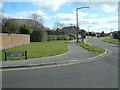
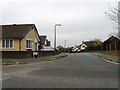
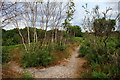
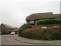
Images taken near to Laidlaw Close, BH12 5EW and the surrounding area


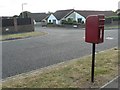


Please click the More button for more images, licensing and image copyright information.
Poole and nearby Videos From YouTube
A day in Old Harry Rocks, UK / 4k Drone FPV Footage
A short film about our visit to Old Harry Rocks in the Jurassic Coast of UK. Made with the DJI FPV and Sony A6500. Music by ...
Channel: Memory Junkies (View Channel)
Published: 13 Aug 2021
Police
This area is policed by Dorset Police.
Dorset Police split their policing area into 21 separate neighbourhoods and this postcode is in the Poole North neighbourhood.

Poole North Neighbourhood Crime
Top 3 Categories
For full details of all categories together with more crime information, click on the Details button.
Member of UK Parliament
This postcode is in the Bournemouth West parliamentary constituency.
Bournemouth West is a constituency in the South West region of England. The seat has been held by Sir Conor Burns (Conservative) since May 2010.

Most Recent House Sales for Laidlaw Close, BH12 5EW
19 Jan 2024
10 Aug 2023
18 Jul 2022
3 Jul 2020
Local Petrol Station Prices
Coordinates for BH12 5EW
Residents at BH12 5EW
Sunrise and Sunset at BH12 5EW
Traffic Emission and Congestion Zones
Historical Weather Summary
| Clear | 13.01% |
| Cloudy | 68.35% |
| Rain | 10.06% |
| Windy | 8.59% |
| Other | -0.01% |
Deprivation Index
the more deprived the postcode
Average Energy Performance
Companies Registered at BH12 5EW
Postcode Details for BH12 5EW
Recent Updates
|
18 Apr 2024 Added Traffic Camera Views from Traffic Scotland to Roadworks within Scotland |
|
15 Apr 2024 Schools Data updated for April 2024 |
|
10 Apr 2024 Companies Data updated for March 2024 |
|
7 Apr 2024 New option to receive automatic updates to roadworks that affect you |
|
7 Apr 2024 Police and Crime data updated for February 2024 |
|
3 Apr 2024 Sold House Price data updated for February 2024 |
|
30 Mar 2024 Energy Performance Certificates (England and Wales) updated February 2024 |
|
28 Mar 2024 New feature to use Geolocating functions to detect your current location |
Random Postcodes
Want an idea of what is in our extensive website? Try somewhere completely random!
The Rural/Urban classification is based upon data collected during the 2011 Census and released in August 2013 and is categorised into 6 distinct classes.
[A] Urban Major conurbation: A built up area with a population of 10,000 (3,000 in Scotland) or more and is assigned to the major conurbation settlement category.
[B] Urban Minor conurbation: A built up area with a population of 10,000 (3,000 in Scotland) or more and is assigned to the minor conurbation settlement category.
[C] Urban City and town: A built up area with a population of 10,000 (3,000 in Scotland) or more and is assigned to the city and town settlement category.
[D] Rural Town and fringe
[E] Rural Village
[F] Rural Hamlet and isolated dwelling
The Index of Multiple Deprivation (IMD) is the official measure of relative deprivation.
The index is based on 39 separate indicators across seven distinct domains (Income; Employment; Health and Disability; Education, Skills and Training; Crime; Barriers to Housing and Services; Living Environment) to provide an overall measure of multiple deprivation and is calculated for every neighbourhood.
The index is relative rather than an absolute scale and so a neighbourhood with a score of 10 is more deprived than one rated 20, but this does not equate to being twice as deprived.
Please note: Different indices are used in England, Scotland, Wales and Northern Ireland and so comparison of scores from neighbourhoods in different countries should not be undertaken.
These figures report on incorporated UK companies only that are registered at this postcode and do not include sole-traders, partnerships or overseas organisations.
The population figure shown for your area are an estimate provided by the Office for National Statistics and is rounded to the nearest 1,000.
The estimates are derived from the Annual Population Survey (APS) which is the Labour Force Survey (LFS) plus various sample boosts.
There are 55 unitary authorities. They provide all local government services in their areas. These are mainly in the cities, urban areas and larger towns although there are now 6 shire county councils that are unitary (ie have no district councils beneath them).