Overview for Crooke Lane, BRADFORD, BD15 0LL
Introduction
Bradford is a city in West Yorkshire, England. It is governed by a metropolitan borough named after the city, the wider county has devolved powers. It had a population of 349,561 at the 2011 census; the second-largest subdivision of the West Yorkshire Built-up Area after Leeds, which is approximately 9 miles (14 km) to the east. The borough had a population of 546,412, making it the 7th most populous district in England.
Historically part of the West Riding of Yorkshire, the city grew in the 19th century as an international centre of textile manufacture, particularly wool. It was a boomtown of the Industrial Revolution, and amongst the earliest industrialised settlements, rapidly becoming the "wool capital of the world"; this in turn gave rise to the nicknames "Woolopolis" and "Wool City". Lying in the eastern foothills of the Pennines, the area's access to supplies of coal, iron ore and soft water facilitated the growth of a manufacturing base, which, as textile manufacture grew, led to an explosion in population and was a stimulus to civic investment. There is a large amount of listed Victorian architecture in the city including the grand Italianate city hall. It became a municipal borough in 1847, received a city charter in 1897 and, since a 1974 reform, the city limits have been within the current wider borough.
From the mid-20th century, deindustrialisation caused the city's textile sector and industrial base to decline and, since then, it has faced similar economic and social challenges to the rest of post-industrial Northern England, including poverty, unemployment and social unrest. It is the third-largest economy within the Yorkshire and the Humber region at around £10 billion, which is mostly provided by financial and manufacturing industries. It is also a tourist destination, the first UNESCO City of Film and it has the National Science and Media Museum, a city park, the Alhambra theatre and Cartwright Hall. The city is the UK City of Culture for 2025 having won the designation on 31 May 2022.
Summary for Crooke Lane, BRADFORD, BD15 0LL
Roadworks near BD15 0LL
Road Safety near BD15 0LL
Details of personal injury accidents in and around Crooke Lane, BD15 0LL that have been reported to West Yorkshire Police over the past 20 years.
Traffic Levels near BD15 0LL
View traffic levels near Crooke Lane, BD15 0LL from official Department for Transport counts.
Images taken near to Crooke Lane, BD15 0LL and the surrounding area
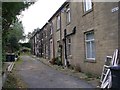
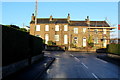
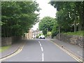
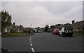
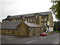
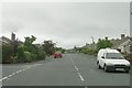
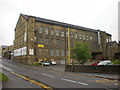
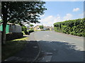
Please click the More button for more images, licensing and image copyright information.
Bradford and nearby Videos From YouTube
Stunning Aerial View of Bradford West Yorkshire UK
Bradford is a historical city in the North of the UK in the West Yorkshire county. With Beautiful dales and valleys, the city is ...
Channel: Stunning World Places (View Channel)
Published: 7 Nov 2022
Police
This area is policed by West Yorkshire Police.
West Yorkshire Police split their policing area into 21 separate neighbourhoods and this postcode is in the Shipley neighbourhood.

Shipley Neighbourhood Crime
Top 3 Categories
For full details of all categories together with more crime information, click on the Details button.
Member of UK Parliament
This postcode is in the Shipley parliamentary constituency.
Shipley is a constituency in the Yorkshire and The Humber region of England. The seat has been held by Sir Philip Davies (Conservative) since May 2010.

Most Recent House Sales for Crooke Lane, BD15 0LL
25 Nov 2022
18 Nov 2022
28 Feb 2020
7 Feb 2019
Local Petrol Station Prices
Coordinates for BD15 0LL
Residents at BD15 0LL
Sunrise and Sunset at BD15 0LL
Traffic Emission and Congestion Zones
Historical Weather Summary
| Clear | 7.08% |
| Cloudy | 66.68% |
| Rain | 9.62% |
| Windy | 15.09% |
| Other | 1.53% |
Population
Deprivation Index
the more deprived the postcode
Average Energy Performance
Companies Registered at BD15 0LL
Postcode Details for BD15 0LL
Recent Updates
|
18 Apr 2024 Added Traffic Camera Views from Traffic Scotland to Roadworks within Scotland |
|
15 Apr 2024 Schools Data updated for April 2024 |
|
10 Apr 2024 Companies Data updated for March 2024 |
|
7 Apr 2024 New option to receive automatic updates to roadworks that affect you |
|
7 Apr 2024 Police and Crime data updated for February 2024 |
|
3 Apr 2024 Sold House Price data updated for February 2024 |
|
30 Mar 2024 Energy Performance Certificates (England and Wales) updated February 2024 |
|
28 Mar 2024 New feature to use Geolocating functions to detect your current location |
Random Postcodes
Want an idea of what is in our extensive website? Try somewhere completely random!
The Rural/Urban classification is based upon data collected during the 2011 Census and released in August 2013 and is categorised into 6 distinct classes.
[A] Urban Major conurbation: A built up area with a population of 10,000 (3,000 in Scotland) or more and is assigned to the major conurbation settlement category.
[B] Urban Minor conurbation: A built up area with a population of 10,000 (3,000 in Scotland) or more and is assigned to the minor conurbation settlement category.
[C] Urban City and town: A built up area with a population of 10,000 (3,000 in Scotland) or more and is assigned to the city and town settlement category.
[D] Rural Town and fringe
[E] Rural Village
[F] Rural Hamlet and isolated dwelling
The Index of Multiple Deprivation (IMD) is the official measure of relative deprivation.
The index is based on 39 separate indicators across seven distinct domains (Income; Employment; Health and Disability; Education, Skills and Training; Crime; Barriers to Housing and Services; Living Environment) to provide an overall measure of multiple deprivation and is calculated for every neighbourhood.
The index is relative rather than an absolute scale and so a neighbourhood with a score of 10 is more deprived than one rated 20, but this does not equate to being twice as deprived.
Please note: Different indices are used in England, Scotland, Wales and Northern Ireland and so comparison of scores from neighbourhoods in different countries should not be undertaken.
These figures report on incorporated UK companies only that are registered at this postcode and do not include sole-traders, partnerships or overseas organisations.
The population figure shown for your area are an estimate provided by the Office for National Statistics and is rounded to the nearest 1,000.
The estimates are derived from the Annual Population Survey (APS) which is the Labour Force Survey (LFS) plus various sample boosts.
There are 36 metropolitan district councils which together cover 6 large urban areas: the counties of Greater Manchester, Merseyside, South Yorkshire, Tyne and Wear, West Midlands, and West Yorkshire.
Metropolitan districts are responsible for all services in their area, although certain conurbation wide services such as fire and civil defence, police, waste disposal and passenger transport are provided through joint authorities (the districts acting jointly).