Overview for Belvedere Road, BURNLEY, BB10 4BE
Introduction
Burnley is a town and the administrative centre of the wider Borough of Burnley in Lancashire, England, with a 2001 population of 73,021. It is 21 miles (34 km) north of Manchester and 20 miles (32 km) east of Preston, at the confluence of the River Calder and River Brun.
The town is located near the countryside to the south and east, with the towns of Padiham and Brierfield to the west and north respectively. It has a reputation as a regional centre of excellence for the manufacturing and aerospace industries.
The town began to develop in the early medieval period as a number of farming hamlets surrounded by manor houses and royal forests, and has held a market for more than 700 years. During the Industrial Revolution it became one of Lancashire's most prominent mill towns; at its peak, it was one of the world's largest producers of cotton cloth and a major centre of engineering.
Burnley has retained a strong manufacturing sector, and has strong economic links with the cities of Manchester and Leeds, as well as neighbouring towns along the M65 corridor. In 2013, in recognition of its success, Burnley received an Enterprising Britain award from the UK Government, for being the "Most Enterprising Area in the UK". For the first time in more than fifty years, a direct train service now operates between the town's Manchester Road railway station and Manchester's Victoria station and onward to Wigan Wallgate via the restored Todmorden Curve which opened in May 2015.
Summary for Belvedere Road, BURNLEY, BB10 4BE
Roadworks near BB10 4BE
Road Safety near BB10 4BE
Details of personal injury accidents in and around Belvedere Road, BB10 4BE that have been reported to Lancashire Constabulary over the past 20 years.
Traffic Levels near BB10 4BE
View traffic levels near Belvedere Road, BB10 4BE from official Department for Transport counts.
Images taken near to Belvedere Road, BB10 4BE and the surrounding area
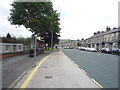
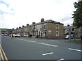
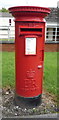
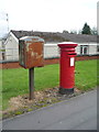
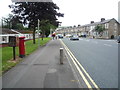
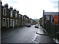
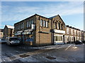
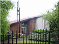
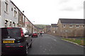
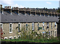
Please click the More button for more images, licensing and image copyright information.
Police
This area is policed by Lancashire Constabulary.
Lancashire Constabulary split their policing area into 236 separate neighbourhoods and this postcode is in the Bank Hall neighbourhood.

Bank Hall Neighbourhood Crime
Top 3 Categories
For full details of all categories together with more crime information, click on the Details button.
Member of UK Parliament
This postcode is in the Burnley parliamentary constituency.
Burnley is a constituency in the North West region of England. The seat has been held by Antony Higginbotham (Conservative) since December 2019.

Most Recent House Sales for Belvedere Road, BB10 4BE
9 Oct 2023
23 Jun 2023
16 Dec 2022
8 Jul 2020
Local Petrol Station Prices
Coordinates for BB10 4BE
Residents at BB10 4BE
Sunrise and Sunset at BB10 4BE
Traffic Emission and Congestion Zones
Historical Weather Summary
| Clear | 6.62% |
| Cloudy | 60.11% |
| Rain | 14.19% |
| Windy | 16.95% |
| Other | 2.13% |
Population
Deprivation Index
the more deprived the postcode
Average Energy Performance
Companies Registered at BB10 4BE
Postcode Details for BB10 4BE
Recent Updates
|
18 Apr 2024 Added Traffic Camera Views from Traffic Scotland to Roadworks within Scotland |
|
15 Apr 2024 Schools Data updated for April 2024 |
|
10 Apr 2024 Companies Data updated for March 2024 |
|
7 Apr 2024 New option to receive automatic updates to roadworks that affect you |
|
7 Apr 2024 Police and Crime data updated for February 2024 |
|
3 Apr 2024 Sold House Price data updated for February 2024 |
|
30 Mar 2024 Energy Performance Certificates (England and Wales) updated February 2024 |
|
28 Mar 2024 New feature to use Geolocating functions to detect your current location |
Random Postcodes
Want an idea of what is in our extensive website? Try somewhere completely random!
The Rural/Urban classification is based upon data collected during the 2011 Census and released in August 2013 and is categorised into 6 distinct classes.
[A] Urban Major conurbation: A built up area with a population of 10,000 (3,000 in Scotland) or more and is assigned to the major conurbation settlement category.
[B] Urban Minor conurbation: A built up area with a population of 10,000 (3,000 in Scotland) or more and is assigned to the minor conurbation settlement category.
[C] Urban City and town: A built up area with a population of 10,000 (3,000 in Scotland) or more and is assigned to the city and town settlement category.
[D] Rural Town and fringe
[E] Rural Village
[F] Rural Hamlet and isolated dwelling
The Index of Multiple Deprivation (IMD) is the official measure of relative deprivation.
The index is based on 39 separate indicators across seven distinct domains (Income; Employment; Health and Disability; Education, Skills and Training; Crime; Barriers to Housing and Services; Living Environment) to provide an overall measure of multiple deprivation and is calculated for every neighbourhood.
The index is relative rather than an absolute scale and so a neighbourhood with a score of 10 is more deprived than one rated 20, but this does not equate to being twice as deprived.
Please note: Different indices are used in England, Scotland, Wales and Northern Ireland and so comparison of scores from neighbourhoods in different countries should not be undertaken.
These figures report on incorporated UK companies only that are registered at this postcode and do not include sole-traders, partnerships or overseas organisations.
The population figure shown for your area are an estimate provided by the Office for National Statistics and is rounded to the nearest 1,000.
The estimates are derived from the Annual Population Survey (APS) which is the Labour Force Survey (LFS) plus various sample boosts.
There are 26 county councils in 2-tier areas, providing services such as education, social services and waste disposal.
In 2-tier areas, each county council area is subdivided into districts, for which there is an independent district council. There are 192 district councils.
District councils are responsible for local services such as rubbish collection, housing and planning applications.