Overview for Goss Drive, STREET, BA16 0RR
Introduction
Street is a large village and civil parish in Somerset, England, with a population of 11,805 in 2011. On a dry spot in the Somerset Levels, at the end of the Polden Hills, it is two miles (three kilometres) southwest of Glastonbury. There is evidence of Roman occupation. Much of the history of the village is dominated by Glastonbury Abbey, and a 12th-century causeway from Glastonbury built to transport local Blue Lias stone to it.
The Society of Friends was established there by the mid-17th century. One Quaker family, the Clarks, started a business in sheepskin rugs, woollen slippers and, later, boots and shoes. This became C&J Clark which still has its headquarters in Street. In 1993, redundant factory buildings were converted to form Clarks Village, the first purpose-built factory outlet in the United Kingdom. The Shoe Museum provides information about the history of Clarks and footwear manufacture in general.
The Clark family's former mansion and its estate at the edge of the village are now owned by Millfield School, an independent co-educational boarding school. Street is also home to Crispin School and Strode College.
To the north of Street is the River Brue, which marks the boundary with Glastonbury. South of Street are the Walton and Ivythorn Hills and East Polden Grasslands biological Sites of Special Scientific Interest. Strode Theatre provides a venue for films, exhibitions and live performances. The Anglican Parish Church of The Holy Trinity dates from the 14th century and has been designated by English Heritage as a Grade I listed building.
Summary for Goss Drive, STREET, BA16 0RR
Roadworks near BA16 0RR
Road Safety near BA16 0RR
Details of personal injury accidents in and around Goss Drive, BA16 0RR that have been reported to Avon and Somerset Constabulary over the past 20 years.
Traffic Levels near BA16 0RR
View traffic levels near Goss Drive, BA16 0RR from official Department for Transport counts.
Images taken near to Goss Drive, BA16 0RR and the surrounding area
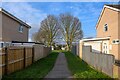
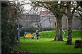
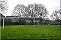
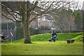

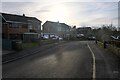
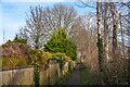
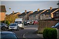
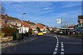
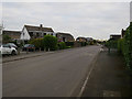
Please click the More button for more images, licensing and image copyright information.
Police
This area is policed by Avon and Somerset Constabulary.
Avon and Somerset Constabulary split their policing area into 123 separate neighbourhoods and this postcode is in the Street neighbourhood.

Street Neighbourhood Crime
Top 3 Categories
For full details of all categories together with more crime information, click on the Details button.
Member of UK Parliament
This postcode is in the Wells parliamentary constituency.
Wells is a constituency in the South West region of England. The seat has been held by James Heappey (Conservative) since May 2015.

Most Recent House Sales for Goss Drive, BA16 0RR
9 Jun 2023
12 May 2023
6 Apr 2023
29 Jul 2022
Local Petrol Station Prices
Coordinates for BA16 0RR
Residents at BA16 0RR
Sunrise and Sunset at BA16 0RR
Traffic Emission and Congestion Zones
Historical Weather Summary
| Clear | 21.46% |
| Cloudy | 66.53% |
| Rain | 7.56% |
| Windy | 4.26% |
| Other | 0.19% |
Deprivation Index
the more deprived the postcode
Average Energy Performance
Companies Registered at BA16 0RR
Postcode Details for BA16 0RR
Recent Updates
|
18 Apr 2024 Added Traffic Camera Views from Traffic Scotland to Roadworks within Scotland |
|
15 Apr 2024 Schools Data updated for April 2024 |
|
10 Apr 2024 Companies Data updated for March 2024 |
|
7 Apr 2024 New option to receive automatic updates to roadworks that affect you |
|
7 Apr 2024 Police and Crime data updated for February 2024 |
|
3 Apr 2024 Sold House Price data updated for February 2024 |
|
30 Mar 2024 Energy Performance Certificates (England and Wales) updated February 2024 |
|
28 Mar 2024 New feature to use Geolocating functions to detect your current location |
Random Postcodes
Want an idea of what is in our extensive website? Try somewhere completely random!
The Rural/Urban classification is based upon data collected during the 2011 Census and released in August 2013 and is categorised into 6 distinct classes.
[A] Urban Major conurbation: A built up area with a population of 10,000 (3,000 in Scotland) or more and is assigned to the major conurbation settlement category.
[B] Urban Minor conurbation: A built up area with a population of 10,000 (3,000 in Scotland) or more and is assigned to the minor conurbation settlement category.
[C] Urban City and town: A built up area with a population of 10,000 (3,000 in Scotland) or more and is assigned to the city and town settlement category.
[D] Rural Town and fringe
[E] Rural Village
[F] Rural Hamlet and isolated dwelling
The Index of Multiple Deprivation (IMD) is the official measure of relative deprivation.
The index is based on 39 separate indicators across seven distinct domains (Income; Employment; Health and Disability; Education, Skills and Training; Crime; Barriers to Housing and Services; Living Environment) to provide an overall measure of multiple deprivation and is calculated for every neighbourhood.
The index is relative rather than an absolute scale and so a neighbourhood with a score of 10 is more deprived than one rated 20, but this does not equate to being twice as deprived.
Please note: Different indices are used in England, Scotland, Wales and Northern Ireland and so comparison of scores from neighbourhoods in different countries should not be undertaken.
These figures report on incorporated UK companies only that are registered at this postcode and do not include sole-traders, partnerships or overseas organisations.
The population figure shown for your area are an estimate provided by the Office for National Statistics and is rounded to the nearest 1,000.
The estimates are derived from the Annual Population Survey (APS) which is the Labour Force Survey (LFS) plus various sample boosts.
There are 55 unitary authorities. They provide all local government services in their areas. These are mainly in the cities, urban areas and larger towns although there are now 6 shire county councils that are unitary (ie have no district councils beneath them).