Overview for Trinity Road South, WEST BROMWICH, B70 6NF
Introduction
West Bromwich (BROM-itch) is a market town in the borough of Sandwell, West Midlands, England. Historically part of Staffordshire, it is 7 miles (11 kilometres) northwest of Birmingham. West Bromwich is part of the area known as the Black Country, in terms of geography, culture and dialect. West Bromwich had a population of 103,112 in the 2021 Census.
Initially a rural village, West Bromwich's growth corresponded with that of the Industrial Revolution, owing to the area's natural richness in ironstone and coal, as well as its proximity to canals and railway branches. It led to the town becoming a centre for coal mining, brick making, the iron industry and metal trades such as nails, springs and guns. The town's primary economy developed into engineering, manufacturing and the automotive industry through the early 20th century. During the Second World War, West Bromwich experienced bombing from the German Luftwaffe. It also suffered heavily during recessions in the mid 1970s, early 1980s and late 2000s.
The town is known for its football club West Bromwich Albion, who have played in the town since the club's formation in 1878. It is also home to parts of Sandwell Valley Country Park and Sandwell Valley RSPB nature reserve.
Summary for Trinity Road South, WEST BROMWICH, B70 6NF
Roadworks near B70 6NF
Road Safety near B70 6NF
Details of personal injury accidents in and around Trinity Road South, B70 6NF that have been reported to West Midlands Police over the past 20 years.
Traffic Levels near B70 6NF
View traffic levels near Trinity Road South, B70 6NF from official Department for Transport counts.
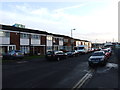
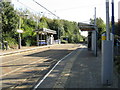
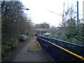
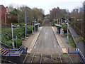
Images taken near to Trinity Road South, B70 6NF and the surrounding area
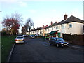
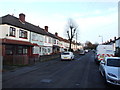
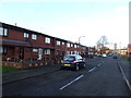
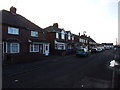
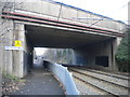
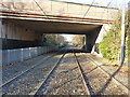
Please click the More button for more images, licensing and image copyright information.
Police
This area is policed by West Midlands Police.
West Midlands Police split their policing area into 87 separate neighbourhoods and this postcode is in the West Bromwich Town neighbourhood.

West Bromwich Town Neighbourhood Crime
Top 3 Categories
For full details of all categories together with more crime information, click on the Details button.
Member of UK Parliament
This postcode is in the West Bromwich East parliamentary constituency.
West Bromwich East is a constituency in the West Midlands region of England. The seat has been held by Nicola Richards (Conservative) since December 2019.

Most Recent House Sales for Trinity Road South, B70 6NF
18 Mar 2022
9 Oct 2019
20 Nov 2018
2 Jul 2018
Local Petrol Station Prices
Coordinates for B70 6NF
Residents at B70 6NF
Sunrise and Sunset at B70 6NF
Traffic Emission and Congestion Zones
Historical Weather Summary
| Clear | 19.89% |
| Cloudy | 66.61% |
| Rain | 6.32% |
| Windy | 7.13% |
| Other | 0.05% |
Population
Deprivation Index
the more deprived the postcode
Average Energy Performance
Companies Registered at B70 6NF
Postcode Details for B70 6NF
Recent Updates
|
18 Apr 2024 Added Traffic Camera Views from Traffic Scotland to Roadworks within Scotland |
|
15 Apr 2024 Schools Data updated for April 2024 |
|
10 Apr 2024 Companies Data updated for March 2024 |
|
7 Apr 2024 New option to receive automatic updates to roadworks that affect you |
|
7 Apr 2024 Police and Crime data updated for February 2024 |
|
3 Apr 2024 Sold House Price data updated for February 2024 |
|
30 Mar 2024 Energy Performance Certificates (England and Wales) updated February 2024 |
|
28 Mar 2024 New feature to use Geolocating functions to detect your current location |
Random Postcodes
Want an idea of what is in our extensive website? Try somewhere completely random!
The Rural/Urban classification is based upon data collected during the 2011 Census and released in August 2013 and is categorised into 6 distinct classes.
[A] Urban Major conurbation: A built up area with a population of 10,000 (3,000 in Scotland) or more and is assigned to the major conurbation settlement category.
[B] Urban Minor conurbation: A built up area with a population of 10,000 (3,000 in Scotland) or more and is assigned to the minor conurbation settlement category.
[C] Urban City and town: A built up area with a population of 10,000 (3,000 in Scotland) or more and is assigned to the city and town settlement category.
[D] Rural Town and fringe
[E] Rural Village
[F] Rural Hamlet and isolated dwelling
The Index of Multiple Deprivation (IMD) is the official measure of relative deprivation.
The index is based on 39 separate indicators across seven distinct domains (Income; Employment; Health and Disability; Education, Skills and Training; Crime; Barriers to Housing and Services; Living Environment) to provide an overall measure of multiple deprivation and is calculated for every neighbourhood.
The index is relative rather than an absolute scale and so a neighbourhood with a score of 10 is more deprived than one rated 20, but this does not equate to being twice as deprived.
Please note: Different indices are used in England, Scotland, Wales and Northern Ireland and so comparison of scores from neighbourhoods in different countries should not be undertaken.
These figures report on incorporated UK companies only that are registered at this postcode and do not include sole-traders, partnerships or overseas organisations.
The population figure shown for your area are an estimate provided by the Office for National Statistics and is rounded to the nearest 1,000.
The estimates are derived from the Annual Population Survey (APS) which is the Labour Force Survey (LFS) plus various sample boosts.
There are 36 metropolitan district councils which together cover 6 large urban areas: the counties of Greater Manchester, Merseyside, South Yorkshire, Tyne and Wear, West Midlands, and West Yorkshire.
Metropolitan districts are responsible for all services in their area, although certain conurbation wide services such as fire and civil defence, police, waste disposal and passenger transport are provided through joint authorities (the districts acting jointly).