Overview for Hazelwell Fordrough, BIRMINGHAM, B30 2RU
Introduction
Birmingham (BUR-ming-əm) is a city and metropolitan borough in the metropolitan county of West Midlands in England. It is the second-largest city in Britain - commonly referred to as the second city of the United Kingdom - with a population of 1.145 million in the city proper. Birmingham borders the Black Country to its west and together with its city of Wolverhampton and towns including Dudley and Solihull to the south-east, forms the West Midlands conurbation. The wider metropolitan area has a population of 4.3 million, making it the largest outside of London.
Located in the West Midlands region of England, approximately 100 miles (160 km) from London, Birmingham is considered to be the social, cultural, financial and commercial centre of the Midlands. It is just west of the traditional centre point of England at Meriden, and is the most inland major city in the country, and lying north of the Cotswolds and east of the Shropshire Hills. Distinctively, Birmingham only has small rivers flowing through it, mainly the River Tame and its tributaries River Rea and River Cole – one of the closest main rivers is the Severn, approximately 20 miles (32 km) west of the city centre. The city does however have numerous canals, collectively named the Birmingham Canal Navigations.
Historically a market town in Warwickshire in the medieval period, Birmingham grew during the 18th century during the Midlands Enlightenment and during the Industrial Revolution, which saw advances in science, technology and economic development, producing a series of innovations that laid many of the foundations of modern industrial society. By 1791, it was being hailed as "the first manufacturing town in the world". Birmingham's distinctive economic profile, with thousands of small workshops practising a wide variety of specialised and highly skilled trades, encouraged exceptional levels of creativity and innovation; this provided an economic base for prosperity that was to last into the final quarter of the 20th century. The Watt steam engine was invented in Birmingham.
The resulting high level of social mobility also fostered a culture of political radicalism which, under leaders from Thomas Attwood to Joseph Chamberlain, was to give it a political influence unparalleled in Britain outside London and a pivotal role in the development of British democracy. From the summer of 1940 to the spring of 1943, Birmingham was bombed heavily by the German Luftwaffe in what is known as the Birmingham Blitz. The damage done to the city's infrastructure, in addition to a deliberate policy of demolition and new building by planners, led to extensive urban regeneration in subsequent decades.
Birmingham's economy is now dominated by the service sector. The city is a major international commercial centre and an important transport, retail, events and conference hub. Its metropolitan economy is the second-largest in the United Kingdom with a GDP of $121.1bn (2014). Its five universities, including the University of Birmingham, make it the largest centre of higher education in the country outside London. Birmingham's major cultural institutions – the City of Birmingham Symphony Orchestra, Birmingham Royal Ballet, Birmingham Repertory Theatre, Library of Birmingham and Barber Institute of Fine Arts – enjoy international reputations, and the city has vibrant and influential grassroots art, music, literary and culinary scenes. The city also successfully hosted the 2022 Commonwealth Games. In 2021, Birmingham was the third most visited city in the UK by people from foreign nations.
Summary for Hazelwell Fordrough, BIRMINGHAM, B30 2RU
Roadworks near B30 2RU
Road Safety near B30 2RU
Details of personal injury accidents in and around Hazelwell Fordrough, B30 2RU that have been reported to West Midlands Police over the past 20 years.
Traffic Levels near B30 2RU
View traffic levels near Hazelwell Fordrough, B30 2RU from official Department for Transport counts.
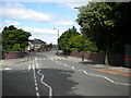
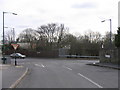
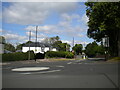
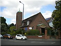
Images taken near to Hazelwell Fordrough, B30 2RU and the surrounding area
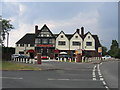
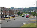
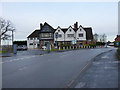
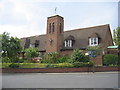
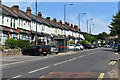
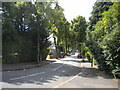
Please click the More button for more images, licensing and image copyright information.
Birmingham and nearby Videos From YouTube
University of Birmingham, 20th December 2021, DJI mini 2 Cinematic 4K drone flight
Short flyover University of Birmingham Chamberlain Square. Flight took in accordance with the CAA drone rules, visual line of ...
Channel: FirstAdeKit (View Channel)
Published: 24 Dec 2021
Police
This area is policed by West Midlands Police.
West Midlands Police split their policing area into 87 separate neighbourhoods and this postcode is in the Bournville neighbourhood.

Bournville Neighbourhood Crime
Top 3 Categories
For full details of all categories together with more crime information, click on the Details button.
Member of UK Parliament
This postcode is in the Birmingham, Selly Oak parliamentary constituency.
Birmingham, Selly Oak is a constituency in the West Midlands region of England. The seat has been held by Steve McCabe (Labour) since May 2010.

Most Recent House Sales for Hazelwell Fordrough, B30 2RU
2 Jun 2023
31 May 2023
19 Jun 2020
12 Oct 2018
Local Petrol Station Prices
Coordinates for B30 2RU
Residents at B30 2RU
Sunrise and Sunset at B30 2RU
Traffic Emission and Congestion Zones
Historical Weather Summary
| Clear | 20.30% |
| Cloudy | 69.09% |
| Rain | 6.40% |
| Windy | 4.17% |
| Other | 0.04% |
Population
Deprivation Index
the more deprived the postcode
Average Energy Performance
Companies Registered at B30 2RU
Postcode Details for B30 2RU
Recent Updates
|
15 Apr 2024 Schools Data updated for April 2024 |
|
10 Apr 2024 Companies Data updated for March 2024 |
|
7 Apr 2024 New option to receive automatic updates to roadworks that affect you |
|
7 Apr 2024 Police and Crime data updated for February 2024 |
|
3 Apr 2024 Sold House Price data updated for February 2024 |
|
30 Mar 2024 Energy Performance Certificates (England and Wales) updated February 2024 |
|
28 Mar 2024 New feature to use Geolocating functions to detect your current location |
|
17 Mar 2024 Schools Data updated for March 2024 |
Random Postcodes
Want an idea of what is in our extensive website? Try somewhere completely random!
The Rural/Urban classification is based upon data collected during the 2011 Census and released in August 2013 and is categorised into 6 distinct classes.
[A] Urban Major conurbation: A built up area with a population of 10,000 (3,000 in Scotland) or more and is assigned to the major conurbation settlement category.
[B] Urban Minor conurbation: A built up area with a population of 10,000 (3,000 in Scotland) or more and is assigned to the minor conurbation settlement category.
[C] Urban City and town: A built up area with a population of 10,000 (3,000 in Scotland) or more and is assigned to the city and town settlement category.
[D] Rural Town and fringe
[E] Rural Village
[F] Rural Hamlet and isolated dwelling
The Index of Multiple Deprivation (IMD) is the official measure of relative deprivation.
The index is based on 39 separate indicators across seven distinct domains (Income; Employment; Health and Disability; Education, Skills and Training; Crime; Barriers to Housing and Services; Living Environment) to provide an overall measure of multiple deprivation and is calculated for every neighbourhood.
The index is relative rather than an absolute scale and so a neighbourhood with a score of 10 is more deprived than one rated 20, but this does not equate to being twice as deprived.
Please note: Different indices are used in England, Scotland, Wales and Northern Ireland and so comparison of scores from neighbourhoods in different countries should not be undertaken.
These figures report on incorporated UK companies only that are registered at this postcode and do not include sole-traders, partnerships or overseas organisations.
The population figure shown for your area are an estimate provided by the Office for National Statistics and is rounded to the nearest 1,000.
The estimates are derived from the Annual Population Survey (APS) which is the Labour Force Survey (LFS) plus various sample boosts.
There are 36 metropolitan district councils which together cover 6 large urban areas: the counties of Greater Manchester, Merseyside, South Yorkshire, Tyne and Wear, West Midlands, and West Yorkshire.
Metropolitan districts are responsible for all services in their area, although certain conurbation wide services such as fire and civil defence, police, waste disposal and passenger transport are provided through joint authorities (the districts acting jointly).