Overview for Rowan Walk, HATFIELD, AL10 8SX
Introduction
Hatfield is a town and civil parish in Hertfordshire, England, in the borough of Welwyn Hatfield. It had a population of 29,616 in 2001, 39,201 at the 2011 Census, and 41,265 at the 2021 Census. The settlement is of Saxon origin. Hatfield House, home of the Marquess of Salisbury, forms the nucleus of the old town. From the 1930s when de Havilland opened a factory, until the 1990s when British Aerospace closed it, aircraft design and manufacture employed more people there than any other industry. Hatfield was one of the post-war New Towns built around London and has much modernist architecture from the period. The University of Hertfordshire is based there.
Hatfield lies 20 miles (30 kilometres) north of London beside the A1(M) motorway and has direct trains to London King's Cross railway station, Finsbury Park and Moorgate. There has been a strong increase in commuters who work in London moving into the area.
In 2022, TV property expert Phil Spencer named Hatfield as the second best place to live for regular commuters to London, based on train times, house prices and the attractions the town has.
Summary for Rowan Walk, HATFIELD, AL10 8SX
Roadworks near AL10 8SX
Road Safety near AL10 8SX
Details of personal injury accidents in and around Rowan Walk, AL10 8SX that have been reported to Hertfordshire Constabulary over the past 20 years.
Traffic Levels near AL10 8SX
View traffic levels near Rowan Walk, AL10 8SX from official Department for Transport counts.
Images taken near to Rowan Walk, AL10 8SX and the surrounding area
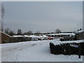
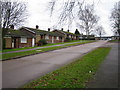
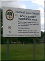
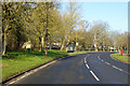
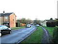
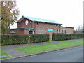
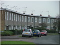
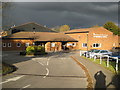
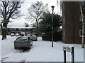
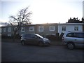
Please click the More button for more images, licensing and image copyright information.
Police
This area is policed by Hertfordshire Constabulary.
Hertfordshire Constabulary split their policing area into 33 separate neighbourhoods and this postcode is in the Welwyn Hatfield West neighbourhood.

Welwyn Hatfield West Neighbourhood Crime
Top 3 Categories
For full details of all categories together with more crime information, click on the Details button.
Member of UK Parliament
This postcode is in the Welwyn Hatfield parliamentary constituency.
Welwyn Hatfield is a constituency in the East of England region of England. The seat has been held by Grant Shapps (Conservative) since May 2010.

Most Recent House Sales for Rowan Walk, AL10 8SX
26 Jan 2018
23 May 2016
20 May 2011
20 Aug 2008
Local Petrol Station Prices
Coordinates for AL10 8SX
Residents at AL10 8SX
Sunrise and Sunset at AL10 8SX
Traffic Emission and Congestion Zones
Historical Weather Summary
| Clear | 9.08% |
| Cloudy | 80.15% |
| Rain | 8.33% |
| Windy | 2.29% |
| Other | 0.15% |
Population
Deprivation Index
the more deprived the postcode
Average Energy Performance
Companies Registered at AL10 8SX
Postcode Details for AL10 8SX
Recent Updates
|
15 Apr 2024 Schools Data updated for April 2024 |
|
10 Apr 2024 Companies Data updated for March 2024 |
|
7 Apr 2024 New option to receive automatic updates to roadworks that affect you |
|
7 Apr 2024 Police and Crime data updated for February 2024 |
|
3 Apr 2024 Sold House Price data updated for February 2024 |
|
30 Mar 2024 Energy Performance Certificates (England and Wales) updated February 2024 |
|
28 Mar 2024 New feature to use Geolocating functions to detect your current location |
|
17 Mar 2024 Schools Data updated for March 2024 |
Random Postcodes
Want an idea of what is in our extensive website? Try somewhere completely random!
The Rural/Urban classification is based upon data collected during the 2011 Census and released in August 2013 and is categorised into 6 distinct classes.
[A] Urban Major conurbation: A built up area with a population of 10,000 (3,000 in Scotland) or more and is assigned to the major conurbation settlement category.
[B] Urban Minor conurbation: A built up area with a population of 10,000 (3,000 in Scotland) or more and is assigned to the minor conurbation settlement category.
[C] Urban City and town: A built up area with a population of 10,000 (3,000 in Scotland) or more and is assigned to the city and town settlement category.
[D] Rural Town and fringe
[E] Rural Village
[F] Rural Hamlet and isolated dwelling
The Index of Multiple Deprivation (IMD) is the official measure of relative deprivation.
The index is based on 39 separate indicators across seven distinct domains (Income; Employment; Health and Disability; Education, Skills and Training; Crime; Barriers to Housing and Services; Living Environment) to provide an overall measure of multiple deprivation and is calculated for every neighbourhood.
The index is relative rather than an absolute scale and so a neighbourhood with a score of 10 is more deprived than one rated 20, but this does not equate to being twice as deprived.
Please note: Different indices are used in England, Scotland, Wales and Northern Ireland and so comparison of scores from neighbourhoods in different countries should not be undertaken.
These figures report on incorporated UK companies only that are registered at this postcode and do not include sole-traders, partnerships or overseas organisations.
The population figure shown for your area are an estimate provided by the Office for National Statistics and is rounded to the nearest 1,000.
The estimates are derived from the Annual Population Survey (APS) which is the Labour Force Survey (LFS) plus various sample boosts.
There are 26 county councils in 2-tier areas, providing services such as education, social services and waste disposal.
In 2-tier areas, each county council area is subdivided into districts, for which there is an independent district council. There are 192 district councils.
District councils are responsible for local services such as rubbish collection, housing and planning applications.