Overview for Grange, KEITH, AB55 6TD
Introduction
Keith is a small town in the Moray council area in north east Scotland. It has a population of 4,734.
Keith is historically in Banffshire, a name which persists in common usage and historical references. Keith has three distinct sections: Old Town, where the original settlement was first established; Keith which is the main commercial centre and Fife Keith which was originally a separate town built in competition by the Earl of Fife but which, having proved less economically successful, was eventually joined to form one homogeneous settlement separated now only by the river.
The oldest part of Keith dates to around 1180 where the Old Town still remains, now almost indistinguishable from the rest of the town. It developed around the old bridge which was built there by two mourning parents as a permanent memorial to their dear child who drowned in the river at that crossing point in the hope that none should suffer similar loss. The main part of the town is on higher ground above the river, laid out around 1750 by the Earl of Findlater. It is located at the crossing of the A95 and A96 roads. Local services include a health centre, dentist, optician and multiple hairdressing salons. The town has three schools: Keith Grammar School, Keith Primary School and St Thomas RC Primary School.
The annual Keith Country Show, held at Seafield Park, is an event in the farming calendar of north-east Scotland.
Newmill is a village approximately two kilometres (1+1⁄4 miles) north of Keith.
Summary for Grange, KEITH, AB55 6TD
Roadworks near AB55 6TD
Road Safety near AB55 6TD
Details of personal injury accidents in and around AB55 6TD that have been reported to over the past 20 years.
Traffic Levels near AB55 6TD
View traffic levels near AB55 6TD from official Department for Transport counts.
Images taken in and around the ab556td area
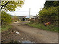
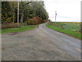
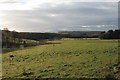
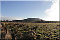
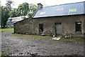
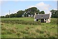
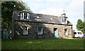
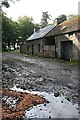
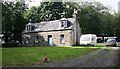
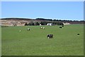
Please click the More button for more images, licensing and image copyright information.
Member of UK Parliament
This postcode is in the Moray parliamentary constituency.
Moray is a constituency in Scotland. The seat has been held by Douglas Ross (Conservative) since June 2017.

Most Recent House Sales for AB55 6TD
No recorded house sales or transfers for this postcode.
Local Petrol Station Prices
Coordinates for AB55 6TD
Sunrise and Sunset at AB55 6TD
Traffic Emission and Congestion Zones
Historical Weather Summary
| Clear | 9.71% |
| Cloudy | 57.00% |
| Rain | 5.43% |
| Windy | 27.16% |
| Other | 0.70% |
Average Energy Performance
Companies Registered at AB55 6TD
Postcode Details for AB55 6TD
Recent Updates
|
18 Apr 2024 Added Traffic Camera Views from Traffic Scotland to Roadworks within Scotland |
|
15 Apr 2024 Schools Data updated for April 2024 |
|
10 Apr 2024 Companies Data updated for March 2024 |
|
7 Apr 2024 New option to receive automatic updates to roadworks that affect you |
|
7 Apr 2024 Police and Crime data updated for February 2024 |
|
3 Apr 2024 Sold House Price data updated for February 2024 |
|
30 Mar 2024 Energy Performance Certificates (England and Wales) updated February 2024 |
|
28 Mar 2024 New feature to use Geolocating functions to detect your current location |
Random Postcodes
Want an idea of what is in our extensive website? Try somewhere completely random!
The Rural/Urban classification is based upon data collected during the 2011 Census and released in August 2013 and is categorised into 6 distinct classes.
[A] Urban Major conurbation: A built up area with a population of 10,000 (3,000 in Scotland) or more and is assigned to the major conurbation settlement category.
[B] Urban Minor conurbation: A built up area with a population of 10,000 (3,000 in Scotland) or more and is assigned to the minor conurbation settlement category.
[C] Urban City and town: A built up area with a population of 10,000 (3,000 in Scotland) or more and is assigned to the city and town settlement category.
[D] Rural Town and fringe
[E] Rural Village
[F] Rural Hamlet and isolated dwelling
The Index of Multiple Deprivation (IMD) is the official measure of relative deprivation.
The index is based on 39 separate indicators across seven distinct domains (Income; Employment; Health and Disability; Education, Skills and Training; Crime; Barriers to Housing and Services; Living Environment) to provide an overall measure of multiple deprivation and is calculated for every neighbourhood.
The index is relative rather than an absolute scale and so a neighbourhood with a score of 10 is more deprived than one rated 20, but this does not equate to being twice as deprived.
Please note: Different indices are used in England, Scotland, Wales and Northern Ireland and so comparison of scores from neighbourhoods in different countries should not be undertaken.
These figures report on incorporated UK companies only that are registered at this postcode and do not include sole-traders, partnerships or overseas organisations.
The population figure shown for your area are an estimate provided by the Office for National Statistics and is rounded to the nearest 1,000.
The estimates are derived from the Annual Population Survey (APS) which is the Labour Force Survey (LFS) plus various sample boosts.
There are 55 unitary authorities. They provide all local government services in their areas. These are mainly in the cities, urban areas and larger towns although there are now 6 shire county councils that are unitary (ie have no district councils beneath them).