Overview for Littleton Way, BURNTWOOD, WS7 1ZT
Introduction
Burntwood is a former mining town and civil parish in the Lichfield District in Staffordshire, England, approximately 4 miles (6 km) west of Lichfield and north east of Brownhills. The town had a population of 26,049 and forms part of Lichfield district. The town forms one of the largest urbanised parishes in England. Samuel Johnson opened an academy in nearby Edial in 1736. The town is home to the smallest park (opened to commemorate the marriage of the Prince of Wales in 1863) in the UK, Prince's Park, which is located next to Christ Church on the junction of Farewell Lane and Church Road. The town expanded in the nineteenth century around the coal mining industry.
Areas of Burntwood are Boney Hay, Chase Terrace, Chasetown, Gorstey Lea and Burntwood Green. Nearby places are Brownhills, Cannock, Cannock Wood, Norton Canes, Gentleshaw, Pipehill, Muckley Corner, Hammerwich and Lichfield.
In July 2009 a Burntwood man, Terry Herbert, discovered a hoard of Saxon treasure with a metal detector in a field in the adjoining village of Hammerwich. Known as the Staffordshire Hoard, it is the largest hoard of Anglo-Saxon gold yet found.
Summary for Littleton Way, BURNTWOOD, WS7 1ZT
Roadworks near WS7 1ZT
Road Safety near WS7 1ZT
Details of personal injury accidents in and around Littleton Way, WS7 1ZT that have been reported to Staffordshire Police over the past 20 years.
Traffic Levels near WS7 1ZT
View traffic levels near Littleton Way, WS7 1ZT from official Department for Transport counts.
Images taken near to Littleton Way, WS7 1ZT and the surrounding area
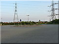
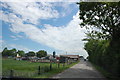
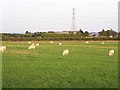
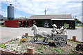
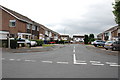
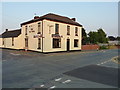
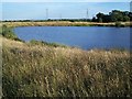
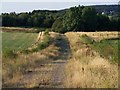
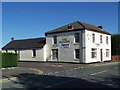
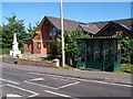
Please click the More button for more images, licensing and image copyright information.
Police
This area is policed by Staffordshire Police.
Staffordshire Police split their policing area into 97 separate neighbourhoods and this postcode is in the Burntwood neighbourhood.

Burntwood Neighbourhood Crime
Top 3 Categories
For full details of all categories together with more crime information, click on the Details button.
Member of UK Parliament
This postcode is in the Lichfield parliamentary constituency.
Lichfield is a constituency in the West Midlands region of England. The seat has been held by Michael Fabricant (Conservative) since May 2010.

Most Recent House Sales for Littleton Way, WS7 1ZT
27 May 2022
13 Nov 2020
1 Oct 2020
12 Aug 2020
Local Petrol Station Prices
Coordinates for WS7 1ZT
Residents at WS7 1ZT
Sunrise and Sunset at WS7 1ZT
Traffic Emission and Congestion Zones
Historical Weather Summary
| Clear | 20.48% |
| Cloudy | 65.90% |
| Rain | 6.52% |
| Windy | 7.00% |
| Other | 0.10% |
Population
Deprivation Index
the more deprived the postcode
Average Energy Performance
Companies Registered at WS7 1ZT
Postcode Details for WS7 1ZT
Recent Updates
|
18 Apr 2024 Added Traffic Camera Views from Traffic Scotland to Roadworks within Scotland |
|
15 Apr 2024 Schools Data updated for April 2024 |
|
10 Apr 2024 Companies Data updated for March 2024 |
|
7 Apr 2024 New option to receive automatic updates to roadworks that affect you |
|
7 Apr 2024 Police and Crime data updated for February 2024 |
|
3 Apr 2024 Sold House Price data updated for February 2024 |
|
30 Mar 2024 Energy Performance Certificates (England and Wales) updated February 2024 |
|
28 Mar 2024 New feature to use Geolocating functions to detect your current location |
Random Postcodes
Want an idea of what is in our extensive website? Try somewhere completely random!
The Rural/Urban classification is based upon data collected during the 2011 Census and released in August 2013 and is categorised into 6 distinct classes.
[A] Urban Major conurbation: A built up area with a population of 10,000 (3,000 in Scotland) or more and is assigned to the major conurbation settlement category.
[B] Urban Minor conurbation: A built up area with a population of 10,000 (3,000 in Scotland) or more and is assigned to the minor conurbation settlement category.
[C] Urban City and town: A built up area with a population of 10,000 (3,000 in Scotland) or more and is assigned to the city and town settlement category.
[D] Rural Town and fringe
[E] Rural Village
[F] Rural Hamlet and isolated dwelling
The Index of Multiple Deprivation (IMD) is the official measure of relative deprivation.
The index is based on 39 separate indicators across seven distinct domains (Income; Employment; Health and Disability; Education, Skills and Training; Crime; Barriers to Housing and Services; Living Environment) to provide an overall measure of multiple deprivation and is calculated for every neighbourhood.
The index is relative rather than an absolute scale and so a neighbourhood with a score of 10 is more deprived than one rated 20, but this does not equate to being twice as deprived.
Please note: Different indices are used in England, Scotland, Wales and Northern Ireland and so comparison of scores from neighbourhoods in different countries should not be undertaken.
These figures report on incorporated UK companies only that are registered at this postcode and do not include sole-traders, partnerships or overseas organisations.
The population figure shown for your area are an estimate provided by the Office for National Statistics and is rounded to the nearest 1,000.
The estimates are derived from the Annual Population Survey (APS) which is the Labour Force Survey (LFS) plus various sample boosts.
There are 26 county councils in 2-tier areas, providing services such as education, social services and waste disposal.
In 2-tier areas, each county council area is subdivided into districts, for which there is an independent district council. There are 192 district councils.
District councils are responsible for local services such as rubbish collection, housing and planning applications.