Overview for Boat Lane, LICHFIELD, WS14 0BS
Introduction
Lichfield is a cathedral city and civil parish in Staffordshire, England. Lichfield is situated 18 miles (29 km) south-east of Stafford, 9 miles (14 km) north-east of Walsall, 8 miles (13 km) north-west of Tamworth and 13 miles (21 km) south-west of Burton Upon Trent. At the time of the 2021 Census, the population was 34,738 and the population of the wider Lichfield District was 106,400.
Notable for its three-spired medieval cathedral, Lichfield was the birthplace of Samuel Johnson, the writer of the first authoritative Dictionary of the English Language. The city's recorded history began when Chad of Mercia arrived to establish his Bishopric in 669 AD and the settlement grew as the ecclesiastical centre of Mercia. In 2009, the Staffordshire Hoard, the largest hoard of Anglo-Saxon gold and silver metalwork, was found 4 mi (6.4 km) south-west of Lichfield.
The development of the city was consolidated in the 12th century under Roger de Clinton, who fortified the Cathedral Close and also laid out the town with the ladder-shaped street pattern that survives to this day. Lichfield's heyday was in the 18th century, when it developed into a thriving coaching city. This was a period of great intellectual activity; the city was the home of many famous people including Samuel Johnson, David Garrick, Erasmus Darwin and Anna Seward, prompting Johnson's remark that Lichfield was "a city of philosophers".
Today, the city still retains its old importance as an ecclesiastical centre, and its industrial and commercial development has been limited. The centre of the city has over 230 listed buildings (including many examples of Georgian architecture) and preserves much of its historic character.
Summary for Boat Lane, LICHFIELD, WS14 0BS
Roadworks near WS14 0BS
Road Safety near WS14 0BS
Details of personal injury accidents in and around Boat Lane, WS14 0BS that have been reported to Staffordshire Police over the past 20 years.
Traffic Levels near WS14 0BS
View traffic levels near Boat Lane, WS14 0BS from official Department for Transport counts.
Images taken near to Boat Lane, WS14 0BS and the surrounding area
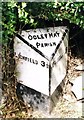
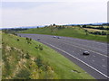
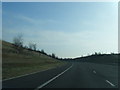
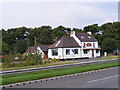
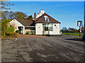


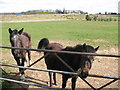
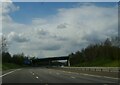
Please click the More button for more images, licensing and image copyright information.
Police
This area is policed by Staffordshire Police.
Staffordshire Police split their policing area into 97 separate neighbourhoods and this postcode is in the Shenstone, Stonnal, Little Aston neighbourhood.

Shenstone, Stonnal, Little Aston Neighbourhood Crime
Top 3 Categories
For full details of all categories together with more crime information, click on the Details button.
Member of UK Parliament
This postcode is in the Tamworth parliamentary constituency.
Tamworth is a constituency in the West Midlands region of England. The seat has been held by Sarah Edwards (Labour) since October 2023.

Most Recent House Sales for Boat Lane, WS14 0BS
1 Oct 2004
Local Petrol Station Prices
Coordinates for WS14 0BS
Residents at WS14 0BS
Sunrise and Sunset at WS14 0BS
Traffic Emission and Congestion Zones
Historical Weather Summary
| Clear | 20.55% |
| Cloudy | 68.18% |
| Rain | 6.52% |
| Windy | 4.67% |
| Other | 0.08% |
Population
Deprivation Index
the more deprived the postcode
Average Energy Performance
Companies Registered at WS14 0BS
Postcode Details for WS14 0BS
Recent Updates
|
18 Apr 2024 Added Traffic Camera Views from Traffic Scotland to Roadworks within Scotland |
|
15 Apr 2024 Schools Data updated for April 2024 |
|
10 Apr 2024 Companies Data updated for March 2024 |
|
7 Apr 2024 New option to receive automatic updates to roadworks that affect you |
|
7 Apr 2024 Police and Crime data updated for February 2024 |
|
3 Apr 2024 Sold House Price data updated for February 2024 |
|
30 Mar 2024 Energy Performance Certificates (England and Wales) updated February 2024 |
|
28 Mar 2024 New feature to use Geolocating functions to detect your current location |
Random Postcodes
Want an idea of what is in our extensive website? Try somewhere completely random!
The Rural/Urban classification is based upon data collected during the 2011 Census and released in August 2013 and is categorised into 6 distinct classes.
[A] Urban Major conurbation: A built up area with a population of 10,000 (3,000 in Scotland) or more and is assigned to the major conurbation settlement category.
[B] Urban Minor conurbation: A built up area with a population of 10,000 (3,000 in Scotland) or more and is assigned to the minor conurbation settlement category.
[C] Urban City and town: A built up area with a population of 10,000 (3,000 in Scotland) or more and is assigned to the city and town settlement category.
[D] Rural Town and fringe
[E] Rural Village
[F] Rural Hamlet and isolated dwelling
The Index of Multiple Deprivation (IMD) is the official measure of relative deprivation.
The index is based on 39 separate indicators across seven distinct domains (Income; Employment; Health and Disability; Education, Skills and Training; Crime; Barriers to Housing and Services; Living Environment) to provide an overall measure of multiple deprivation and is calculated for every neighbourhood.
The index is relative rather than an absolute scale and so a neighbourhood with a score of 10 is more deprived than one rated 20, but this does not equate to being twice as deprived.
Please note: Different indices are used in England, Scotland, Wales and Northern Ireland and so comparison of scores from neighbourhoods in different countries should not be undertaken.
These figures report on incorporated UK companies only that are registered at this postcode and do not include sole-traders, partnerships or overseas organisations.
The population figure shown for your area are an estimate provided by the Office for National Statistics and is rounded to the nearest 1,000.
The estimates are derived from the Annual Population Survey (APS) which is the Labour Force Survey (LFS) plus various sample boosts.
There are 26 county councils in 2-tier areas, providing services such as education, social services and waste disposal.
In 2-tier areas, each county council area is subdivided into districts, for which there is an independent district council. There are 192 district councils.
District councils are responsible for local services such as rubbish collection, housing and planning applications.