Overview for Grange Drive, WIDNES, WA8 8SG
Introduction
Widnes (WID-nəss) is an industrial town in the Borough of Halton, Cheshire, England, which at the 2021 census had a population of 62,400.
Historically in Lancashire, it is on the northern bank of the River Mersey where the estuary narrows to form the Runcorn Gap. Directly to the south across the Mersey is the town of Runcorn. Upstream 8 miles (13 km) to the east is Warrington, and 4 miles downstream to the west is Speke, a suburb of Liverpool.
Before the Industrial Revolution, Widnes was a small settlement on marsh and moorland. In 1847, the chemist and industrialist John Hutchinson established a chemical factory at Spike Island. The town grew in population and rapidly became a major centre of the chemical industry. The demand for labour was met by large-scale immigration from Ireland, Poland, Lithuania and Wales. The town continues to be a major manufacturer of chemicals, although many of the chemical factories have closed and the economy is predominantly based upon service industries.
Widnes and Hough Green railway stations are on the Liverpool–Manchester line. The main roads through the town are the A557 in a north–south direction and the A562 east–west. The disused Sankey Canal terminates at Spike Island. The Silver Jubilee Bridge crosses the River Mersey west of Warrington. In 2017, the Mersey Gateway Bridge opened to relieve congestion at the older bridge. The Catalyst Science Discovery Centre is the United Kingdom's only museum dedicated solely to the Chemical Industry and is inside Hutchinson's former administrative building. The town's sport stadium hosts Widnes Vikings rugby league club.
The motto of Widnes is the Latin phrase Industria Ditat ("Industry Enriches").
Summary for Grange Drive, WIDNES, WA8 8SG
Roadworks near WA8 8SG
Road Safety near WA8 8SG
Details of personal injury accidents in and around Grange Drive, WA8 8SG that have been reported to Cheshire Constabulary over the past 20 years.
Traffic Levels near WA8 8SG
View traffic levels near Grange Drive, WA8 8SG from official Department for Transport counts.
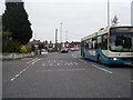
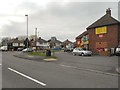
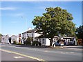
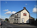
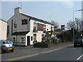
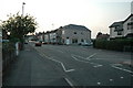
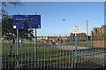
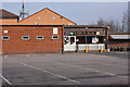
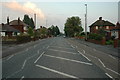
Images taken near to Grange Drive, WA8 8SG and the surrounding area

Please click the More button for more images, licensing and image copyright information.
Police
This area is policed by Cheshire Constabulary.
Cheshire Constabulary split their policing area into 122 separate neighbourhoods and this postcode is in the Broadheath neighbourhood.

Broadheath Neighbourhood Crime
Top 3 Categories
For full details of all categories together with more crime information, click on the Details button.
Member of UK Parliament
This postcode is in the Halton parliamentary constituency.
Halton is a constituency in the North West region of England. The seat has been held by Derek Twigg (Labour) since May 2010.

Most Recent House Sales for Grange Drive, WA8 8SG
12 May 2023
24 Jan 2020
17 Feb 2018
30 Oct 2006
Local Petrol Station Prices
Coordinates for WA8 8SG
Residents at WA8 8SG
Sunrise and Sunset at WA8 8SG
Traffic Emission and Congestion Zones
Historical Weather Summary
| Clear | 18.66% |
| Cloudy | 61.96% |
| Rain | 7.29% |
| Windy | 12.05% |
| Other | 0.04% |
Population
Deprivation Index
the more deprived the postcode
Average Energy Performance
Companies Registered at WA8 8SG
Postcode Details for WA8 8SG
Recent Updates
|
18 Apr 2024 Added Traffic Camera Views from Traffic Scotland to Roadworks within Scotland |
|
15 Apr 2024 Schools Data updated for April 2024 |
|
10 Apr 2024 Companies Data updated for March 2024 |
|
7 Apr 2024 New option to receive automatic updates to roadworks that affect you |
|
7 Apr 2024 Police and Crime data updated for February 2024 |
|
3 Apr 2024 Sold House Price data updated for February 2024 |
|
30 Mar 2024 Energy Performance Certificates (England and Wales) updated February 2024 |
|
28 Mar 2024 New feature to use Geolocating functions to detect your current location |
Random Postcodes
Want an idea of what is in our extensive website? Try somewhere completely random!
The Rural/Urban classification is based upon data collected during the 2011 Census and released in August 2013 and is categorised into 6 distinct classes.
[A] Urban Major conurbation: A built up area with a population of 10,000 (3,000 in Scotland) or more and is assigned to the major conurbation settlement category.
[B] Urban Minor conurbation: A built up area with a population of 10,000 (3,000 in Scotland) or more and is assigned to the minor conurbation settlement category.
[C] Urban City and town: A built up area with a population of 10,000 (3,000 in Scotland) or more and is assigned to the city and town settlement category.
[D] Rural Town and fringe
[E] Rural Village
[F] Rural Hamlet and isolated dwelling
The Index of Multiple Deprivation (IMD) is the official measure of relative deprivation.
The index is based on 39 separate indicators across seven distinct domains (Income; Employment; Health and Disability; Education, Skills and Training; Crime; Barriers to Housing and Services; Living Environment) to provide an overall measure of multiple deprivation and is calculated for every neighbourhood.
The index is relative rather than an absolute scale and so a neighbourhood with a score of 10 is more deprived than one rated 20, but this does not equate to being twice as deprived.
Please note: Different indices are used in England, Scotland, Wales and Northern Ireland and so comparison of scores from neighbourhoods in different countries should not be undertaken.
These figures report on incorporated UK companies only that are registered at this postcode and do not include sole-traders, partnerships or overseas organisations.
The population figure shown for your area are an estimate provided by the Office for National Statistics and is rounded to the nearest 1,000.
The estimates are derived from the Annual Population Survey (APS) which is the Labour Force Survey (LFS) plus various sample boosts.
There are 55 unitary authorities. They provide all local government services in their areas. These are mainly in the cities, urban areas and larger towns although there are now 6 shire county councils that are unitary (ie have no district councils beneath them).