Overview for Churchill Road, UXBRIDGE, UB10 0WL
Introduction
Uxbridge is a suburban town in west London and the administrative headquarters of the London Borough of Hillingdon. Situated 15.4 miles (24.8 km) west-northwest of Charing Cross, it is one of the major metropolitan centres identified in the London Plan. Uxbridge formed part of the parish of Hillingdon in the county of Middlesex, and was a significant local commercial centre from an early time. As part of the suburban growth of London in the 20th century it expanded and increased in population, becoming a municipal borough in 1955, and has formed part of Greater London since 1965.
A few major events have taken place in and around the town, including attempted negotiations between King Charles I and the Parliamentary Army during the English Civil War. The public house at the centre of those events, since renamed the Crown & Treaty, still stands. RAF Uxbridge houses the Battle of Britain Bunker, from where the air defence of the south-east of England was coordinated during the Battle of Britain especially from its No. 11 Group Operations Room, also used during the D-Day landings.
Today the town serves as a significant retail and commercial centre; it is also considered as a university town as it houses Brunel University London as well as the Uxbridge campus of Buckinghamshire New University. A part of the town which has large converted flour mills adjoins Buckinghamshire, the boundary being the River Colne.
Government data analysts have confirmed within its Borough are suburbs Harefield, Ickenham, Hillingdon, Newyears Green and Cowley; with Uxbridge these are represented by six electoral wards (units for the election of councillors to Hillingdon Council and commonly for statistical purposes). The 2011 Census recorded a population figure of 70,560 for these wards combined.
Summary for Churchill Road, UXBRIDGE, UB10 0WL
Roadworks near UB10 0WL
Road Safety near UB10 0WL
Details of personal injury accidents in and around Churchill Road, UB10 0WL that have been reported to Metropolitan Police Service over the past 20 years.
Traffic Levels near UB10 0WL
View traffic levels near Churchill Road, UB10 0WL from official Department for Transport counts.
Images taken near to Churchill Road, UB10 0WL and the surrounding area
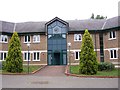
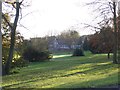
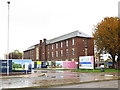
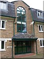
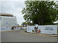
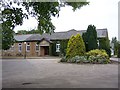
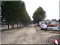
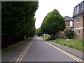

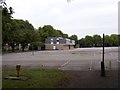
Please click the More button for more images, licensing and image copyright information.
Member of UK Parliament
This postcode is in the Uxbridge and South Ruislip parliamentary constituency.
Uxbridge and South Ruislip is a constituency in London, England. The seat has been held by Steve Tuckwell (Conservative) since July 2023.

Most Recent House Sales for Churchill Road, UB10 0WL
10 Nov 2023
20 Jul 2023
27 Sep 2019
23 Sep 2019
Local Petrol Station Prices
Coordinates for UB10 0WL
Residents at UB10 0WL
Sunrise and Sunset at UB10 0WL
Traffic Emission Zones
Historical Weather Summary
| Clear | 9.13% |
| Cloudy | 78.49% |
| Rain | 8.38% |
| Windy | 3.96% |
| Other | 0.04% |
Population
Deprivation Index
the more deprived the postcode
Average Energy Performance
Companies Registered at UB10 0WL
Postcode Details for UB10 0WL
Recent Updates
|
18 Apr 2024 Added Traffic Camera Views from Traffic Scotland to Roadworks within Scotland |
|
15 Apr 2024 Schools Data updated for April 2024 |
|
10 Apr 2024 Companies Data updated for March 2024 |
|
7 Apr 2024 New option to receive automatic updates to roadworks that affect you |
|
7 Apr 2024 Police and Crime data updated for February 2024 |
|
3 Apr 2024 Sold House Price data updated for February 2024 |
|
30 Mar 2024 Energy Performance Certificates (England and Wales) updated February 2024 |
|
28 Mar 2024 New feature to use Geolocating functions to detect your current location |
Random Postcodes
Want an idea of what is in our extensive website? Try somewhere completely random!
The Rural/Urban classification is based upon data collected during the 2011 Census and released in August 2013 and is categorised into 6 distinct classes.
[A] Urban Major conurbation: A built up area with a population of 10,000 (3,000 in Scotland) or more and is assigned to the major conurbation settlement category.
[B] Urban Minor conurbation: A built up area with a population of 10,000 (3,000 in Scotland) or more and is assigned to the minor conurbation settlement category.
[C] Urban City and town: A built up area with a population of 10,000 (3,000 in Scotland) or more and is assigned to the city and town settlement category.
[D] Rural Town and fringe
[E] Rural Village
[F] Rural Hamlet and isolated dwelling
The Index of Multiple Deprivation (IMD) is the official measure of relative deprivation.
The index is based on 39 separate indicators across seven distinct domains (Income; Employment; Health and Disability; Education, Skills and Training; Crime; Barriers to Housing and Services; Living Environment) to provide an overall measure of multiple deprivation and is calculated for every neighbourhood.
The index is relative rather than an absolute scale and so a neighbourhood with a score of 10 is more deprived than one rated 20, but this does not equate to being twice as deprived.
Please note: Different indices are used in England, Scotland, Wales and Northern Ireland and so comparison of scores from neighbourhoods in different countries should not be undertaken.
These figures report on incorporated UK companies only that are registered at this postcode and do not include sole-traders, partnerships or overseas organisations.
The population figure shown for your area are an estimate provided by the Office for National Statistics and is rounded to the nearest 1,000.
The estimates are derived from the Annual Population Survey (APS) which is the Labour Force Survey (LFS) plus various sample boosts.
There are 32 London boroughs. They provide nearly all the services in their area. However, the Greater London Authority (GLA) provides London-wide government, including special responsibility for police, fire, strategic planning and transport.