Overview for Gower Street, TELFORD, TF2 9BE (Withdrawn)
Introduction
Telford is a town in Shropshire, England. It is the administrative centre of Telford and Wrekin borough, a unitary authority which covers the town, its suburbs and surrounding settlements. The town is inland and near the River Severn.
The notable hill near the town called The Wrekin is part of the Shropshire Hills an Area of Outstanding Natural Beauty. To the south of the town, is the Ironbridge Gorge, a UNESCO World Heritage Site. Places around the Ironbridge Gorge area, which were developed into the town itself, are internationally recognised as being "The Birthplace of Industry" being to a large extent constructed during the Industrial Revolution on the Shropshire Coalfield.
The M54 motorway was completed in 1983, improving the town's road links with the West Midlands conurbation, Wolverhampton is 19 miles (31 km) south east and Birmingham is 28 miles (45 km) in the same direction. In the 2011 census, the town had a population of 142,723 while in 2017, the wider borough had an estimated population of 175,271. It is the most populous settlement in Shropshire, Shrewsbury is second and is 15 miles (24 km) to the west of the town. It is near Staffordshire: Stafford is 21 miles (34 km) to the east and Stoke-on-Trent is 25 miles (40 km) north east from the town.
The town is polycentric, having been designated under the New Towns Acts in 1963 and 1968 and developed between the 1960s to the 1970s. Centred on a shopping centre and a public park, the new town is named after Thomas Telford; a civil engineer to many road, canal and rail projects in the county. It was originally designated under the name Dawley New Town, Dawley being to the south of new-town’s centre. As well as multiple villages and Dawley, the other constituent towns are Wellington, Madeley and Oakengates.
Summary for Gower Street, TELFORD, TF2 9BE
Roadworks near TF2 9BE
Road Safety near TF2 9BE
Details of personal injury accidents in and around Gower Street, TF2 9BE that have been reported to West Mercia Police over the past 20 years.
Traffic Levels near TF2 9BE
View traffic levels near Gower Street, TF2 9BE from official Department for Transport counts.
Images taken near to Gower Street, TF2 9BE and the surrounding area
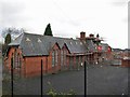
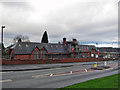
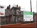
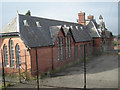
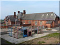
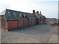
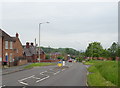
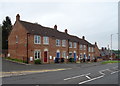
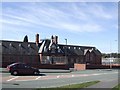
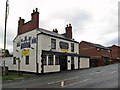
Please click the More button for more images, licensing and image copyright information.
Telford and nearby Videos From YouTube
Drone Over Leighton Millennium Seat (DJI Air 3 4K60)
Drone Over #Leighton #Millennium Seat (#DJIAir3 #4K60fps) Get 15% off at Neewer.com by using my referral link: ...
Channel: WandomWill (View Channel)
Published: 1 Sep 2023
Police
This area is policed by West Mercia Police.
West Mercia Police split their policing area into 82 separate neighbourhoods and this postcode is in the St Georges and Priorslee neighbourhood.

St Georges and Priorslee Neighbourhood Crime
Top 3 Categories
For full details of all categories together with more crime information, click on the Details button.
Member of UK Parliament
This postcode is in the Telford parliamentary constituency.
Telford is a constituency in the West Midlands region of England. The seat has been held by Lucy Allan (Conservative) since May 2015.

Most Recent House Sales for Gower Street, TF2 9BE
No recorded house sales or transfers for this postcode.
Local Petrol Station Prices
Coordinates for TF2 9BE
Residents at TF2 9BE
Sunrise and Sunset at TF2 9BE
Traffic Emission and Congestion Zones
Historical Weather Summary
| Clear | 19.86% |
| Cloudy | 66.61% |
| Rain | 6.64% |
| Windy | 6.82% |
| Other | 0.07% |
Population
Deprivation Index
the more deprived the postcode
Companies Registered at TF2 9BE
Postcode Details for TF2 9BE
Recent Updates
|
18 Apr 2024 Added Traffic Camera Views from Traffic Scotland to Roadworks within Scotland |
|
15 Apr 2024 Schools Data updated for April 2024 |
|
10 Apr 2024 Companies Data updated for March 2024 |
|
7 Apr 2024 New option to receive automatic updates to roadworks that affect you |
|
7 Apr 2024 Police and Crime data updated for February 2024 |
|
3 Apr 2024 Sold House Price data updated for February 2024 |
|
30 Mar 2024 Energy Performance Certificates (England and Wales) updated February 2024 |
|
28 Mar 2024 New feature to use Geolocating functions to detect your current location |
Random Postcodes
Want an idea of what is in our extensive website? Try somewhere completely random!
The Rural/Urban classification is based upon data collected during the 2011 Census and released in August 2013 and is categorised into 6 distinct classes.
[A] Urban Major conurbation: A built up area with a population of 10,000 (3,000 in Scotland) or more and is assigned to the major conurbation settlement category.
[B] Urban Minor conurbation: A built up area with a population of 10,000 (3,000 in Scotland) or more and is assigned to the minor conurbation settlement category.
[C] Urban City and town: A built up area with a population of 10,000 (3,000 in Scotland) or more and is assigned to the city and town settlement category.
[D] Rural Town and fringe
[E] Rural Village
[F] Rural Hamlet and isolated dwelling
The Index of Multiple Deprivation (IMD) is the official measure of relative deprivation.
The index is based on 39 separate indicators across seven distinct domains (Income; Employment; Health and Disability; Education, Skills and Training; Crime; Barriers to Housing and Services; Living Environment) to provide an overall measure of multiple deprivation and is calculated for every neighbourhood.
The index is relative rather than an absolute scale and so a neighbourhood with a score of 10 is more deprived than one rated 20, but this does not equate to being twice as deprived.
Please note: Different indices are used in England, Scotland, Wales and Northern Ireland and so comparison of scores from neighbourhoods in different countries should not be undertaken.
These figures report on incorporated UK companies only that are registered at this postcode and do not include sole-traders, partnerships or overseas organisations.
The population figure shown for your area are an estimate provided by the Office for National Statistics and is rounded to the nearest 1,000.
The estimates are derived from the Annual Population Survey (APS) which is the Labour Force Survey (LFS) plus various sample boosts.
There are 55 unitary authorities. They provide all local government services in their areas. These are mainly in the cities, urban areas and larger towns although there are now 6 shire county councils that are unitary (ie have no district councils beneath them).