Overview for Oulton, STONE, ST15 8UR
Introduction
Stone is a market town and civil parish in Staffordshire, England, situated approximately 7 miles (11 km) north of the county town of Stafford, 7 miles (11 km) south of Stoke-on-Trent, and 15 miles (24 km) north of Rugeley. As a notable canal town, Stone is recognised for its rich history, originating from the early Bronze Age and continuing through the Industrial Revolution, with the introduction of the Trent and Mersey Canal shaping the town's development and local industry.
Originally governed as an urban district council and a rural district council, Stone became part of the Borough of Stafford in 1974. Over the years, the town has seen a steady growth in its population, which was recorded as 12,305 in the 1991 census, 14,555 in 2001, and 16,385 in 2011.
Summary for Oulton, STONE, ST15 8UR
Roadworks near ST15 8UR
Road Safety near ST15 8UR
Details of personal injury accidents in and around ST15 8UR that have been reported to Staffordshire Police over the past 20 years.
Traffic Levels near ST15 8UR
View traffic levels near ST15 8UR from official Department for Transport counts.
Images taken in and around the st158ur area
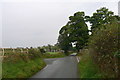
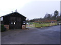
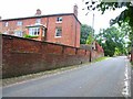

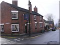
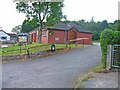
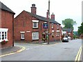
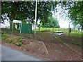
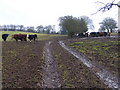
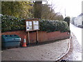
Please click the More button for more images, licensing and image copyright information.
Police
This area is policed by Staffordshire Police.
Staffordshire Police split their policing area into 97 separate neighbourhoods and this postcode is in the Fulford Barlaston and Oulton neighbourhood.

Fulford Barlaston and Oulton Neighbourhood Crime
Top 3 Categories
For full details of all categories together with more crime information, click on the Details button.
Member of UK Parliament
This postcode is in the Stone parliamentary constituency.
Stone is a constituency in the West Midlands region of England. The seat has been held by Sir William Cash (Conservative) since May 2010.

Most Recent House Sales for ST15 8UR
21 Jul 2015
9 Jun 1995
Local Petrol Station Prices
Coordinates for ST15 8UR
Residents at ST15 8UR
Sunrise and Sunset at ST15 8UR
Traffic Emission and Congestion Zones
Historical Weather Summary
| Clear | 19.48% |
| Cloudy | 65.43% |
| Rain | 6.80% |
| Windy | 8.23% |
| Other | 0.06% |
Population
Deprivation Index
the more deprived the postcode
Average Energy Performance
Companies Registered at ST15 8UR
Postcode Details for ST15 8UR
Recent Updates
|
18 Apr 2024 Added Traffic Camera Views from Traffic Scotland to Roadworks within Scotland |
|
15 Apr 2024 Schools Data updated for April 2024 |
|
10 Apr 2024 Companies Data updated for March 2024 |
|
7 Apr 2024 New option to receive automatic updates to roadworks that affect you |
|
7 Apr 2024 Police and Crime data updated for February 2024 |
|
3 Apr 2024 Sold House Price data updated for February 2024 |
|
30 Mar 2024 Energy Performance Certificates (England and Wales) updated February 2024 |
|
28 Mar 2024 New feature to use Geolocating functions to detect your current location |
Random Postcodes
Want an idea of what is in our extensive website? Try somewhere completely random!
The Rural/Urban classification is based upon data collected during the 2011 Census and released in August 2013 and is categorised into 6 distinct classes.
[A] Urban Major conurbation: A built up area with a population of 10,000 (3,000 in Scotland) or more and is assigned to the major conurbation settlement category.
[B] Urban Minor conurbation: A built up area with a population of 10,000 (3,000 in Scotland) or more and is assigned to the minor conurbation settlement category.
[C] Urban City and town: A built up area with a population of 10,000 (3,000 in Scotland) or more and is assigned to the city and town settlement category.
[D] Rural Town and fringe
[E] Rural Village
[F] Rural Hamlet and isolated dwelling
The Index of Multiple Deprivation (IMD) is the official measure of relative deprivation.
The index is based on 39 separate indicators across seven distinct domains (Income; Employment; Health and Disability; Education, Skills and Training; Crime; Barriers to Housing and Services; Living Environment) to provide an overall measure of multiple deprivation and is calculated for every neighbourhood.
The index is relative rather than an absolute scale and so a neighbourhood with a score of 10 is more deprived than one rated 20, but this does not equate to being twice as deprived.
Please note: Different indices are used in England, Scotland, Wales and Northern Ireland and so comparison of scores from neighbourhoods in different countries should not be undertaken.
These figures report on incorporated UK companies only that are registered at this postcode and do not include sole-traders, partnerships or overseas organisations.
The population figure shown for your area are an estimate provided by the Office for National Statistics and is rounded to the nearest 1,000.
The estimates are derived from the Annual Population Survey (APS) which is the Labour Force Survey (LFS) plus various sample boosts.
There are 26 county councils in 2-tier areas, providing services such as education, social services and waste disposal.
In 2-tier areas, each county council area is subdivided into districts, for which there is an independent district council. There are 192 district councils.
District councils are responsible for local services such as rubbish collection, housing and planning applications.