Overview for Priory Way, MALMESBURY, SN16 0FB
Introduction
Malmesbury is a town and civil parish in north Wiltshire, England, which lies approximately 14 miles (23 km) west of Swindon, 25 miles (40 km) northeast of Bristol, and 9 miles (14 km) north of Chippenham. The older part of the town is on a hilltop which is almost surrounded by the upper waters of the Bristol Avon and one of its tributaries.
Once the site of an Iron Age fort, in the early medieval period, Malmesbury became the site of Malmesbury Abbey, a monastery famed for its learning. It was later home to one of Alfred the Great's fortified burhs for defence against the Vikings. Æthelstan, the first king of all England, was buried in Malmesbury Abbey when he died in 939. As a market town, it became prominent in the Middle Ages as a centre for learning, focused on and around the abbey.
In modern times, Malmesbury is best known for its abbey, the bulk of which forms a rare survival of the dissolution of the monasteries. The economy benefits mostly from agriculture, as well as tourism to the Cotswolds, and a Dyson facility, the town's main employer. At the 2011 census, the population of the parish was 5,380.
Summary for Priory Way, MALMESBURY, SN16 0FB
Roadworks near SN16 0FB
Road Safety near SN16 0FB
Details of personal injury accidents in and around Priory Way, SN16 0FB that have been reported to Wiltshire Police over the past 20 years.
Traffic Levels near SN16 0FB
View traffic levels near Priory Way, SN16 0FB from official Department for Transport counts.
Images taken near to Priory Way, SN16 0FB and the surrounding area
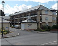
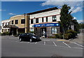
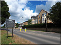
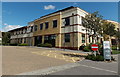
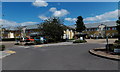
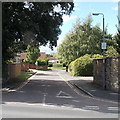
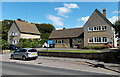
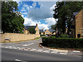
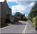

Please click the More button for more images, licensing and image copyright information.
Police
This area is policed by Wiltshire Police.
Wiltshire Police split their policing area into 105 separate neighbourhoods and this postcode is in the Malmesbury Town neighbourhood.

Malmesbury Town Neighbourhood Crime
Top 3 Categories
For full details of all categories together with more crime information, click on the Details button.
Member of UK Parliament
This postcode is in the North Wiltshire parliamentary constituency.
North Wiltshire is a constituency in the South West region of England. The seat has been held by James Gray (Conservative) since May 2010.

Most Recent House Sales for Priory Way, SN16 0FB
6 Dec 2023
31 Oct 2023
31 May 2023
25 May 2023
Local Petrol Station Prices
Coordinates for SN16 0FB
Residents at SN16 0FB
Sunrise and Sunset at SN16 0FB
Traffic Emission and Congestion Zones
Historical Weather Summary
| Clear | 20.02% |
| Cloudy | 69.76% |
| Rain | 7.01% |
| Windy | 3.05% |
| Other | 0.16% |
Population
Deprivation Index
the more deprived the postcode
Average Energy Performance
Companies Registered at SN16 0FB
Postcode Details for SN16 0FB
Recent Updates
|
18 Apr 2024 Added Traffic Camera Views from Traffic Scotland to Roadworks within Scotland |
|
15 Apr 2024 Schools Data updated for April 2024 |
|
10 Apr 2024 Companies Data updated for March 2024 |
|
7 Apr 2024 New option to receive automatic updates to roadworks that affect you |
|
7 Apr 2024 Police and Crime data updated for February 2024 |
|
3 Apr 2024 Sold House Price data updated for February 2024 |
|
30 Mar 2024 Energy Performance Certificates (England and Wales) updated February 2024 |
|
28 Mar 2024 New feature to use Geolocating functions to detect your current location |
Random Postcodes
Want an idea of what is in our extensive website? Try somewhere completely random!
The Rural/Urban classification is based upon data collected during the 2011 Census and released in August 2013 and is categorised into 6 distinct classes.
[A] Urban Major conurbation: A built up area with a population of 10,000 (3,000 in Scotland) or more and is assigned to the major conurbation settlement category.
[B] Urban Minor conurbation: A built up area with a population of 10,000 (3,000 in Scotland) or more and is assigned to the minor conurbation settlement category.
[C] Urban City and town: A built up area with a population of 10,000 (3,000 in Scotland) or more and is assigned to the city and town settlement category.
[D] Rural Town and fringe
[E] Rural Village
[F] Rural Hamlet and isolated dwelling
The Index of Multiple Deprivation (IMD) is the official measure of relative deprivation.
The index is based on 39 separate indicators across seven distinct domains (Income; Employment; Health and Disability; Education, Skills and Training; Crime; Barriers to Housing and Services; Living Environment) to provide an overall measure of multiple deprivation and is calculated for every neighbourhood.
The index is relative rather than an absolute scale and so a neighbourhood with a score of 10 is more deprived than one rated 20, but this does not equate to being twice as deprived.
Please note: Different indices are used in England, Scotland, Wales and Northern Ireland and so comparison of scores from neighbourhoods in different countries should not be undertaken.
These figures report on incorporated UK companies only that are registered at this postcode and do not include sole-traders, partnerships or overseas organisations.
The population figure shown for your area are an estimate provided by the Office for National Statistics and is rounded to the nearest 1,000.
The estimates are derived from the Annual Population Survey (APS) which is the Labour Force Survey (LFS) plus various sample boosts.
There are 55 unitary authorities. They provide all local government services in their areas. These are mainly in the cities, urban areas and larger towns although there are now 6 shire county councils that are unitary (ie have no district councils beneath them).