Overview for Eden Street, CHESTERFIELD, S42 6TE
Introduction
Chesterfield is a market town in the Borough of Chesterfield, Derbyshire, England. It is 24 miles (39 km) north of Derby and 11 miles (18 km) south of Sheffield at the confluence of the River Rother and River Hipper. In 2011, the built-up-area subdivision had a population of 88,483, making it the second-largest settlement in Derbyshire, after Derby. The wider borough had a population of 103,801 in 2011. In 2011, the town had a population of 76,753.
It has been traced to a transitory Roman fort of the 1st century CE. The name of the later Anglo-Saxon village comes from the Old English ceaster (Roman fort) and feld (pasture). It has a sizeable street market three days a week. The town sits on an old coalfield, but little visual evidence of mining remains since the closure of the final town centre mine nicknamed “The Green Room”. The main landmark is the crooked spire of the Church of St Mary and All Saints.
Summary for Eden Street, CHESTERFIELD, S42 6TE
Roadworks near S42 6TE
Road Safety near S42 6TE
Details of personal injury accidents in and around Eden Street, S42 6TE that have been reported to Derbyshire Constabulary over the past 20 years.
Traffic Levels near S42 6TE
View traffic levels near Eden Street, S42 6TE from official Department for Transport counts.
Images taken near to Eden Street, S42 6TE and the surrounding area
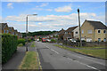
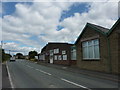
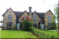
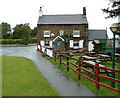
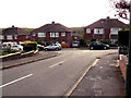
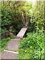
Please click the More button for more images, licensing and image copyright information.
Chesterfield and nearby Videos From YouTube
Anesco Battery Storage Park - Newtonwood Lane, Nottinghamshire - 4K Drone
At the highest point of Nottinghamshire lies the under construction, Newtonwood Lane Anesco Battery Storage facility. Here's a ...
Channel: Hinksy's Drone UK (View Channel)
Published: 9 Sep 2023
Police
This area is policed by Derbyshire Constabulary.
Derbyshire Constabulary split their policing area into 95 separate neighbourhoods and this postcode is in the Wingerworth and Rural neighbourhood.

Wingerworth and Rural Neighbourhood Crime
Top 3 Categories
For full details of all categories together with more crime information, click on the Details button.
Member of UK Parliament
This postcode is in the North East Derbyshire parliamentary constituency.
North East Derbyshire is a constituency in the East Midlands region of England. The seat has been held by Lee Rowley (Conservative) since June 2017.

Most Recent House Sales for Eden Street, S42 6TE
29 Jul 2016
16 Sep 2015
12 Mar 2015
16 May 2014
Local Petrol Station Prices
Coordinates for S42 6TE
Residents at S42 6TE
Sunrise and Sunset at S42 6TE
Traffic Emission and Congestion Zones
Historical Weather Summary
| Clear | 9.09% |
| Cloudy | 72.41% |
| Rain | 8.96% |
| Windy | 9.18% |
| Other | 0.36% |
Population
Deprivation Index
the more deprived the postcode
Average Energy Performance
Companies Registered at S42 6TE
Postcode Details for S42 6TE
Recent Updates
|
18 Apr 2024 Added Traffic Camera Views from Traffic Scotland to Roadworks within Scotland |
|
15 Apr 2024 Schools Data updated for April 2024 |
|
10 Apr 2024 Companies Data updated for March 2024 |
|
7 Apr 2024 New option to receive automatic updates to roadworks that affect you |
|
7 Apr 2024 Police and Crime data updated for February 2024 |
|
3 Apr 2024 Sold House Price data updated for February 2024 |
|
30 Mar 2024 Energy Performance Certificates (England and Wales) updated February 2024 |
|
28 Mar 2024 New feature to use Geolocating functions to detect your current location |
Random Postcodes
Want an idea of what is in our extensive website? Try somewhere completely random!
The Rural/Urban classification is based upon data collected during the 2011 Census and released in August 2013 and is categorised into 6 distinct classes.
[A] Urban Major conurbation: A built up area with a population of 10,000 (3,000 in Scotland) or more and is assigned to the major conurbation settlement category.
[B] Urban Minor conurbation: A built up area with a population of 10,000 (3,000 in Scotland) or more and is assigned to the minor conurbation settlement category.
[C] Urban City and town: A built up area with a population of 10,000 (3,000 in Scotland) or more and is assigned to the city and town settlement category.
[D] Rural Town and fringe
[E] Rural Village
[F] Rural Hamlet and isolated dwelling
The Index of Multiple Deprivation (IMD) is the official measure of relative deprivation.
The index is based on 39 separate indicators across seven distinct domains (Income; Employment; Health and Disability; Education, Skills and Training; Crime; Barriers to Housing and Services; Living Environment) to provide an overall measure of multiple deprivation and is calculated for every neighbourhood.
The index is relative rather than an absolute scale and so a neighbourhood with a score of 10 is more deprived than one rated 20, but this does not equate to being twice as deprived.
Please note: Different indices are used in England, Scotland, Wales and Northern Ireland and so comparison of scores from neighbourhoods in different countries should not be undertaken.
These figures report on incorporated UK companies only that are registered at this postcode and do not include sole-traders, partnerships or overseas organisations.
The population figure shown for your area are an estimate provided by the Office for National Statistics and is rounded to the nearest 1,000.
The estimates are derived from the Annual Population Survey (APS) which is the Labour Force Survey (LFS) plus various sample boosts.
There are 26 county councils in 2-tier areas, providing services such as education, social services and waste disposal.
In 2-tier areas, each county council area is subdivided into districts, for which there is an independent district council. There are 192 district councils.
District councils are responsible for local services such as rubbish collection, housing and planning applications.