Overview for Castle Hill, DRONFIELD, S18 7WQ
Introduction
Dronfield is a town in North East Derbyshire, England, which includes Dronfield Woodhouse and Coal Aston. It lies in the valley of the River Drone between Chesterfield and Sheffield. The Peak District National Park is three miles (4.8 km) to the west. The name comes from the Old English Dranfleld, probably meaning an open land infested with drone bees.
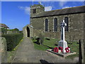
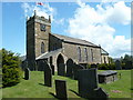
The town existed before the 1086 Domesday Book, and has a 13th-century parish church. In 1662, Charles II granted the town a market, although this later ceased. The industrial history of the town includes coal mining, the wool trade, the production of soap and steel, and engineering. Today a range of manufacturing firms still operate in the town. The stadium to the north of the town is officially "The Home of Football", providing the playing surface for Sheffield F.
C., the world's oldest football club.
Dronfield's population increased in the post-war years from 6,500 in 1945 to 21,261 at the 2011 Census.
Summary for Castle Hill, DRONFIELD, S18 7WQ
Roadworks near S18 7WQ
Road Safety near S18 7WQ
Details of personal injury accidents in and around Castle Hill, S18 7WQ that have been reported to Derbyshire Constabulary over the past 20 years.
Traffic Levels near S18 7WQ
View traffic levels near Castle Hill, S18 7WQ from official Department for Transport counts.
Images taken near to Castle Hill, S18 7WQ and the surrounding area
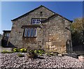
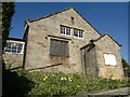
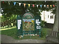
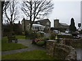
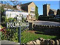
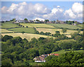
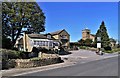
Please click the More button for more images, licensing and image copyright information.
Police
This area is policed by Derbyshire Constabulary.
Derbyshire Constabulary split their policing area into 95 separate neighbourhoods and this postcode is in the Unstone and Rural neighbourhood.

Unstone and Rural Neighbourhood Crime
Top 3 Categories
For full details of all categories together with more crime information, click on the Details button.
Member of UK Parliament
This postcode is in the North East Derbyshire parliamentary constituency.
North East Derbyshire is a constituency in the East Midlands region of England. The seat has been held by Lee Rowley (Conservative) since June 2017.

Most Recent House Sales for Castle Hill, S18 7WQ
6 Feb 2020
2 Sep 2019
19 Dec 2017
29 Nov 2013
Local Petrol Station Prices
Coordinates for S18 7WQ
Residents at S18 7WQ
Sunrise and Sunset at S18 7WQ
Traffic Emission and Congestion Zones
Historical Weather Summary
| Clear | 8.39% |
| Cloudy | 68.08% |
| Rain | 9.04% |
| Windy | 13.33% |
| Other | 1.16% |
Population
Deprivation Index
the more deprived the postcode
Average Energy Performance
Companies Registered at S18 7WQ
Postcode Details for S18 7WQ
Recent Updates
|
15 Apr 2024 Schools Data updated for April 2024 |
|
10 Apr 2024 Companies Data updated for March 2024 |
|
7 Apr 2024 New option to receive automatic updates to roadworks that affect you |
|
7 Apr 2024 Police and Crime data updated for February 2024 |
|
3 Apr 2024 Sold House Price data updated for February 2024 |
|
30 Mar 2024 Energy Performance Certificates (England and Wales) updated February 2024 |
|
28 Mar 2024 New feature to use Geolocating functions to detect your current location |
|
17 Mar 2024 Schools Data updated for March 2024 |
Random Postcodes
Want an idea of what is in our extensive website? Try somewhere completely random!
The Rural/Urban classification is based upon data collected during the 2011 Census and released in August 2013 and is categorised into 6 distinct classes.
[A] Urban Major conurbation: A built up area with a population of 10,000 (3,000 in Scotland) or more and is assigned to the major conurbation settlement category.
[B] Urban Minor conurbation: A built up area with a population of 10,000 (3,000 in Scotland) or more and is assigned to the minor conurbation settlement category.
[C] Urban City and town: A built up area with a population of 10,000 (3,000 in Scotland) or more and is assigned to the city and town settlement category.
[D] Rural Town and fringe
[E] Rural Village
[F] Rural Hamlet and isolated dwelling
The Index of Multiple Deprivation (IMD) is the official measure of relative deprivation.
The index is based on 39 separate indicators across seven distinct domains (Income; Employment; Health and Disability; Education, Skills and Training; Crime; Barriers to Housing and Services; Living Environment) to provide an overall measure of multiple deprivation and is calculated for every neighbourhood.
The index is relative rather than an absolute scale and so a neighbourhood with a score of 10 is more deprived than one rated 20, but this does not equate to being twice as deprived.
Please note: Different indices are used in England, Scotland, Wales and Northern Ireland and so comparison of scores from neighbourhoods in different countries should not be undertaken.
These figures report on incorporated UK companies only that are registered at this postcode and do not include sole-traders, partnerships or overseas organisations.
The population figure shown for your area are an estimate provided by the Office for National Statistics and is rounded to the nearest 1,000.
The estimates are derived from the Annual Population Survey (APS) which is the Labour Force Survey (LFS) plus various sample boosts.
There are 26 county councils in 2-tier areas, providing services such as education, social services and waste disposal.
In 2-tier areas, each county council area is subdivided into districts, for which there is an independent district council. There are 192 district councils.
District councils are responsible for local services such as rubbish collection, housing and planning applications.