Overview for Cameron Close, NEWPORT, PO30 5RZ
Introduction
Newport is a city and county borough in Wales, situated on the River Usk close to its confluence with the Severn Estuary, 12 mi (19 km) northeast of Cardiff. With a population of 145,700 at the 2011 census, Newport is the third-largest authority with city status in Wales, and seventh most populous overall. Newport became a unitary authority in 1996 and forms part of the Cardiff-Newport metropolitan area. Newport was the site of the last large-scale armed insurrection in Great Britain, the Newport Rising of 1839.
The population grew considerably during the 2021 census, rising to 159,587, the largest growth of a unitary authority in Wales.
Newport has been a port since medieval times when the first Newport Castle was built by the Normans. The town outgrew the earlier Roman town of Caerleon, immediately upstream and now part of the borough. Newport gained its first charter in 1314. It grew significantly in the 19th century when its port became the focus of coal exports from the eastern South Wales Valleys. Newport was the largest coal exporter in Wales until the rise of Cardiff in the mid-1800s.
In the 20th century, the docks declined in importance, but Newport remained an important centre for manufacturing and engineering. Latterly its economy is bolstered as part of the M4 corridor high-technology cluster. It was granted city status in 2002. Newport hosted the Ryder Cup in 2010 and was the venue for the 2014 NATO summit. It contains extensive rural areas surrounding the built-up core. Its villages are of considerable archaeological importance. Newport Cathedral is the cathedral of the Diocese of Monmouth.
Summary for Cameron Close, NEWPORT, PO30 5RZ
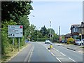
Roadworks near PO30 5RZ
Road Safety near PO30 5RZ
Details of personal injury accidents in and around Cameron Close, PO30 5RZ that have been reported to Hampshire Constabulary over the past 20 years.
Traffic Levels near PO30 5RZ
View traffic levels near Cameron Close, PO30 5RZ from official Department for Transport counts.
Images taken near to Cameron Close, PO30 5RZ and the surrounding area


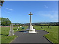
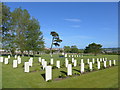

Please click the More button for more images, licensing and image copyright information.
Newport and nearby Videos From YouTube
Mavic Pro 2 Take-off & land from Beechwood Park, Newport
Mavic 2 Pro - First Takeoff, short flight and land. Beechwood Park, Newport ...
Channel: Al Bartlett (View Channel)
Published: 20 Jul 2020
Police
This area is policed by Hampshire Constabulary.
Hampshire Constabulary split their policing area into 95 separate neighbourhoods and this postcode is in the Newport neighbourhood.

Newport Neighbourhood Crime
Top 3 Categories
For full details of all categories together with more crime information, click on the Details button.
Member of UK Parliament
This postcode is in the Isle of Wight parliamentary constituency.
Isle of Wight is a constituency in the South East region of England. The seat has been held by Bob Seely (Conservative) since June 2017.

Most Recent House Sales for Cameron Close, PO30 5RZ
17 Dec 2021
22 Jan 2021
27 Mar 2020
7 Aug 2019
Local Petrol Station Prices
Coordinates for PO30 5RZ
Residents at PO30 5RZ
Sunrise and Sunset at PO30 5RZ
Traffic Emission and Congestion Zones
Historical Weather Summary
| Clear | 12.45% |
| Cloudy | 69.07% |
| Rain | 10.55% |
| Windy | 7.84% |
| Other | 0.09% |
Population
Deprivation Index
the more deprived the postcode
Average Energy Performance
Companies Registered at PO30 5RZ
Postcode Details for PO30 5RZ
Recent Updates
|
18 Apr 2024 Added Traffic Camera Views from Traffic Scotland to Roadworks within Scotland |
|
15 Apr 2024 Schools Data updated for April 2024 |
|
10 Apr 2024 Companies Data updated for March 2024 |
|
7 Apr 2024 New option to receive automatic updates to roadworks that affect you |
|
7 Apr 2024 Police and Crime data updated for February 2024 |
|
3 Apr 2024 Sold House Price data updated for February 2024 |
|
30 Mar 2024 Energy Performance Certificates (England and Wales) updated February 2024 |
|
28 Mar 2024 New feature to use Geolocating functions to detect your current location |
Random Postcodes
Want an idea of what is in our extensive website? Try somewhere completely random!
The Rural/Urban classification is based upon data collected during the 2011 Census and released in August 2013 and is categorised into 6 distinct classes.
[A] Urban Major conurbation: A built up area with a population of 10,000 (3,000 in Scotland) or more and is assigned to the major conurbation settlement category.
[B] Urban Minor conurbation: A built up area with a population of 10,000 (3,000 in Scotland) or more and is assigned to the minor conurbation settlement category.
[C] Urban City and town: A built up area with a population of 10,000 (3,000 in Scotland) or more and is assigned to the city and town settlement category.
[D] Rural Town and fringe
[E] Rural Village
[F] Rural Hamlet and isolated dwelling
The Index of Multiple Deprivation (IMD) is the official measure of relative deprivation.
The index is based on 39 separate indicators across seven distinct domains (Income; Employment; Health and Disability; Education, Skills and Training; Crime; Barriers to Housing and Services; Living Environment) to provide an overall measure of multiple deprivation and is calculated for every neighbourhood.
The index is relative rather than an absolute scale and so a neighbourhood with a score of 10 is more deprived than one rated 20, but this does not equate to being twice as deprived.
Please note: Different indices are used in England, Scotland, Wales and Northern Ireland and so comparison of scores from neighbourhoods in different countries should not be undertaken.
These figures report on incorporated UK companies only that are registered at this postcode and do not include sole-traders, partnerships or overseas organisations.
The population figure shown for your area are an estimate provided by the Office for National Statistics and is rounded to the nearest 1,000.
The estimates are derived from the Annual Population Survey (APS) which is the Labour Force Survey (LFS) plus various sample boosts.
There are 55 unitary authorities. They provide all local government services in their areas. These are mainly in the cities, urban areas and larger towns although there are now 6 shire county councils that are unitary (ie have no district councils beneath them).