Overview for Spilsby Road, SKEGNESS, PE24 4LN
Introduction
Skegness (skeg-NESS) is a seaside town and civil parish in the East Lindsey District of Lincolnshire, England. On the Lincolnshire coast of the North Sea, the town is 43 miles (69 km) east of Lincoln and 22 miles (35 km) north-east of Boston. With a population of 19,579 as of 2011, it is the largest settlement in East Lindsey. It also incorporates Winthorpe and Seacroft, and forms a larger built-up area with the resorts of Ingoldmells and Chapel St Leonards to the north. The town is on the A52 and A158 roads, connecting it with Boston and the East Midlands, and Lincoln respectively. Skegness railway station is on the Nottingham to Skegness (via Grantham) line.
The original Skegness was situated farther east at the mouth of The Wash. Its Norse name refers to a headland which sat near the settlement. By the 14th century, it was a locally important port for coastal trade. The natural sea defences which protected the harbour eroded in the later Middle Ages, and it was lost to the sea after a storm in the 1520s. Rebuilt along the new shoreline, early modern Skegness was a small fishing and farming village, but from the late 18th century members of the local gentry visited for holidays. The arrival of the railways in 1873 transformed it into a popular seaside resort. This was the intention of The 9th Earl of Scarbrough, who owned most of the land in the vicinity; he built the infrastructure of the town and laid out plots, which he leased to speculative developers. This new Skegness quickly became a popular destination for holiday-makers and day trippers from the East Midlands factory towns. By the interwar years the town was established as one of the most popular seaside resorts in Britain. The layout of the modern seafront dates to this time and holiday camps were built around the town, including the first Butlin's holiday resort which opened in Ingoldmells in 1936.
The package holiday abroad became an increasingly popular and affordable option for many British holiday-makers during the 1970s; this trend combined with declining industrial employment in the East Midlands to harm Skegness's visitor economy in the late 20th century. Nevertheless, the resort retains a loyal visitor base and has increasingly attracted people visiting for a short holiday alongside their trip abroad. Tourism increased following the recession of 2007–09 owing to the resort's affordability. In 2011, the town was England's fourth most popular holiday destination for UK residents, and in 2015 it received over 1.4 million visitors. It has a reputation as a traditional English seaside resort owing to its long, sandy beach and seafront attractions which include amusement arcades, eateries, Botton's fairground, the pier, nightclubs and bars. Other visitor attractions include Natureland Seal Sanctuary, a museum, an aquarium, a heritage railway, an annual carnival, a yearly arts festival, and Gibraltar Point nature reserve to the south of the town.
Despite the arrival of several manufacturing firms since the 1950s and Skegness's prominence as a local commercial centre, the tourism industry remains very important for the economy and employment but the tourism service economy's low wages and seasonal nature, along with the town's aging population, have contributed towards high levels of relative deprivation among the resident population. Poor transport and communication links are barriers to economic diversification. Residents are served by five state primary schools and a preparatory school, two state secondary schools (one of which is selective), several colleges, a community hospital, several churches and two local newspapers. The town is home to a police station, a magistrates' court and a lifeboat station.
Summary for Spilsby Road, SKEGNESS, PE24 4LN
Roadworks near PE24 4LN
Road Safety near PE24 4LN
Details of personal injury accidents in and around Spilsby Road, PE24 4LN that have been reported to Lincolnshire Police over the past 20 years.
Traffic Levels near PE24 4LN
View traffic levels near Spilsby Road, PE24 4LN from official Department for Transport counts.
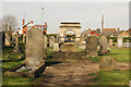
Images taken near to Spilsby Road, PE24 4LN and the surrounding area
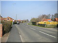
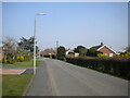
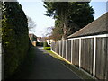
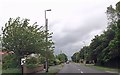

Please click the More button for more images, licensing and image copyright information.
Police
This area is policed by Lincolnshire Police.
Lincolnshire Police split their policing area into 58 separate neighbourhoods and this postcode is in the Wainfleet and Burgh Le Marsh neighbourhood.

Wainfleet and Burgh Le Marsh Neighbourhood Crime
Top 3 Categories
For full details of all categories together with more crime information, click on the Details button.
Member of UK Parliament
This postcode is in the Boston and Skegness parliamentary constituency.
Boston and Skegness is a constituency in the East Midlands region of England. The seat has been held by Matt Warman (Conservative) since May 2015.

Most Recent House Sales for Spilsby Road, PE24 4LN
24 Feb 2023
6 Oct 2022
20 Sep 2021
29 Apr 2021
Local Petrol Station Prices
Coordinates for PE24 4LN
Residents at PE24 4LN
Sunrise and Sunset at PE24 4LN
Traffic Emission and Congestion Zones
Historical Weather Summary
| Clear | 9.74% |
| Cloudy | 41.76% |
| Rain | 8.24% |
| Windy | 40.26% |
| Other | 0.00% |
Population
Deprivation Index
the more deprived the postcode
Average Energy Performance
Companies Registered at PE24 4LN
Postcode Details for PE24 4LN
Recent Updates
|
18 Apr 2024 Added Traffic Camera Views from Traffic Scotland to Roadworks within Scotland |
|
15 Apr 2024 Schools Data updated for April 2024 |
|
10 Apr 2024 Companies Data updated for March 2024 |
|
7 Apr 2024 New option to receive automatic updates to roadworks that affect you |
|
7 Apr 2024 Police and Crime data updated for February 2024 |
|
3 Apr 2024 Sold House Price data updated for February 2024 |
|
30 Mar 2024 Energy Performance Certificates (England and Wales) updated February 2024 |
|
28 Mar 2024 New feature to use Geolocating functions to detect your current location |
Random Postcodes
Want an idea of what is in our extensive website? Try somewhere completely random!
The Rural/Urban classification is based upon data collected during the 2011 Census and released in August 2013 and is categorised into 6 distinct classes.
[A] Urban Major conurbation: A built up area with a population of 10,000 (3,000 in Scotland) or more and is assigned to the major conurbation settlement category.
[B] Urban Minor conurbation: A built up area with a population of 10,000 (3,000 in Scotland) or more and is assigned to the minor conurbation settlement category.
[C] Urban City and town: A built up area with a population of 10,000 (3,000 in Scotland) or more and is assigned to the city and town settlement category.
[D] Rural Town and fringe
[E] Rural Village
[F] Rural Hamlet and isolated dwelling
The Index of Multiple Deprivation (IMD) is the official measure of relative deprivation.
The index is based on 39 separate indicators across seven distinct domains (Income; Employment; Health and Disability; Education, Skills and Training; Crime; Barriers to Housing and Services; Living Environment) to provide an overall measure of multiple deprivation and is calculated for every neighbourhood.
The index is relative rather than an absolute scale and so a neighbourhood with a score of 10 is more deprived than one rated 20, but this does not equate to being twice as deprived.
Please note: Different indices are used in England, Scotland, Wales and Northern Ireland and so comparison of scores from neighbourhoods in different countries should not be undertaken.
These figures report on incorporated UK companies only that are registered at this postcode and do not include sole-traders, partnerships or overseas organisations.
The population figure shown for your area are an estimate provided by the Office for National Statistics and is rounded to the nearest 1,000.
The estimates are derived from the Annual Population Survey (APS) which is the Labour Force Survey (LFS) plus various sample boosts.
There are 26 county councils in 2-tier areas, providing services such as education, social services and waste disposal.
In 2-tier areas, each county council area is subdivided into districts, for which there is an independent district council. There are 192 district councils.
District councils are responsible for local services such as rubbish collection, housing and planning applications.