Overview for Newark Street, PORT GLASGOW, PA14 5PE
Introduction
Port Glasgow is the second-largest town in the Inverclyde council area of Scotland. The population according to the 1991 census for Port Glasgow was 19,426 persons and in the 2001 census was 16,617 persons. The most recent census in 2011 states that the population has declined to 15,414. It is located immediately to the east of Greenock and was previously a burgh in the county of Renfrewshire.
Originally a fishing hamlet named Newark, Port Glasgow came about as a result of large ships being unable to navigate the shallow and meandering River Clyde to the centre of the city of Glasgow. As a result, it was formed as a remote port for Glasgow in 1668, and became known as 'New Port Glasgow', which was shortened to 'Port Glasgow' in 1775. Port Glasgow was home to dry docks and shipbuilding beginning in 1780.
The town grew from the central area of the present town and thus many of the town's historic buildings and people are found here. Port Glasgow expanded up the steep hills inland to open fields where areas such as Park Farm, Boglestone, Slaemuir and Devol were founded. This area has subsequently become known as upper Port Glasgow and most of the town's population occupies these areas.
Summary for Newark Street, PORT GLASGOW, PA14 5PE
Roadworks near PA14 5PE
Road Safety near PA14 5PE
Details of personal injury accidents in and around Newark Street, PA14 5PE that have been reported to over the past 20 years.
Traffic Levels near PA14 5PE
View traffic levels near Newark Street, PA14 5PE from official Department for Transport counts.
Images taken near to Newark Street, PA14 5PE and the surrounding area
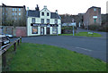
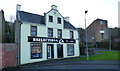
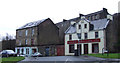
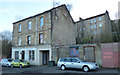
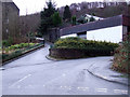
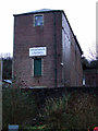
Please click the More button for more images, licensing and image copyright information.
Member of UK Parliament
This postcode is in the Inverclyde parliamentary constituency.
Inverclyde is a constituency in Scotland. The seat has been held by Ronnie Cowan (Scottish National Party) since May 2015.

Most Recent House Sales for Newark Street, PA14 5PE
No recorded house sales or transfers for this postcode.
Local Petrol Station Prices
Coordinates for PA14 5PE
Sunrise and Sunset at PA14 5PE
Traffic Emission and Congestion Zones
Historical Weather Summary
| Clear | 5.92% |
| Cloudy | 55.75% |
| Rain | 12.52% |
| Windy | 25.09% |
| Other | 0.72% |
Companies Registered at PA14 5PE
Postcode Details for PA14 5PE
Recent Updates
|
18 Apr 2024 Added Traffic Camera Views from Traffic Scotland to Roadworks within Scotland |
|
15 Apr 2024 Schools Data updated for April 2024 |
|
10 Apr 2024 Companies Data updated for March 2024 |
|
7 Apr 2024 New option to receive automatic updates to roadworks that affect you |
|
7 Apr 2024 Police and Crime data updated for February 2024 |
|
3 Apr 2024 Sold House Price data updated for February 2024 |
|
30 Mar 2024 Energy Performance Certificates (England and Wales) updated February 2024 |
|
28 Mar 2024 New feature to use Geolocating functions to detect your current location |
Random Postcodes
Want an idea of what is in our extensive website? Try somewhere completely random!
The Rural/Urban classification is based upon data collected during the 2011 Census and released in August 2013 and is categorised into 6 distinct classes.
[A] Urban Major conurbation: A built up area with a population of 10,000 (3,000 in Scotland) or more and is assigned to the major conurbation settlement category.
[B] Urban Minor conurbation: A built up area with a population of 10,000 (3,000 in Scotland) or more and is assigned to the minor conurbation settlement category.
[C] Urban City and town: A built up area with a population of 10,000 (3,000 in Scotland) or more and is assigned to the city and town settlement category.
[D] Rural Town and fringe
[E] Rural Village
[F] Rural Hamlet and isolated dwelling
The Index of Multiple Deprivation (IMD) is the official measure of relative deprivation.
The index is based on 39 separate indicators across seven distinct domains (Income; Employment; Health and Disability; Education, Skills and Training; Crime; Barriers to Housing and Services; Living Environment) to provide an overall measure of multiple deprivation and is calculated for every neighbourhood.
The index is relative rather than an absolute scale and so a neighbourhood with a score of 10 is more deprived than one rated 20, but this does not equate to being twice as deprived.
Please note: Different indices are used in England, Scotland, Wales and Northern Ireland and so comparison of scores from neighbourhoods in different countries should not be undertaken.
These figures report on incorporated UK companies only that are registered at this postcode and do not include sole-traders, partnerships or overseas organisations.
The population figure shown for your area are an estimate provided by the Office for National Statistics and is rounded to the nearest 1,000.
The estimates are derived from the Annual Population Survey (APS) which is the Labour Force Survey (LFS) plus various sample boosts.
There are 55 unitary authorities. They provide all local government services in their areas. These are mainly in the cities, urban areas and larger towns although there are now 6 shire county councils that are unitary (ie have no district councils beneath them).