Overview for Merlin Way, BICESTER, OX26 6YG
Introduction
Bicester (BISS-tər) is a historical market town, garden town, and civil parish in the Cherwell district of northeastern Oxfordshire in south-central England that also comprises an eco town development at North-East Bicester and a self-build village at Graven Hill. Its local market continues to thrive and is now located on Sheep Street, a very wide pedestrian zone in the conservation area of the town. Bicester is also known for Bicester Village, a nearby shopping centre.
Bicester has expanded rapidly in recent generations due to the town's picturesque historical town centre, garden town, independent and high-street shops, restaurants, and excellent rail connections to Oxford and its imminent connection to Cambridge, as well as rail links to Birmingham and London. It is similarly proximate to Brackley, Buckingham, Banbury, Milton Keynes, and Aylesbury. A considerable volume of high quality and environmentally friendly housing stock has been constructed recently, in particular at the Elmsbrook eco-town and the self-build homes at Graven Hill. Its flat topography and compact size is suited to walking and cycling, which, together with an active cycle campaign, has attracted a significant focus on developing improved active travel infrastructure, including the majority of a recent £14 million central government award to Oxfordshire County Council dedicated to safer walking and cycling.
Bicester has its own town council. In 2014 the government, in concert with the local planning authority, planned for Bicester to become a garden city on the basis of the size of its buffers, and distance from the Metropolitan Green Belt as well as to accommodate the demand of commuters to London and Oxford. Up to 13,000 new homes will be built.
Summary for Merlin Way, BICESTER, OX26 6YG
Roadworks near OX26 6YG
Road Safety near OX26 6YG
Details of personal injury accidents in and around Merlin Way, OX26 6YG that have been reported to Thames Valley Police over the past 20 years.
Traffic Levels near OX26 6YG
View traffic levels near Merlin Way, OX26 6YG from official Department for Transport counts.
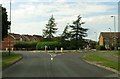
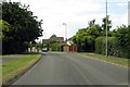
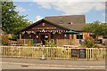
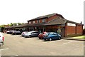
Images taken near to Merlin Way, OX26 6YG and the surrounding area


Please click the More button for more images, licensing and image copyright information.
Police
This area is policed by Thames Valley Police.
Thames Valley Police split their policing area into 108 separate neighbourhoods and this postcode is in the Bicester Town neighbourhood.

Bicester Town Neighbourhood Crime
Top 3 Categories
For full details of all categories together with more crime information, click on the Details button.
Member of UK Parliament
This postcode is in the Banbury parliamentary constituency.
Banbury is a constituency in the South East region of England. The seat has been held by Victoria Prentis (Conservative) since May 2015.

Most Recent House Sales for Merlin Way, OX26 6YG
29 Nov 2022
10 Feb 2022
12 Nov 2021
30 Jun 2021
Local Petrol Station Prices
Coordinates for OX26 6YG
Residents at OX26 6YG
Sunrise and Sunset at OX26 6YG
Traffic Emission and Congestion Zones
Historical Weather Summary
| Clear | 21.50% |
| Cloudy | 67.75% |
| Rain | 6.47% |
| Windy | 4.16% |
| Other | 0.12% |
Population
Deprivation Index
the more deprived the postcode
Average Energy Performance
Companies Registered at OX26 6YG
Postcode Details for OX26 6YG
Recent Updates
|
15 Apr 2024 Schools Data updated for April 2024 |
|
10 Apr 2024 Companies Data updated for March 2024 |
|
7 Apr 2024 New option to receive automatic updates to roadworks that affect you |
|
7 Apr 2024 Police and Crime data updated for February 2024 |
|
3 Apr 2024 Sold House Price data updated for February 2024 |
|
30 Mar 2024 Energy Performance Certificates (England and Wales) updated February 2024 |
|
28 Mar 2024 New feature to use Geolocating functions to detect your current location |
|
17 Mar 2024 Schools Data updated for March 2024 |
Random Postcodes
Want an idea of what is in our extensive website? Try somewhere completely random!
The Rural/Urban classification is based upon data collected during the 2011 Census and released in August 2013 and is categorised into 6 distinct classes.
[A] Urban Major conurbation: A built up area with a population of 10,000 (3,000 in Scotland) or more and is assigned to the major conurbation settlement category.
[B] Urban Minor conurbation: A built up area with a population of 10,000 (3,000 in Scotland) or more and is assigned to the minor conurbation settlement category.
[C] Urban City and town: A built up area with a population of 10,000 (3,000 in Scotland) or more and is assigned to the city and town settlement category.
[D] Rural Town and fringe
[E] Rural Village
[F] Rural Hamlet and isolated dwelling
The Index of Multiple Deprivation (IMD) is the official measure of relative deprivation.
The index is based on 39 separate indicators across seven distinct domains (Income; Employment; Health and Disability; Education, Skills and Training; Crime; Barriers to Housing and Services; Living Environment) to provide an overall measure of multiple deprivation and is calculated for every neighbourhood.
The index is relative rather than an absolute scale and so a neighbourhood with a score of 10 is more deprived than one rated 20, but this does not equate to being twice as deprived.
Please note: Different indices are used in England, Scotland, Wales and Northern Ireland and so comparison of scores from neighbourhoods in different countries should not be undertaken.
These figures report on incorporated UK companies only that are registered at this postcode and do not include sole-traders, partnerships or overseas organisations.
The population figure shown for your area are an estimate provided by the Office for National Statistics and is rounded to the nearest 1,000.
The estimates are derived from the Annual Population Survey (APS) which is the Labour Force Survey (LFS) plus various sample boosts.
There are 26 county councils in 2-tier areas, providing services such as education, social services and waste disposal.
In 2-tier areas, each county council area is subdivided into districts, for which there is an independent district council. There are 192 district councils.
District councils are responsible for local services such as rubbish collection, housing and planning applications.