Overview for Greenmere, WALLINGFORD, OX10 0QH
Introduction
Wallingford is a historic market town and civil parish on the River Thames in Oxfordshire, England, 12 miles (19 km) north of Reading, 13 miles (21 km) south of Oxford and 11 miles (18 km) north west of Henley-on-Thames. Although belonging to the historic county of Berkshire, it is within the ceremonial county of Oxfordshire for administrative purposes (since 1974) as a result of the 1972 Local Government Act. The population was 11,600 at the 2011 census.
The town has played an important role in English history starting with the surrender of Stigand to William the Conqueror in 1066, which led to his taking the throne and the creation of Wallingford Castle. The castle and the town enjoyed royal status and flourished for much of the Middle Ages. The Treaty of Wallingford, which ended a civil war known as The Anarchy between King Stephen and Empress Matilda, was signed there. The town then entered a period of decline after the arrival of the Black Death and falling out of favour with the Tudor monarchs before being called on once again during the English Civil War. Wallingford held out as the last remaining Royalist stronghold in Berkshire before surrendering after a 16-week siege. Fearing that Wallingford Castle could be used in a future uprising, Oliver Cromwell ordered its destruction.
Since then Wallingford has become a market town and centre of local commerce. At the centre of the town is a market square with the war memorial and Wallingford Town Hall to the south, the Corn Exchange theatre to the east and numerous shops around the edges. Off the square there are alleyways and streets with more shops and a number of historic inns. Although it was a small town, Wallingford once had 14 churches; now, there are three ancient churches within the Parish of St Mary-le-More and St Leonard, a modern Roman Catholic church, a Quaker Meeting House dating from 1724 and Baptist, Methodist and community churches.
Summary for Greenmere, WALLINGFORD, OX10 0QH
Roadworks near OX10 0QH
Road Safety near OX10 0QH
Details of personal injury accidents in and around Greenmere, OX10 0QH that have been reported to Thames Valley Police over the past 20 years.
Traffic Levels near OX10 0QH
View traffic levels near Greenmere, OX10 0QH from official Department for Transport counts.
Images taken near to Greenmere, OX10 0QH and the surrounding area
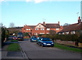
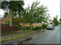
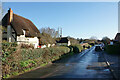
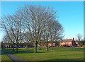
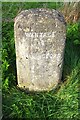
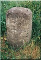
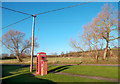
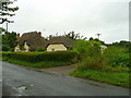
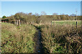
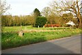
Please click the More button for more images, licensing and image copyright information.
Police
This area is policed by Thames Valley Police.
Thames Valley Police split their policing area into 108 separate neighbourhoods and this postcode is in the Wallingford, Berinsfield and Cholsey neighbourhood.

Wallingford, Berinsfield and Cholsey Neighbourhood Crime
Top 3 Categories
For full details of all categories together with more crime information, click on the Details button.
Member of UK Parliament
This postcode is in the Wantage parliamentary constituency.
Wantage is a constituency in the South East region of England. The seat has been held by David Johnston (Conservative) since December 2019.

Most Recent House Sales for Greenmere, OX10 0QH
26 Aug 2022
11 May 2018
22 Dec 2015
26 Jul 2013
Local Petrol Station Prices
Coordinates for OX10 0QH
Residents at OX10 0QH
Sunrise and Sunset at OX10 0QH
Traffic Emission and Congestion Zones
Historical Weather Summary
| Clear | 21.72% |
| Cloudy | 69.33% |
| Rain | 6.34% |
| Windy | 2.45% |
| Other | 0.16% |
Population
Deprivation Index
the more deprived the postcode
Average Energy Performance
Companies Registered at OX10 0QH
Postcode Details for OX10 0QH
Recent Updates
|
15 Apr 2024 Schools Data updated for April 2024 |
|
10 Apr 2024 Companies Data updated for March 2024 |
|
7 Apr 2024 New option to receive automatic updates to roadworks that affect you |
|
7 Apr 2024 Police and Crime data updated for February 2024 |
|
3 Apr 2024 Sold House Price data updated for February 2024 |
|
30 Mar 2024 Energy Performance Certificates (England and Wales) updated February 2024 |
|
28 Mar 2024 New feature to use Geolocating functions to detect your current location |
|
17 Mar 2024 Schools Data updated for March 2024 |
Random Postcodes
Want an idea of what is in our extensive website? Try somewhere completely random!
The Rural/Urban classification is based upon data collected during the 2011 Census and released in August 2013 and is categorised into 6 distinct classes.
[A] Urban Major conurbation: A built up area with a population of 10,000 (3,000 in Scotland) or more and is assigned to the major conurbation settlement category.
[B] Urban Minor conurbation: A built up area with a population of 10,000 (3,000 in Scotland) or more and is assigned to the minor conurbation settlement category.
[C] Urban City and town: A built up area with a population of 10,000 (3,000 in Scotland) or more and is assigned to the city and town settlement category.
[D] Rural Town and fringe
[E] Rural Village
[F] Rural Hamlet and isolated dwelling
The Index of Multiple Deprivation (IMD) is the official measure of relative deprivation.
The index is based on 39 separate indicators across seven distinct domains (Income; Employment; Health and Disability; Education, Skills and Training; Crime; Barriers to Housing and Services; Living Environment) to provide an overall measure of multiple deprivation and is calculated for every neighbourhood.
The index is relative rather than an absolute scale and so a neighbourhood with a score of 10 is more deprived than one rated 20, but this does not equate to being twice as deprived.
Please note: Different indices are used in England, Scotland, Wales and Northern Ireland and so comparison of scores from neighbourhoods in different countries should not be undertaken.
These figures report on incorporated UK companies only that are registered at this postcode and do not include sole-traders, partnerships or overseas organisations.
The population figure shown for your area are an estimate provided by the Office for National Statistics and is rounded to the nearest 1,000.
The estimates are derived from the Annual Population Survey (APS) which is the Labour Force Survey (LFS) plus various sample boosts.
There are 26 county councils in 2-tier areas, providing services such as education, social services and waste disposal.
In 2-tier areas, each county council area is subdivided into districts, for which there is an independent district council. There are 192 district councils.
District councils are responsible for local services such as rubbish collection, housing and planning applications.