Overview for Kelty Grove, HEYWOOD, OL10 3FT
Introduction
Heywood is a town in the Metropolitan Borough of Rochdale, Greater Manchester, England, in the historic county of Lancashire. It had a population of 28,205 at the 2011 Census. The town lies on the south bank of the River Roch, 2 miles (3.2 km) east of Bury, 4 miles (6.4 km) southwest of Rochdale, and 8 miles (12.9 km) north of Manchester. Middleton lies to the south, whilst to the north is the Cheesden Valley, open moorland, and the Pennines. Heywood's nickname is Monkey Town.
The Anglo-Saxons cleared the densely wooded area, dividing it into heys or fenced clearings. In the Middle Ages, Heywood formed a chapelry in the township, around Heywood Hall, a manor house owned by a family with that surname. Farming was the main industry of a sparsely populated rural area. The population supplemented their incomes by hand-loom woollen weaving in the domestic system.
The factory system in the town can be traced to a spinning mill in the late 18th century. Following the introduction of textile manufacture during the Industrial Revolution, Heywood developed into a mill town and coal mining district. A period of "extraordinary growth of the cotton-trade" in the mid 19th century was so quick and profound that there was "an influx of strangers causing a very dense population". The town became a municipal borough in 1881. Imports of foreign cotton goods in the mid-20th century precipitated the decline of Heywood's textile and mining industries, resulting in a more diverse industrial base. The town was well respected for the quality of its cotton goods. The Queen mother once visited Heywood in the very early 1900s to admire the cotton in its factories. Cotton from Heywood cotton mills was used to create the dress that she wore for her 50th birthday celebration speech.
Heywood is close to junction 19 of the M62 motorway, which provides transport links for the large distribution parks in the south of the town. The 1860s-built 188-foot (57 m) tall Parish Church of St Luke the Evangelist dominates the town centre and skyline. Heywood was the birthplace of Peter Heywood, the magistrate who aided the discovery of the Gunpowder Plot, whose family seat was Heywood Hall. Heywood has a station on the East Lancashire heritage railway.
Summary for Kelty Grove, HEYWOOD, OL10 3FT
Roadworks near OL10 3FT
Road Safety near OL10 3FT
Details of personal injury accidents in and around Kelty Grove, OL10 3FT that have been reported to Greater Manchester Police over the past 20 years.
Traffic Levels near OL10 3FT
View traffic levels near Kelty Grove, OL10 3FT from official Department for Transport counts.
Images taken near to Kelty Grove, OL10 3FT and the surrounding area
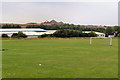
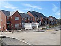
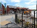
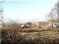
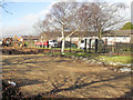
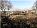
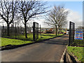
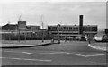
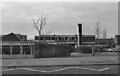
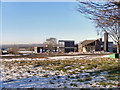
Please click the More button for more images, licensing and image copyright information.
Member of UK Parliament
This postcode is in the Heywood and Middleton parliamentary constituency.
Heywood and Middleton is a constituency in the North West region of England. The seat has been held by Chris Clarkson (Conservative) since December 2019.

Most Recent House Sales for Kelty Grove, OL10 3FT
7 Apr 2022
14 Jan 2022
5 Feb 2021
14 Dec 2020
Local Petrol Station Prices
Coordinates for OL10 3FT
Residents at OL10 3FT
Sunrise and Sunset at OL10 3FT
Traffic Emission and Congestion Zones
Historical Weather Summary
| Clear | 7.04% |
| Cloudy | 76.67% |
| Rain | 13.30% |
| Windy | 2.63% |
| Other | 0.36% |
Population
Deprivation Index
the more deprived the postcode
Average Energy Performance
Companies Registered at OL10 3FT
Postcode Details for OL10 3FT
Recent Updates
|
18 Apr 2024 Added Traffic Camera Views from Traffic Scotland to Roadworks within Scotland |
|
15 Apr 2024 Schools Data updated for April 2024 |
|
10 Apr 2024 Companies Data updated for March 2024 |
|
7 Apr 2024 New option to receive automatic updates to roadworks that affect you |
|
7 Apr 2024 Police and Crime data updated for February 2024 |
|
3 Apr 2024 Sold House Price data updated for February 2024 |
|
30 Mar 2024 Energy Performance Certificates (England and Wales) updated February 2024 |
|
28 Mar 2024 New feature to use Geolocating functions to detect your current location |
Random Postcodes
Want an idea of what is in our extensive website? Try somewhere completely random!
The Rural/Urban classification is based upon data collected during the 2011 Census and released in August 2013 and is categorised into 6 distinct classes.
[A] Urban Major conurbation: A built up area with a population of 10,000 (3,000 in Scotland) or more and is assigned to the major conurbation settlement category.
[B] Urban Minor conurbation: A built up area with a population of 10,000 (3,000 in Scotland) or more and is assigned to the minor conurbation settlement category.
[C] Urban City and town: A built up area with a population of 10,000 (3,000 in Scotland) or more and is assigned to the city and town settlement category.
[D] Rural Town and fringe
[E] Rural Village
[F] Rural Hamlet and isolated dwelling
The Index of Multiple Deprivation (IMD) is the official measure of relative deprivation.
The index is based on 39 separate indicators across seven distinct domains (Income; Employment; Health and Disability; Education, Skills and Training; Crime; Barriers to Housing and Services; Living Environment) to provide an overall measure of multiple deprivation and is calculated for every neighbourhood.
The index is relative rather than an absolute scale and so a neighbourhood with a score of 10 is more deprived than one rated 20, but this does not equate to being twice as deprived.
Please note: Different indices are used in England, Scotland, Wales and Northern Ireland and so comparison of scores from neighbourhoods in different countries should not be undertaken.
These figures report on incorporated UK companies only that are registered at this postcode and do not include sole-traders, partnerships or overseas organisations.
The population figure shown for your area are an estimate provided by the Office for National Statistics and is rounded to the nearest 1,000.
The estimates are derived from the Annual Population Survey (APS) which is the Labour Force Survey (LFS) plus various sample boosts.
There are 36 metropolitan district councils which together cover 6 large urban areas: the counties of Greater Manchester, Merseyside, South Yorkshire, Tyne and Wear, West Midlands, and West Yorkshire.
Metropolitan districts are responsible for all services in their area, although certain conurbation wide services such as fire and civil defence, police, waste disposal and passenger transport are provided through joint authorities (the districts acting jointly).