Overview for Countess Drive, NEWCASTLE UPON TYNE, NE15 7AB
Introduction
Newcastle upon Tyne, or simply Newcastle, is a city and metropolitan borough in Tyne and Wear, England. It is located on the River Tyne's northern bank, opposite Gateshead to the south. It is the most populous settlement in the Tyneside conurbation and North East England.
Newcastle developed around a Roman settlement called Pons Aelius, the settlement became known as Monkchester before taking on the name of a castle built in 1080 by William the Conqueror's eldest son, Robert Curthose. It was one of the world's largest ship building and repair centres during the industrial revolution. Newcastle was part of the county of Northumberland until 1400, when it separated and formed a county of itself. In 1974, Newcastle become part of Tyne and Wear. Since 2018, the city council has been part of the North of Tyne Combined Authority.
Summary for Countess Drive, NEWCASTLE UPON TYNE, NE15 7AB
Roadworks near NE15 7AB
Road Safety near NE15 7AB
Details of personal injury accidents in and around Countess Drive, NE15 7AB that have been reported to Northumbria Police over the past 20 years.
Traffic Levels near NE15 7AB
View traffic levels near Countess Drive, NE15 7AB from official Department for Transport counts.
Images taken near to Countess Drive, NE15 7AB and the surrounding area
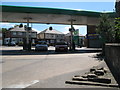
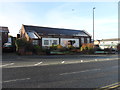
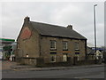
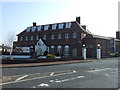

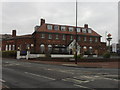
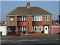
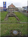
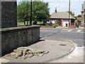
Please click the More button for more images, licensing and image copyright information.
Newcastle Upon Tyne and nearby Videos From YouTube
Henderson Hall Fire - Newcastle University - Drone Footage 2023
08/06/2023 On the 8th June 2023, firefighters were called to a large fire at Henderson Hall halls of residence, Newcastle ...
Channel: Road Closed (View Channel)
Published: 26 Jun 2023
Police
This area is policed by Northumbria Police.
Northumbria Police split their policing area into 35 separate neighbourhoods and this postcode is in the Fenham and Scotswood neighbourhood.

Fenham and Scotswood Neighbourhood Crime
Top 3 Categories
For full details of all categories together with more crime information, click on the Details button.
Member of UK Parliament
This postcode is in the Newcastle upon Tyne Central parliamentary constituency.
Newcastle upon Tyne Central is a constituency in the North East region of England. The seat has been held by Chi Onwurah (Labour) since May 2010.

Most Recent House Sales for Countess Drive, NE15 7AB
4 Nov 2022
8 Jul 2022
25 May 2021
9 Apr 2020
Local Petrol Station Prices
Coordinates for NE15 7AB
Residents at NE15 7AB
Sunrise and Sunset at NE15 7AB
Traffic Emission and Congestion Zones
Historical Weather Summary
| Clear | 10.89% |
| Cloudy | 62.32% |
| Rain | 9.11% |
| Windy | 17.59% |
| Other | 0.09% |
Population
Deprivation Index
the more deprived the postcode
Average Energy Performance
Companies Registered at NE15 7AB
Postcode Details for NE15 7AB
Recent Updates
|
18 Apr 2024 Added Traffic Camera Views from Traffic Scotland to Roadworks within Scotland |
|
15 Apr 2024 Schools Data updated for April 2024 |
|
10 Apr 2024 Companies Data updated for March 2024 |
|
7 Apr 2024 New option to receive automatic updates to roadworks that affect you |
|
7 Apr 2024 Police and Crime data updated for February 2024 |
|
3 Apr 2024 Sold House Price data updated for February 2024 |
|
30 Mar 2024 Energy Performance Certificates (England and Wales) updated February 2024 |
|
28 Mar 2024 New feature to use Geolocating functions to detect your current location |
Random Postcodes
Want an idea of what is in our extensive website? Try somewhere completely random!
The Rural/Urban classification is based upon data collected during the 2011 Census and released in August 2013 and is categorised into 6 distinct classes.
[A] Urban Major conurbation: A built up area with a population of 10,000 (3,000 in Scotland) or more and is assigned to the major conurbation settlement category.
[B] Urban Minor conurbation: A built up area with a population of 10,000 (3,000 in Scotland) or more and is assigned to the minor conurbation settlement category.
[C] Urban City and town: A built up area with a population of 10,000 (3,000 in Scotland) or more and is assigned to the city and town settlement category.
[D] Rural Town and fringe
[E] Rural Village
[F] Rural Hamlet and isolated dwelling
The Index of Multiple Deprivation (IMD) is the official measure of relative deprivation.
The index is based on 39 separate indicators across seven distinct domains (Income; Employment; Health and Disability; Education, Skills and Training; Crime; Barriers to Housing and Services; Living Environment) to provide an overall measure of multiple deprivation and is calculated for every neighbourhood.
The index is relative rather than an absolute scale and so a neighbourhood with a score of 10 is more deprived than one rated 20, but this does not equate to being twice as deprived.
Please note: Different indices are used in England, Scotland, Wales and Northern Ireland and so comparison of scores from neighbourhoods in different countries should not be undertaken.
These figures report on incorporated UK companies only that are registered at this postcode and do not include sole-traders, partnerships or overseas organisations.
The population figure shown for your area are an estimate provided by the Office for National Statistics and is rounded to the nearest 1,000.
The estimates are derived from the Annual Population Survey (APS) which is the Labour Force Survey (LFS) plus various sample boosts.
There are 36 metropolitan district councils which together cover 6 large urban areas: the counties of Greater Manchester, Merseyside, South Yorkshire, Tyne and Wear, West Midlands, and West Yorkshire.
Metropolitan districts are responsible for all services in their area, although certain conurbation wide services such as fire and civil defence, police, waste disposal and passenger transport are provided through joint authorities (the districts acting jointly).