Overview for Seafront, ROCHESTER, ME3 9RY
Introduction
Rochester (ROTCH-iss-tər) is a town in the unitary authority of Medway, in Kent, England. It is at the lowest bridging point of the River Medway, about 30 miles (50 km) from London. The town forms a conurbation with neighbouring towns Chatham, Rainham, Strood and Gillingham. Rochester was a city until losing its status as one in 1998 following the forming of Medway and failing to protect its status as a city. There have been ongoing campaigns to reinstate the city status for Rochester.
Rochester was for many years a favourite of Charles Dickens, who owned nearby Gads Hill Place, Higham, basing many of his novels on the area. The Diocese of Rochester, the second oldest in England, is centred on Rochester Cathedral and was responsible for founding a school, now The King's School, in 604 AD, which is recognised as the second oldest continuously running school in the world. Rochester Castle, built by Bishop Gundulf of Rochester, has one of the best-preserved keeps in either England or France. During the First Barons' War (1215–1217) in King John's reign, baronial forces captured the castle from Archbishop Stephen Langton and held it against the king, who then besieged it.
As well as the historic centre, the suburbs of Borstal and The Delce are also part of Rochester, forming part of the Medway Towns urban area with a population of about 250,000.
Summary for Seafront, ROCHESTER, ME3 9RY
Roadworks near ME3 9RY
Road Safety near ME3 9RY
Details of personal injury accidents in and around Seafront, ME3 9RY that have been reported to Kent Police over the past 20 years.
Traffic Levels near ME3 9RY
View traffic levels near Seafront, ME3 9RY from official Department for Transport counts.
Images taken near to Seafront, ME3 9RY and the surrounding area
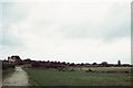
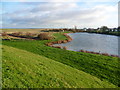
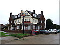
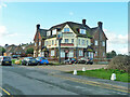
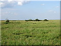
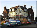
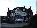

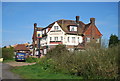
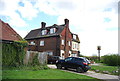
Please click the More button for more images, licensing and image copyright information.
Police
This area is policed by Kent Police.
Kent Police split their policing area into 293 separate neighbourhoods and this postcode is in the Peninsula neighbourhood.

Peninsula Neighbourhood Crime
Top 3 Categories
For full details of all categories together with more crime information, click on the Details button.
Member of UK Parliament
This postcode is in the Rochester and Strood parliamentary constituency.
Rochester and Strood is a constituency in the South East region of England. The seat has been held by Kelly Tolhurst (Conservative) since May 2015.

Most Recent House Sales for Seafront, ME3 9RY
14 Sep 2010
12 May 2003
Local Petrol Station Prices
Coordinates for ME3 9RY
Residents at ME3 9RY
Sunrise and Sunset at ME3 9RY
Traffic Emission and Congestion Zones
Historical Weather Summary
| Clear | 8.96% |
| Cloudy | 57.28% |
| Rain | 6.73% |
| Windy | 27.02% |
| Other | 0.01% |
Population
Deprivation Index
the more deprived the postcode
Companies Registered at ME3 9RY
Postcode Details for ME3 9RY
Recent Updates
|
18 Apr 2024 Added Traffic Camera Views from Traffic Scotland to Roadworks within Scotland |
|
15 Apr 2024 Schools Data updated for April 2024 |
|
10 Apr 2024 Companies Data updated for March 2024 |
|
7 Apr 2024 New option to receive automatic updates to roadworks that affect you |
|
7 Apr 2024 Police and Crime data updated for February 2024 |
|
3 Apr 2024 Sold House Price data updated for February 2024 |
|
30 Mar 2024 Energy Performance Certificates (England and Wales) updated February 2024 |
|
28 Mar 2024 New feature to use Geolocating functions to detect your current location |
Random Postcodes
Want an idea of what is in our extensive website? Try somewhere completely random!
The Rural/Urban classification is based upon data collected during the 2011 Census and released in August 2013 and is categorised into 6 distinct classes.
[A] Urban Major conurbation: A built up area with a population of 10,000 (3,000 in Scotland) or more and is assigned to the major conurbation settlement category.
[B] Urban Minor conurbation: A built up area with a population of 10,000 (3,000 in Scotland) or more and is assigned to the minor conurbation settlement category.
[C] Urban City and town: A built up area with a population of 10,000 (3,000 in Scotland) or more and is assigned to the city and town settlement category.
[D] Rural Town and fringe
[E] Rural Village
[F] Rural Hamlet and isolated dwelling
The Index of Multiple Deprivation (IMD) is the official measure of relative deprivation.
The index is based on 39 separate indicators across seven distinct domains (Income; Employment; Health and Disability; Education, Skills and Training; Crime; Barriers to Housing and Services; Living Environment) to provide an overall measure of multiple deprivation and is calculated for every neighbourhood.
The index is relative rather than an absolute scale and so a neighbourhood with a score of 10 is more deprived than one rated 20, but this does not equate to being twice as deprived.
Please note: Different indices are used in England, Scotland, Wales and Northern Ireland and so comparison of scores from neighbourhoods in different countries should not be undertaken.
These figures report on incorporated UK companies only that are registered at this postcode and do not include sole-traders, partnerships or overseas organisations.
The population figure shown for your area are an estimate provided by the Office for National Statistics and is rounded to the nearest 1,000.
The estimates are derived from the Annual Population Survey (APS) which is the Labour Force Survey (LFS) plus various sample boosts.
There are 55 unitary authorities. They provide all local government services in their areas. These are mainly in the cities, urban areas and larger towns although there are now 6 shire county councils that are unitary (ie have no district councils beneath them).